Bolivar, Ohio facts for kids
Quick facts for kids
Bolivar, Ohio
|
|
|---|---|
|
Village
|
|

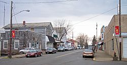
Canal Street in Bolivar in 2006
|
|

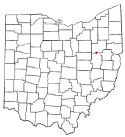
Location of Bolivar, Ohio
|
|

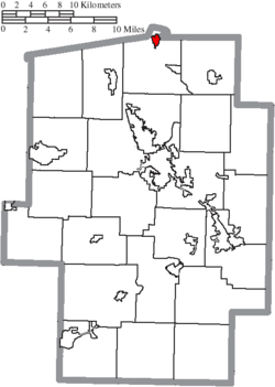
Location of Bolivar in Tuscarawas County
|
|
| Country | United States |
| State | Ohio |
| County | Tuscarawas |
| Township | Lawrence |
| Area | |
| • Total | 0.96 sq mi (2.48 km2) |
| • Land | 0.95 sq mi (2.46 km2) |
| • Water | 0.01 sq mi (0.02 km2) |
| Elevation | 932 ft (284 m) |
| Population
(2020)
|
|
| • Total | 1,000 |
| • Estimate
(2023)
|
965 |
| • Density | 1,053.74/sq mi (406.66/km2) |
| Time zone | UTC-5 (Eastern (EST)) |
| • Summer (DST) | UTC-4 (EDT) |
| ZIP code |
44612
|
| Area code(s) | 330 |
| FIPS code | 39-07594 |
| GNIS feature ID | 2398148 |
Bolivar (pronounced like Oliver) is a small village located in Tuscarawas County, Ohio, in the United States. In 2020, the village had a population of 1,000 people. Bolivar is also special because it is home to Fort Laurens, which was the only fort built in what is now Ohio during the American Revolutionary War.
Contents
History of Bolivar
The area where Bolivar is now located has a long history.
Early Settlements
In 1752, a Delaware Indian leader named Shingas created a village called Shingas Town near where Bolivar stands today. Later, in 1778, Fort Laurens was built in this same area. This fort played a role in the American Revolutionary War.
Founding of the Village
The village of Bolivar itself was officially planned and settled in 1830. This happened because of the growth and development brought by the Ohio and Erie Canal. The community was named after Simón Bolívar, a famous leader who helped many South American countries gain their independence.
Geography of Bolivar
Bolivar is situated along the Tuscarawas River.
Area and Location
According to the United States Census Bureau, the village covers a total area of about 0.70 square miles (1.81 square kilometers). Most of this area is land, with a small part being water.
Bolivar is the northernmost town in Tuscarawas County. It is also unique because some parts of Stark County are actually further south than Bolivar.
Population of Bolivar
The population of Bolivar has changed over the years.
| Historical population | |||
|---|---|---|---|
| Census | Pop. | %± | |
| 1840 | 309 | — | |
| 1850 | 302 | −2.3% | |
| 1860 | 372 | 23.2% | |
| 1870 | 413 | 11.0% | |
| 1880 | 564 | 36.6% | |
| 1890 | 675 | 19.7% | |
| 1910 | 567 | — | |
| 1920 | 519 | −8.5% | |
| 1930 | 506 | −2.5% | |
| 1940 | 596 | 17.8% | |
| 1950 | 776 | 30.2% | |
| 1960 | 932 | 20.1% | |
| 1970 | 1,084 | 16.3% | |
| 1980 | 989 | −8.8% | |
| 1990 | 914 | −7.6% | |
| 2000 | 894 | −2.2% | |
| 2010 | 994 | 11.2% | |
| 2020 | 1,000 | 0.6% | |
| 2023 (est.) | 965 | −2.9% | |
| U.S. Decennial Census | |||
Population in 2010
In 2010, there were 994 people living in Bolivar. These people lived in 380 households, and 257 of these were families. The village had about 1,440 people per square mile (556 people per square kilometer).
The average age of people in the village was 45.9 years. About 21% of the residents were under 18 years old.
Education in Bolivar
Bolivar has a branch of the Tuscarawas County Public Library. This library helps residents with their learning and reading needs.
See also
 In Spanish: Bolivar (Ohio) para niños
 | Roy Wilkins |
 | John Lewis |
 | Linda Carol Brown |

