Bontecou Lake facts for kids
Quick facts for kids Bontecou Lake |
|
|---|---|

|
|
| Location | Stanford and Washington, New York, United States |
| Coordinates | 41°50′48″N 73°38′58″W / 41.84667°N 73.64944°W |
| Type | Rural reservoir |
| Basin countries | United States |
| Designation | New York State Critical Environmental Area |
| First flooded | ca. 1956 |
| Surface area | At least 113 acres (46 ha) |
| Water volume | 350,000,000 US gallons (1.3×10⁹ L) |
| Surface elevation | 738 ft (225 m) |
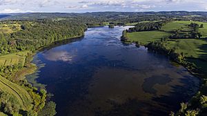
Bontecou Lake, also known as Tamarack Swamp, is a shallow, man-made lake in Dutchess County, New York. It is located in the towns of Stanford and Washington. The lake is less than 5 miles (8 km) from the Village of Millbrook.
Bontecou Lake is special because it sits on a "drainage divide." This means water from one side of the lake flows into the Wappinger Creek, and water from the other side flows into the Tenmile River. The lake covers at least 113 acres (46 ha), making it one of the largest lakes in Dutchess County. Parts of the lake are a "Critical Environmental Area." This is a special protected zone because it's a very important home for many waterfowl (birds that live near water) that are migrating or breeding.
How Bontecou Lake Was Created
Bontecou Lake is on land that belongs to Rally Farms. This farm was started in 1926 by Frederic H. Bontecou. He later became a state senator. Rally Farms was famous for its angus cattle. As the farm grew, it needed more water.
Around 1956, there was a bad drought. To help with the water shortage, Mr. Bontecou worked with a local conservation group. They built two earthen dams. These dams blocked an existing small pond, about 5 to 6 acres (2 to 2.4 ha) in size. This pond was in the middle of a forest wetland called Tamarack Swamp.
The dams created a large reservoir (a man-made lake for storing water). This new lake held about 350 million US gallons (1.3 billion liters) of water. It flooded at least 113 acres (46 ha) of the swamp. The lake was used to provide water for the farm.
In 1968, the lake was known for good fishing. However, the next year, many fish died. This happened because of a very cold winter. The cold killed many water plants in the shallow lake. This caused the oxygen levels in the water to drop, which harmed the fish.
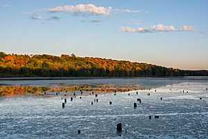
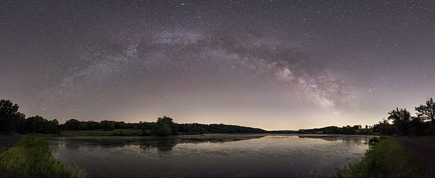
The lake is long and narrow, shaped like an oval. It is surrounded by woods and farmlands. Shuman Road is on its western side.
Water Flow in the Lake
Bontecou Lake is unique because it sits on a "drainage divide." Imagine a rooftop: rain on one side flows one way, and rain on the other side flows another way. The lake is like that rooftop for water.
Water from the western part of the lake flows into a stream unofficially called Tamarack Swamp Creek. This creek then flows into the Wappinger Creek. Water from the eastern part of the lake flows into the Tenmile River. It's not entirely clear exactly where in the lake this split happens.
The Tamarack Swamp Creek is an important part of the Wappinger Creek system. However, it only adds about 2% of the total water to the Wappinger Creek. During a big storm like Hurricane Floyd in 1999, the water flow from Tamarack Swamp Creek increased a lot.
Bontecou Lake is the only large body of water (over 20 acres or 8.1 ha) in the Wappinger Creek area that doesn't have a special water quality classification from the New York State Department of Environmental Conservation (NYSDEC).
Wildlife and Protecting the Lake
Bontecou Lake is a very important home for many animals. In 1987, the town of Stanford named its part of the lake and nearby wetlands a "Critical Environmental Area." This was done to protect the many waterfowl that use the lake. These birds either migrate through the area or stay there to breed.
The NYSDEC also helps protect the land around the lake. They watch over a 320-acre (130 ha) area that includes the lake. This is part of the New York State Freshwater Wetlands Act of 1975.
Bontecou Lake was one of the first places in Dutchess County where Canada geese were seen nesting in 1964. Before that, only one other nesting site had ever been recorded in the county. Today, hundreds of Canada geese live at the lake all year. Thousands more use the area as a resting stop during their long migrations.
In May 1977, the first cackling goose ever seen in Dutchess County was spotted at Bontecou Lake. Dead trees sticking out of the water quickly became favorite nesting spots for great blue herons. These large birds still nest on the eastern side of the lake. Even though only a few of these trees are still standing, they offer nesting places for other birds too, like the eastern bluebird. For bluebirds, these partially underwater trees are a rare natural place to nest, away from buildings and other birds that might compete for space.
Even though the lake is on private property, many birders enjoy visiting. They get permission to access the land, either on their own or through birding clubs.


