Boone, Colorado facts for kids
Quick facts for kids
Boone, Colorado
|
|
|---|---|

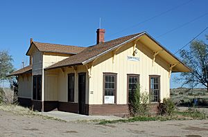
The old Boone Santa Fe Railroad depot that now serves as the town hall.
|
|

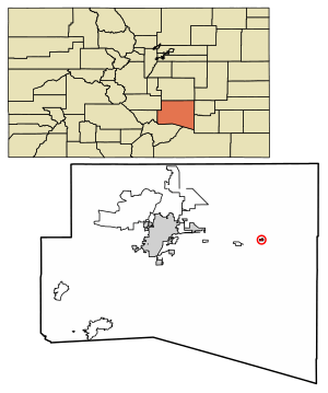
Location of the Town of Boone in Pueblo County, Colorado.
|
|
| Country | |
| State | |
| County | Pueblo County |
| Incorporated (town) | September 22, 1956 |
| Government | |
| • Type | Statutory Town |
| Area | |
| • Total | 0.388 sq mi (1.006 km2) |
| • Land | 0.379 sq mi (0.981 km2) |
| • Water | 0.010 sq mi (0.025 km2) |
| Elevation | 4,475 ft (1,364 m) |
| Population
(2020)
|
|
| • Total | 305 |
| • Density | 805/sq mi (311/km2) |
| • Metro | 168,162 (257th) |
| • CSA | 217,101 (186th) |
| • Front Range | 5,055,344 |
| Time zone | UTC−07:00 (MST) |
| • Summer (DST) | UTC−06:00 (MDT) |
| ZIP code |
81025
|
| Area code(s) | 719 |
| FIPS code | 08-07795 |
| GNIS feature ID | 2411709 |
| Highways | |
Boone is a small town in Pueblo County, Colorado, United States. It is located along the Arkansas River. In 2020, about 305 people lived there. Boone is known as a Statutory Town, which means it follows certain rules set by the state of Colorado.
History of Boone
Boone was first called Booneville. It was started during the Pikes Peak Gold Rush. This was a time when many people moved to Colorado hoping to find gold. The town was founded by Albert Gallatin Boone. He was the grandson of the famous explorer Daniel Boone.
The first post office in Booneville, Colorado Territory, opened on January 2, 1863. Albert Boone was also the first postmaster. Later, on December 5, 1891, the town's name was made shorter to just Boone. The Town of Boone officially became an incorporated town on September 22, 1956. This means it became an official town with its own local government.
Geography and Location
Boone is a small town in terms of size. In 2020, the town covered about 1.006 square kilometers (0.388 square miles). A small part of this area, about 0.025 square kilometers (0.010 square miles), is water.
The town is part of a larger area called the Pueblo, CO Metropolitan Statistical Area. It is also part of the Front Range Urban Corridor. This is a long area in Colorado where many cities and towns are located.
Population of Boone
| Historical population | |||
|---|---|---|---|
| Census | Pop. | %± | |
| 1960 | 548 | — | |
| 1970 | 448 | −18.2% | |
| 1980 | 431 | −3.8% | |
| 1990 | 341 | −20.9% | |
| 2000 | 323 | −5.3% | |
| 2010 | 339 | 5.0% | |
| 2020 | 305 | −10.0% | |
| U.S. Decennial Census | |||
In 2000, there were 323 people living in Boone. There were 131 households, which are groups of people living in one home. Most people in Boone were White. About one-third of the population was of Hispanic or Latino background.
The town's population has changed over the years. In 1960, there were 548 people. By 2020, the population was 305. The average age of people in Boone in 2000 was 43 years old.
Highways in Boone
Two main highways pass through or near Boone. These are important roads for getting around the area.
See also
- In Spanish: Boone (Colorado) para niños
 | Laphonza Butler |
 | Daisy Bates |
 | Elizabeth Piper Ensley |


