Bow Brook facts for kids
Quick facts for kids Bow Brook |
|
|---|---|

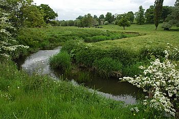
Bow Brook near Froxmere Court
|
|
|
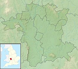
Location within Worcestershire
|
|
| Country | England |
| Counties | Worcestershire |
| Physical characteristics | |
| River mouth | River Avon 52°04′51″N 2°07′09″W / 52.0809°N 2.1191°W |
| Length | 46 km (29 mi) |
The Bow Brook is a significant brook that flows for about 46 kilometers (28.6 miles) through Worcestershire, England. It's like a smaller river that eventually joins a bigger one, the River Avon. This meeting point is near Defford, which is downstream from Eckington Bridge. Some smaller streams, like the Stoulton, Dean, and Seeley brooks, also flow into the Bow Brook.
Contents
Where Does the Bow Brook Flow?
The Bow Brook begins its journey near Upper Bentley, which is west of Redditch. From there, it flows south through Feckenham. After Feckenham, it turns west. It then reaches Shell, where it is sometimes called the Shell Brook. The brook continues its path towards Himbleton.
The brook keeps flowing south, passing by Huddington and Upton Snodsbury. Here, a main road, the A422, crosses over it. It then goes past Broughton Hackett and Peopleton. Another main road, the A44, crosses the brook after Peopleton.
A small road crosses the brook between Walcot and Pinvin. At this point, the Bow Brook turns southwest. It flows past Ufnell Bridge on the B4084 road. Finally, it reaches Besford Bridge, where its flow is measured. The A4104 road also bridges the brook before it passes Defford. Defford is the last village on its course. Downstream from Defford, the Bow Brook joins the River Avon.
How We Measure the Bow Brook
Since 1969, the flow of the Bow Brook has been measured. This happens using a special structure called a weir at Besford Bridge. A weir is like a small dam that helps measure how much water is flowing. This long-term record helps us understand the brook better.
Understanding the Water Flow
The area of land that drains into the Bow Brook, called its catchment area, is about 156 square kilometers (60 square miles). At the gauging station (the place where measurements are taken), the average flow of water is about 1.1 cubic meters per second. This is like saying 1,100 liters (about 290 gallons) of water pass by every second.
The highest water level ever recorded at the station was on July 21, 2007. The water reached a height of 4.06 meters (13.3 feet). The lowest water flows were measured in August 1976.
Rainfall and Land Use
The catchment area of the Bow Brook gets an average of 643 millimeters (25.3 inches) of rain each year. The highest point in this area is 164 meters (538 feet) high, located at Tardebigge. Most of the land around the brook is used for farming. This includes growing crops, gardening, and raising animals on grasslands. There are also some areas of woodland.
 | Madam C. J. Walker |
 | Janet Emerson Bashen |
 | Annie Turnbo Malone |
 | Maggie L. Walker |


