Box Springs Mountains facts for kids
Quick facts for kids Box Springs Mountains |
|
|---|---|

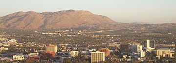
Box Springs Mountains with Riverside in foreground.
|
|
| Highest point | |
| Peak | Box Springs Mountain |
| Elevation | 939 m (3,081 ft) |
| Geography | |
| Country | United States |
| State | California |
| Region | Inland Empire |
| District | Riverside County |
| Range coordinates | 33°57′42″N 117°16′50″W / 33.96167°N 117.28056°W |
| Topo map | USGS Riverside East |
The Box Springs Mountains are a mountain range located in Riverside County, California, United States. These mountains are a natural landmark in the area. The tallest point in the range is Box Springs Mountain, which reaches a height of over 3,080 ft (940 m) (939 meters).
Exploring the Box Springs Mountains
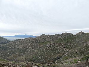
The Box Springs Mountains offer a great place for outdoor adventures. They are a popular spot for people who enjoy hiking and exploring nature. The views from the higher points are amazing, showing off the surrounding landscapes of Riverside County.
Box Spring Mountain Reserve
A big part of the Box Springs Mountains is protected as the Box Spring Mountain Reserve. This reserve is managed by the Riverside County Regional Park and Open-Space District. It helps keep the natural environment safe for everyone to enjoy. The reserve has many trails, like the Two Trees Trail, where you can walk or bike. It is a perfect place to see local plants and animals.
Peaks of the Box Springs Mountains
The Box Springs Mountains have several distinct peaks. Each peak has its own elevation and location within the range. Here are some of the notable peaks you can find:
| Peak | Elevation | Coordinates |
|---|---|---|
| Box Springs Mountain | 3,080 feet (940 m) | 33°57′42″N 117°16′50″W / 33.96167°N 117.28056°W |
| Table Mountain | 2,359 feet (719 m) | 33°59′26″N 117°17′33″W / 33.99056°N 117.29249°W |
| Sugarloaf Mountain | 1,944 feet (593 m) | 33°59′37″N 117°19′21″W / 33.99371°N 117.32240°W |
| Jessie | 1,781 feet (543 m) | 33°56′56″N 117°17′00″W / 33.94876°N 117.28339°W |
| Pigeon | 1,423 feet (434 m) | 33°59′35″N 117°19′46″W / 33.99295°N 117.32944°W |
| Versity | 1,386 feet (422 m) | 33°58′04″N 117°19′27″W / 33.96773°N 117.32430°W |


