Bracklesham Bay facts for kids
| Site of Special Scientific Interest | |
 |
|
| Area of Search | West Sussex |
|---|---|
| Interest | Biological Geological |
| Area | 200.6 hectares (496 acres) |
| Notification | 1986 |
| Location map | Magic Map |
Bracklesham Bay is a special place in West Sussex, England. It's known as a Site of Special Scientific Interest (SSSI) because of its amazing nature and rocks. It covers about 200.6 hectares, which is like 500 football fields!
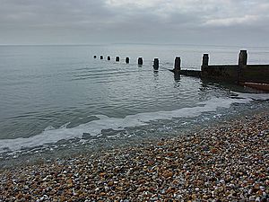
This beautiful bay is on the west side of the Manhood Peninsula. From its sandy and shingly beaches, you can see the wide English Channel. On a clear day, you might even spot the Isle of Wight, the tall Nab Tower lighthouse, and the famous Spinnaker Tower in Portsmouth. The villages of Bracklesham and East Wittering are right in the middle of the bay. To the south, you'll find the town of Selsey, and to the west, the village of West Wittering.
Contents
What Makes Bracklesham Bay Special?
Bracklesham Bay is important for two main reasons: its amazing wildlife (biology) and its ancient rocks (geology).
Wildlife and Habitats
The area along the coast has different types of land. You'll find natural grazing fields, shingle beaches, salty marshes, tall reed beds, and small water channels called ditches. These fields sometimes get flooded when it rains a lot. This mix of habitats makes the bay a perfect home for many birds. Some birds come here to build their nests and raise their young, while others visit during winter to escape colder places.
Ancient Fossils and Rocks
Bracklesham Bay is like a giant outdoor museum for rocks and fossils!
Eocene Fossils
The rocks here are very old, from a time called the Eocene period. This was between 56 and 34 million years ago! In these rocks, scientists have found over 160 different kinds of fish fossils. Imagine finding a fish that lived millions of years ago! These fossils help us learn about what life was like on Earth long, long ago.
Ice Age Deposits
There are also much newer rock layers from about 500,000 years ago. These are from the Chibanian age, which was part of the Middle Pleistocene. These layers show us how sea levels have changed over time, giving clues about Earth's past climate and ice ages.
Medmerry: A New Way to Protect the Coast
For many years, there was a big earth wall at Medmerry that stopped the sea from flooding the land. This wall was built in the 1960s. However, the coast here often flooded, and it was becoming too difficult and expensive to keep fixing the old wall.
Why Change the Coastline?
To solve the flooding problem, experts decided on a plan called "managed realignment." This means letting the sea come inland a little bit in a controlled way, instead of trying to stop it completely. This idea came from discussions about how to protect the coast between Pagham and East Head.
Building a New Flood Defence
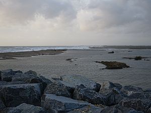
In 2013, the Environment Agency finished building a new, longer flood bank. This new bank is about 7 kilometers (4.3 miles) long and is further inland. They also made a planned opening in the old shingle wall. This allowed the sea to flow into a new area, creating a natural flood zone. This big project cost about £28 million.
A New Nature Reserve
By letting the sea in, they also created a fantastic new wetland area. This area is now the Medmerry RSPB nature reserve. It's a safe haven for many birds and other wildlife. When it was finished in 2013, it was the biggest project of its kind on an open coast in Europe! It's also considered one of the most environmentally friendly projects the Environment Agency has ever done.
 | Sharif Bey |
 | Hale Woodruff |
 | Richmond Barthé |
 | Purvis Young |


