Bradenton Beach, Florida facts for kids
Quick facts for kids
Bradenton Beach, Florida
|
||
|---|---|---|
| City of Bradenton Beach | ||

Bradenton Beach
|
||
|
||
| Motto(s):
"Blessed with History, Hospitality, & Spirit"
|
||

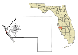
Location in Manatee County and the U.S. state of Florida
|
||
| Country | ||
| State | ||
| County | Manatee | |
| Settled (Cortez Beach) |
1893 | |
| Incorporated (City of Bradenton Beach) |
December 21, 1952 | |
| Government | ||
| • Type | Mayor-Commission | |
| Area | ||
| • Total | 1.19 sq mi (3.08 km2) | |
| • Land | 0.52 sq mi (1.34 km2) | |
| • Water | 0.67 sq mi (1.74 km2) | |
| Elevation | 5 ft (2 m) | |
| Population
(2020)
|
||
| • Total | 908 | |
| • Density | 1,756.29/sq mi (678.15/km2) | |
| Time zone | UTC-5 (Eastern (EST)) | |
| • Summer (DST) | UTC-4 (EDT) | |
| ZIP codes |
34217-34218
|
|
| Area code(s) | 941 | |
| FIPS code | 12-07975 | |
| GNIS feature ID | 0279312 | |
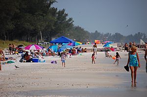
Bradenton Beach is a small city located on Anna Maria Island in Manatee County, Florida, United States. In 2020, about 908 people lived there. It's part of a larger area called the North Port-Bradenton-Sarasota Metropolitan Statistical Area.
This city covers the southern part of Anna Maria Island. It's one of three towns on the island. To its north is Holmes Beach, and further north is Anna Maria.
Contents
History of Bradenton Beach
Early Days: Before 1950
The 1920s and 1930s
Bradenton Beach was first settled in 1893. Back then, it was known as "Cortez Beach" because it was close to the community of Cortez.
Work began on a wooden bridge connecting the island to the mainland in the summer of 1921. A big storm, the 1921 Tampa Bay hurricane, hit in October and destroyed most of the bridge. Even so, the bridge was finished in June 1922, just eight months later.
A two-story building called a pavilion was built at the end of Bridge Street that same year. It had 100 lockers, a dance hall, and a dining room. The owners lived in apartments on the second floor. This pavilion burned down once and was rebuilt, but it burned down again in 1929 and was never rebuilt.
The name "Bradenton Beach" started being used in the mid-1920s. This was during a time when many people were buying land in Florida, known as the Florida land boom. Developers used the new name to make people think the area was closer to the bigger city of Bradenton.
In early 1926, a plan was approved to build another wooden bridge. This bridge would connect Bradenton Beach to Longboat Key. It was finished in August but was damaged by a hurricane in October. On March 6, 1932, a high tide swept the bridge away. It was not replaced until 1957.
The 1940s
On March 8, 1940, a tanker ship named the Regina sank about 200 yards offshore. It was carrying over 350,000 gallons of molasses. The ship was being pulled by a tugboat, but the tow line broke during bad weather. Sadly, one person and a dog did not survive the event. The other seven crew members were rescued.
A post office opened in Bradenton Beach in 1941.
Becoming a City: After 1950
Bradenton Beach officially became a city on December 21, 1952. Residents voted 84 to 56 in favor of becoming a city. Bernard Wagaman, who owned a rental apartment complex there, became the first mayor.
The main wooden bridge from Cortez to the island was replaced with a stronger concrete bridge in 1957. Local people wanted a more solid bridge. To show how strong the new bridge was, the city even had a parade led by an elephant! To help pay for the bridge, it was a toll bridge until 1964. Cars paid 30 cents to enter the island, but there was no charge to leave.
Geography
Bradenton Beach is located at about 27°28′16″N 82°41′59″W.
The city is on the southern part of Anna Maria Island. It has the Gulf of Mexico to its west and Anna Maria Sound to its east. To the north, it borders Holmes Beach. To the south, across Longboat Pass, is Longboat Key. The community of Cortez is to the east, across Anna Maria Sound, and is connected by the Cortez Bridge. The city of Bradenton is about 10 miles (16 km) to the east.
The total area of Bradenton Beach is about 1.19 square miles (3.08 square kilometers). Most of this area, about 56.55%, is water.
Climate
The weather in Bradenton Beach has hot, humid summers and generally mild winters. This type of weather is called a humid subtropical climate.
Population Information
| Historical population | |||
|---|---|---|---|
| Census | Pop. | %± | |
| 1960 | 1,124 | — | |
| 1970 | 1,370 | 21.9% | |
| 1980 | 1,603 | 17.0% | |
| 1990 | 1,657 | 3.4% | |
| 2000 | 1,482 | −10.6% | |
| 2010 | 1,171 | −21.0% | |
| 2020 | 908 | −22.5% | |
| U.S. Decennial Census | |||
In 2020, there were 908 people living in Bradenton Beach. There were 495 households and 255 families. In 2010, the population was 1,171 people.
Library
The Tingley Memorial Library is located at 111 2nd Street, North, right behind City Hall. It was built thanks to a large gift of $600,000 from the estate of Beulah Rebecca Hooks Hannah Tingley (1893–1986). The library is special because it is kept running without using public money. In 2000, Beulah Tingley was honored as a "Great Floridian" by the state of Florida. A special plaque celebrating this honor is placed above the library's front door.
See also
 In Spanish: Bradenton Beach para niños
 | Ernest Everett Just |
 | Mary Jackson |
 | Emmett Chappelle |
 | Marie Maynard Daly |


