
Anna Maria, Florida facts for kids
Quick facts for kids
Anna Maria, Florida
|
||
|---|---|---|
| City of Anna Maria | ||

Beachfront homes in Anna Maria
|
||
|
||

Location in Manatee County, Florida
|
||
| Country | ||
| State | ||
| County | Manatee | |
| Settled | 1893 | |
| Incorporated | 1923 | |
| Government | ||
| • Type | Mayor-Commission | |
| Area | ||
| • Total | 0.86 sq mi (2.23 km2) | |
| • Land | 0.73 sq mi (1.90 km2) | |
| • Water | 0.13 sq mi (0.32 km2) | |
| Elevation | 4 ft (1 m) | |
| Population
(2020)
|
||
| • Total | 968 | |
| • Density | 1,317.01/sq mi (508.26/km2) | |
| Time zone | UTC-5 (Eastern (EST)) | |
| • Summer (DST) | UTC-4 (EDT) | |
| ZIP code |
34216
|
|
| Area code(s) | 941 | |
| FIPS code | 12-01475 | |
| GNIS feature ID | 0277889 | |

Anna Maria is a small city in Manatee County, Florida, United States. It is located on the northern part of Anna Maria Island. This city is part of the larger North Port-Bradenton-Sarasota area in Florida.
In 2020, about 968 people lived in Anna Maria. This number was lower than the 1,503 people who lived there in 2010. Anna Maria is one of three towns on the island. The other two are Holmes Beach in the middle and Bradenton Beach to the south.
Contents
How Anna Maria Got Its Name
The city of Anna Maria has an interesting name! One story says that Madison Post, a former mayor of Tampa, named the island. He supposedly named it after his wife, Maria, and his sister-in-law, Anna.
Another popular story is that Juan Ponce de León named the island. This legend says he named it after Maria Anna von der Pfalz-Neuburg. She was the queen of Charles II of Spain, who supported Ponce de Leon's travels.
In the past, people said the name differently. Older residents would say "Anna Mar-EYE-a." But today, most people say "Anna Mar-EE-a."
History of Anna Maria
Early Settlement and Development
In 1893, a man named George Emerson Bean built a home close to where the Rod & Reel Pier is today. Two years later, in 1895, he claimed 160 acres (0.65 square kilometers) of land on the north side of Anna Maria Island. Before Bean, another person named Andrew Gowanlack lived in the area. Andrew didn't claim the land, but he received three acres after Bean's claim because he had been living there.
After George Bean passed away in 1898, his son, George Wilhelm Bean, took over the land. He teamed up with Charles Roser, a rich real estate developer from St. Petersburg. Together, they created the Anna Maria Beach Company to build up the area.
The Anna Maria City Pier
In 1911, the Anna Maria Beach Company built the Anna Maria City Pier. This pier was important because it allowed steamships to bring people to and from the island. The pier had several buildings on it. In 1913, an extension was added with a house. However, this part of the pier was destroyed in September 1927.
The City of Anna Maria officially became a city in 1923.

Changes Over Time
Around 1927, a jail was built in Anna Maria. It was used to hold people who caused trouble at local bars. The jail was used until 1940, when a fire burned down its roof and cells.
In 1963, the nearby city of Bradenton tried to make Anna Maria part of its city. Anna Maria held a special vote on April 2, 1963, to decide. The people of Anna Maria did not approve this idea. A large majority, 297 people, voted against it, while only 9 voted for it.
Recent Pier History
The city pier was badly damaged during Hurricane Irma in 2017. It was taken down the next year, and plans were made to rebuild it. The new historic city pier opened in April 2020. However, Hurricane Milton in 2024 also caused a lot of damage to this new pier.
Geography of Anna Maria
Location and Surroundings
The City of Anna Maria is the westernmost community in Manatee County. It is located on Anna Maria Island at coordinates 27.530214 degrees North and 82.734370 degrees West.
To the southwest, the city is next to the Gulf of Mexico. To the northeast, it borders Tampa Bay. These two bodies of water are connected by Passage Key Inlet at the northwest end of the island. To the southeast, Anna Maria borders Holmes Beach. The city of Bradenton is about 11 miles (18 kilometers) to the east. You can reach Bradenton by taking Florida State Road 64 from Holmes Beach.
Size of the City
According to the United States Census Bureau, the city of Anna Maria covers a total area of 0.86 square miles (2.23 square kilometers). About 0.74 square miles (1.90 square kilometers) of this is land. The remaining 0.12 square miles (0.32 square kilometers), which is about 14.53%, is water.
Climate in Anna Maria
The weather in Anna Maria is known for its hot and humid summers. The winters are generally mild. The climate here is called a humid subtropical climate (Cfa). This means it has warm temperatures and plenty of rain throughout the year.
Population of Anna Maria
| Historical population | |||
|---|---|---|---|
| Census | Pop. | %± | |
| 1930 | 77 | — | |
| 1940 | 158 | 105.2% | |
| 1950 | 345 | 118.4% | |
| 1960 | 690 | 100.0% | |
| 1970 | 1,137 | 64.8% | |
| 1980 | 1,537 | 35.2% | |
| 1990 | 1,744 | 13.5% | |
| 2000 | 1,814 | 4.0% | |
| 2010 | 1,503 | −17.1% | |
| 2020 | 968 | −35.6% | |
| U.S. Decennial Census | |||
Recent Population Data
The population of Anna Maria changes over time. In 2020, the 2020 United States census counted 968 people living in the city. There were 607 households and 350 families.
In 2010, the 2010 United States census showed that 1,503 people lived in Anna Maria. At that time, there were 688 households and 412 families.
Images for kids
-
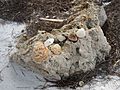
Shelling is popular on the beaches of Anna Maria.

See also
 In Spanish: Anna María (Florida) para niños
