Brannan Island facts for kids

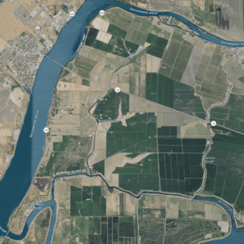
USGS aerial imagery of Brannan Island
|
|
| Geography | |
|---|---|
| Location | Northern California |
| Coordinates | 38°07′19″N 121°38′37″W / 38.12194°N 121.64361°W |
| Adjacent bodies of water | Sacramento–San Joaquin River Delta |
| Highest elevation | -13 ft (-3.96 m) |
| Administration | |
|
United States
|
|
| State | |
| County | Sacramento |
Brannan Island is a small island located in the Sacramento–San Joaquin River Delta in Northern California. It's part of Sacramento County and is managed by a group called Reclamation District 2067. In 1981, experts from the United States Geological Survey measured its elevation as 13 feet (about 4 meters) below sea level. This means it's a special place that needs protection from the surrounding water.
Contents
Where is Brannan Island Located?
Brannan Island is found within the huge Sacramento–San Joaquin River Delta. This delta is a really important area where the Sacramento River and San Joaquin River meet. These rivers then flow into the San Francisco Bay. The delta is a network of islands, channels, and sloughs (small waterways).
Why is the Delta Important?
The Sacramento-San Joaquin River Delta is super important for many reasons.
- It provides drinking water for millions of Californians.
- It helps farmers grow crops by supplying water for irrigation.
- It's a vital habitat for many kinds of fish, birds, and other wildlife.
- It's also a popular spot for boating, fishing, and other outdoor activities.
What Does "Below Sea Level" Mean?
Brannan Island's elevation is -13 feet, which means it's lower than the ocean's surface. This is common for many islands in the Sacramento-San Joaquin Delta.
How Islands Stay Dry
To keep these low-lying islands from flooding, people have built special walls called levees. Levees are like big earthen dams that surround the islands. They hold back the river water, protecting the land inside. Without these levees, much of Brannan Island would be underwater!
A Look at Brannan Island's History
Brannan Island has been on maps for a long time. An early map from 1850 shows a "Brannan Island" in the same general area. This map was made by Cadwalader Ringgold, a U.S. Navy officer. Another map from 1854 by Henry Lange also labels the island. This shows that Brannan Island has been a recognized part of the delta for over 170 years.


