Brislington Brook facts for kids
Quick facts for kids Brislington Brook |
|
|---|---|

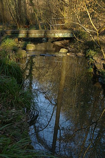
Brislington Brook in St Annes Wood
|
|

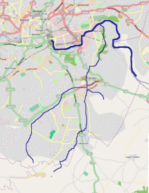
Diagrammatic map of the Brislington Brook within Bristol
|
|
| Country | England |
| Region | West Country |
| District | Bristol |
| Physical characteristics | |
| Main source | Maes Knoll Whitchurch, Bristol, England 476 ft (145 m) 51°23′43″N 2°34′22″W / 51.3952°N 2.5729°W |
| River mouth | Bristol Avon St Annes, Bristol, England 33 ft (10 m) 51°27′14″N 2°32′49″W / 51.4539°N 2.5469°W |
| Length | 5 mi (8.0 km), northerly |
| Basin features | |
| Basin size | 4.6 sq mi (12 km2) |
| River system | Bristol Avon |
The Brislington Brook is a small river, about 5 miles (8.0 km) long, in Bristol, England. It flows into the Bristol Avon. This brook starts on the northern side of Maes Knoll, which is a hill at the edge of Bristol.
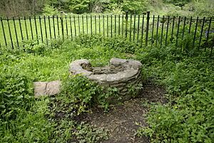
For a long time, the brook had problems with pollution. But over the last few decades, people have worked hard to make it cleaner. Now, some wildlife can live there again. Near the end of the brook, there's a place called St Anne's Well. This spot was very important for Christian pilgrims many years ago.
Contents
Where Does Brislington Brook Flow?
The Brislington Brook begins as two smaller streams. These streams are fed by springs on the northern slopes of Maes Knoll. This area is close to the border between Somerset and Bristol.
The Two Branches
One branch of the brook flows underground through an area called the Bamfield estate. Then, it comes to the surface and runs next to Airport Road.
The other branch briefly enters Bath and North East Somerset. After that, it flows into a shallow valley. It passes under the Saltwell Viaduct, which is a bridge carrying the A37 Wells Road.
Joining Together
The brook then re-enters Bristol. It flows between areas called Hengrove and Flowers Hill, and then into Brislington. A small stream joins it before it goes under the A4174 road. Here, the two main branches of Brislington Brook meet at West Town Lane.
Journey to the Avon
After joining, Brislington Brook turns and flows towards the northeast. It goes under the A4 Bath Road. Then, it flows down into Nightingale Valley in Broomhill. Here, you can see it pass under a restored packhorse bridge, which is a type of old bridge for horses carrying goods.
When there's a lot of rain, extra water from the brook can go into a tunnel. This tunnel then carries the water into the Avon River, across from a place called Conham. The main part of Brislington Brook continues its journey north. It gets more water from St Anne's Spring. Finally, it flows through industrial areas in St Annes Park. The brook then joins the Avon River through an underground pipe where the old St Annes Board Mills used to be.
A Look Back in Time: St Anne's Well

St Anne's Spring was a very special place in the Middle Ages. People would travel there on a pilgrimage to honor Saint Anne, who was the mother of the Virgin Mary.
Pilgrims and Chapels
As far back as 1087, the Domesday Book mentioned a ferry that carried pilgrims across the Avon River from the northern side. In 1485, King Henry VII himself visited a chapel nearby called St Anne in the Wood. This chapel might have been built by the Barons de la Warr, who owned the Brislington area.
A writer from the 1400s, William Worcester, described the chapel as being about 19 yards (17 m) long and 5 yards (4.6 m) wide. He said it had huge wax candles, some as tall as 80 feet (24 m)! These candles were given by different city groups. While some people thought the candle heights were a bit exaggerated, the site was very famous. An early religious reformer, Hugh Latimer, said it was as well-known for pilgrimages as a place called Walsingham.
After the Monasteries
Later, during a time called the Dissolution of the Monasteries, the chapel was taken down. The land was then rented out to local wealthy families.
Wildlife and Water Quality
Even though the Brislington Brook has faced pollution, some amazing wildlife can still be found. In Nightingale Valley, people have seen Kingfishers and Eels. This area also has many different kinds of trees and plants.
Keeping the Water Clean
Bristol City Council regularly checks the water quality of the brook. In the 1990s, big improvements were made. They found and fixed illegal sewage pipes that were draining into the brook.
However, the water quality still needs more work. It has a relatively high biochemical oxygen demand, which means there isn't enough oxygen for some aquatic life. There are also many coliform bacteria, which can be a sign of pollution. Efforts continue to make the brook even healthier for all its creatures.
 | Chris Smalls |
 | Fred Hampton |
 | Ralph Abernathy |

