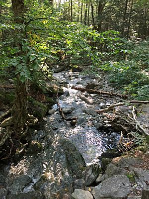
Browns River (Vermont) facts for kids
For other places named "Browns River," see Browns River (disambiguation).
The Browns River is a cool waterway in northern Vermont. It flows for about 20 miles (32 kilometers). This river is a "tributary," which means it's a smaller river that flows into a larger one. The Browns River flows into the Lamoille River.
About the Browns River
The Browns River is an important part of Vermont's natural landscape. It provides homes for many plants and animals. It also helps shape the land as it flows from the mountains to the larger Lamoille River.
Where Does the River Start and End?
The Browns River begins high up on the western side of Mount Mansfield. This mountain is in a town called Underhill. This starting point is called the river's "source."
The river ends in the town of Fairfax. This ending point is called the river's "mouth." Here, the Browns River joins the larger Lamoille River.
The River's Journey
From its source on Mount Mansfield, the Browns River flows west. It travels through Underhill State Park. Then, it reaches the town of Jericho.
The river keeps flowing west. It enters the town of Essex. Near the village of Essex Center, the river turns and starts flowing north. It continues its journey through the town of Westford. Finally, the Browns River reaches its mouth in the southwestern part of Fairfax, where it empties into the Lamoille River.
 | Janet Taylor Pickett |
 | Synthia Saint James |
 | Howardena Pindell |
 | Faith Ringgold |


