
Brownstown, Cambria County, Pennsylvania facts for kids
Quick facts for kids
Brownstown, Pennsylvania
|
|
|---|---|
|
Borough
|
|

Houses on Habicht St. at dusk
|
|

Location of Brownstown in Cambria County, Pennsylvania.
|
|

Brownstown, Cambria County, Pennsylvania
Location in Pennsylvania
|
|
| Country | United States |
| State | Pennsylvania |
| County | Cambria |
| Incorporated | 1908 |
| Government | |
| • Type | Borough Council |
| Area | |
| • Total | 0.24 sq mi (0.61 km2) |
| • Land | 0.24 sq mi (0.61 km2) |
| • Water | 0.00 sq mi (0.00 km2) |
| Elevation | 1,470 ft (450 m) |
| Population
(2020)
|
|
| • Total | 696 |
| • Density | 2,936.71/sq mi (1,132.44/km2) |
| Time zone | UTC-5 (Eastern (EST)) |
| • Summer (DST) | UTC-4 (EDT) |
| ZIP code |
15906
|
| Area code(s) | 814 |
| FIPS code | 42-09400 |
| GNIS feature ID | 1215010 |
Brownstown is a small town, called a borough, in Cambria County, Pennsylvania, in the United States. In 2010, about 744 people lived there. It's part of the larger Johnstown, Pennsylvania area.
Contents
Where is Brownstown Located?
Brownstown is in the southwestern part of Cambria County. Its exact location is 40°20′01″N 78°56′14″W / 40.33361°N 78.93722°W. The town is next to Westmont on its south side.
The borough sits on a hill. This hill is on the west side of the Conemaugh River valley. Brownstown is about 2 miles (3.2 km) northwest of the center of Johnstown by road.
How Big is Brownstown?
According to the United States Census Bureau, Brownstown covers a total area of about 0.6 square kilometers (0.24 square miles). All of this area is land. There is no water within the borough limits.
Who Lives in Brownstown?
| Historical population | |||
|---|---|---|---|
| Census | Pop. | %± | |
| 1890 | 550 | — | |
| 1910 | 1,300 | — | |
| 1920 | 1,489 | 14.5% | |
| 1930 | 1,586 | 6.5% | |
| 1940 | 1,598 | 0.8% | |
| 1950 | 1,508 | −5.6% | |
| 1960 | 1,379 | −8.6% | |
| 1970 | 1,035 | −24.9% | |
| 1980 | 1,077 | 4.1% | |
| 1990 | 937 | −13.0% | |
| 2000 | 883 | −5.8% | |
| 2010 | 744 | −15.7% | |
| 2020 | 696 | −6.5% | |
| Sources: | |||
In the year 2000, a census counted 883 people living in Brownstown. These people lived in 354 households. About 259 of these were families. The town had about 3,468 people per square mile (1,339 people per square kilometer).
Most people in Brownstown were White (99.32%). A small number were African American (0.23%) or Asian (0.11%). Some people (0.34%) were from two or more racial backgrounds.
Households and Families
Out of 354 households, 31.1% had children under 18 living with them. More than half (56.8%) were married couples living together. About 9.6% of households had a female head with no husband. About 26.6% were not families.
Almost a quarter (23.4%) of all households were single individuals. About 13.6% of these were people aged 65 or older living alone. On average, each household had 2.49 people. The average family had 2.94 people.
Age and Income
The population of Brownstown was spread out by age. About 21.5% were under 18 years old. About 7.0% were between 18 and 24. The largest group, 27.5%, was between 25 and 44. People aged 45 to 64 made up 25.4%. About 18.6% were 65 years or older. The average age in Brownstown was 41 years.
In 2000, the average income for a household in Brownstown was $33,043. For families, the average income was $36,645. Men earned about $25,000 per year. Women earned about $17,386 per year. The average income per person in the borough was $13,494.
About 8.0% of all people in Brownstown lived below the poverty line. This included 8.3% of those under 18. It also included 5.2% of people aged 65 or older.
Images for kids
-
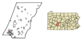
This map shows where Brownstown is located in Cambria County, Pennsylvania.
See also
 In Spanish: Brownstown (condado de Cambria, Pensilvania) para niños
