
Bruche (river) facts for kids
Quick facts for kids Bruche |
|
| River | |
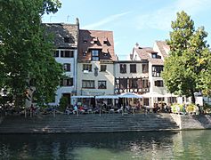
 The Bruche in Fouday.
|
|
| Country | |
|---|---|
| Region | Grand Est |
| Department | Bas-Rhin |
| Municipalities | Schirmeck, Mutzig, Molsheim, Lingolsheim, Eckbolsheim, Strasbourg |
| Tributaries | |
| - left | Mossig |
| - right | Magel |
| Large city | Strasbourg |
| Source | Climont |
| - location | Vosgues mountains, Urbeis, Bas-Rhin, France |
| - elevation | 662 m (2,172 ft) |
| - coordinates | 48°20′40″N 7°10′01″E / 48.34444°N 7.16694°E |
| Confluence | Ill |
| - location | Strasbourg, Bas-Rhin, France |
| - elevation | 130 m (427 ft) |
| - coordinates | 48°34′3″N 7°42′45″E / 48.56750°N 7.71250°E |
| Length | 76.7 km (48 mi) |
| Basin | 727 km² (281 sq mi) |
| Discharge | for Holtzheim |
| - average | 8.080 m³/s (285 cu ft/s) |
The Bruche is a river in Alsace, a region in north-eastern France. It flows into the Ill river, which then joins the larger Rhine river. This means the Bruche is part of the water system that eventually reaches the Rhine.
Contents
Where is the Bruche River Located?
The Bruche river is about 76.7 km (47.7 mi) long. It has a drainage basin (the area of land where all the water drains into the river) of about 727 km2 (281 sq mi).
The River's Journey
The Bruche starts its journey in the Vosges mountains. Its source is at the foot of the Climont mountain, in a small area called Urbeis. This is in the Bas-Rhin department of France. The river begins at a high point, about 662 m (2,172 ft) above sea level.
From its start, the Bruche first flows north. Then, it turns and flows towards the northeast.
The Bruche river flows through the Grand Est region and the Bas-Rhin department. It passes through 38 different towns and villages.
Finally, the Bruche river flows into the Ill river. This happens in the big city of Strasbourg, just southwest of its historic center.
What Rivers Join the Bruche?
The Bruche river has a few smaller rivers that flow into it. These are called tributaries. The two most important ones are:
- The Magel: This river joins the Bruche from the right side. It is about 17.4 km (10.8 mi) long.
- The Mossig: This river joins the Bruche from the left side. It is about 33.1 km (20.6 mi) long.
How Much Water Flows in the Bruche?
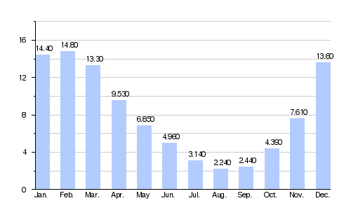
The average amount of water flowing in the Bruche river each year is measured at Holtzheim. This measurement is called the discharge. It tells us the volume of water that passes a certain point in the river over a period of time. From 1965 to 2017, the average discharge was 8.080 m3/s (285.3 cu ft/s).
Average monthly discharge (m3/s) at Holtzheim (1965 - 2017)
Images for kids
-
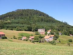
Climont, a small village and a mountain peak.
-
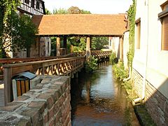
A bridge over the Bruche in Molsheim.
-
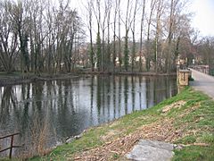
Where the Mossig and the Bruche rivers meet in Wolxheim.
-
The Bruche river flowing through Strasbourg.

.jpg)

.jpg)
Related pages
See also
 In Spanish: Bruche para niños
