
Bug (river) facts for kids
Quick facts for kids Bug |
|
|---|---|

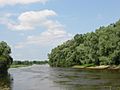
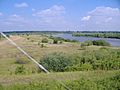
Bug River in the vicinity of Wyszków, Poland
|
|

Bug River
|
|
| Country | Poland, Belarus, Ukraine |
| Voivodeship Voblast Oblast |
Podlaskie, Mazovian, Lublin, Brest, Lviv |
| Physical characteristics | |
| Main source | near Verkhobuzh, Lviv Oblast, Ukraine 310 m (1,020 ft) 49°52′0.5736″N 25°5′48.609″E / 49.866826000°N 25.09683583°E |
| River mouth | Narew near Serock, Poland 75 m (246 ft) 52°30′29.286″N 21°5′2.688″E / 52.50813500°N 21.08408000°E |
| Length | 774 km (481 mi) |
| Discharge (location 2) |
|
| Basin features | |
| Progression | Narew→ Vistula→ Baltic Sea |
| Basin size | 38,712 km2 (14,947 sq mi) |
The Bug River (also known as the Western Bug) is a big river in Eastern Europe. It flows through three countries: Belarus, Poland, and Ukraine. The river is about 774 kilometers (481 miles) long.
The Bug River is a tributary of the Narew River. This means it flows into the Narew. For a long part of its journey, the Bug River acts as a natural border. It forms about 178 kilometers (111 miles) of the border between Belarus and Poland. It also forms about 185 kilometers (115 miles) of the border between Ukraine and Poland.
The Bug River is connected to the Dnieper River by the Dnieper-Bug Canal. The area of land that drains into the Bug River is called its drainage basin. This basin covers about 38,712 square kilometers (14,947 square miles). About half of this area is in Poland, a quarter in Belarus, and a quarter in Ukraine.
Contents
History of the Bug River
The name Bug comes from an old word that means "bend" or "turn." This makes sense because rivers often have many bends. The name might describe the river's winding path.
For a long time, the Bug River was seen as an important dividing line. It was often considered the border between Eastern and Western cultures. It also separated people who followed the Eastern Orthodox Church (like Ukrainians and Belarusians) from those who followed the Roman Catholic Church (like Poles).
The Bug River as a Border
The Bug River has played a role in many historical borders.
- After Poland was divided in 1795, the Bug was part of the border between areas controlled by Austria and Russia.
- It was also part of the eastern border of the Duchy of Warsaw (1809-1815).
- Later, it marked parts of the border for Congress Poland and the Regency Kingdom of Poland.
- During World War II in 1939, the Bug River became a dividing line. It separated the areas of Poland taken over by the German army and the Soviet army.
Where the Bug River Flows

The Bug River starts in the Lviv Oblast in western Ukraine. It then flows north into the Volyn Oblast. After that, it runs along the border between Ukraine and Poland. Then it follows part of the border between Poland and Belarus. Finally, it enters Poland completely.
In Poland, the Bug River flows along the border of the Masovian Voivodeship and the Podlaskie Voivodeship. It eventually joins the Narew River near Serock. This meeting point is just a few kilometers upstream from a large artificial lake called Zegrze Lake.
For a while, the part of the Narew River after the Bug joined it was sometimes called "Bugo-Narew." However, this name was officially removed in 1962 after Zegrze Lake was finished.
The Bug River also marks the westernmost point of Belarus. This spot is near the town of Vysokaye. The Bug is connected to the Dnieper River through another river called the Mukhavets and the Dnieper-Bug Canal.
The Bug River Basin
The total area that drains into the Bug River is about 38,712 square kilometers (14,947 square miles).
- About half of this area (19,239 square kilometers or 7,428 square miles) is in Poland.
- More than a quarter (11,400 square kilometers or 4,402 square miles) is in Belarus.
- A bit less than a quarter (8,700 square kilometers or 3,359 square miles) is in Ukraine.
The climate in the Bug River basin is temperate. This means it has four distinct seasons.
Water Levels and Floods
The Bug River usually has high water levels in spring. This happens because snow melts and adds a lot of water to the river. After spring, the water level drops and stays low until October or November.
Sometimes, summer floods can happen, especially in the upper parts of the river where mountains are. In autumn, the water level usually does not rise much. In some years, it might not rise at all.
During winter, the river can freeze over. Sometimes, the ice breaks up temporarily. This can cause "ice jams," where pieces of ice block the river. These jams can make the water level rise by up to 2 meters (6.6 feet). The water levels can change a lot in winter because the ice cover is not stable.
Flooding Events
Over the past 60 years, there have been several big floods in the Belarusian part of the Bug River. Major floods were recorded in 1958, 1962, 1967, 1971, and 1974.
The biggest spring flood happened in 1979. The amount of water flowing was very high. For example, near the village of Chersk, it was 19.1 cubic meters per second on March 24, 1979. Near Brest, it reached 269 cubic meters per second on April 1, 1979. Another large spring flood happened in 1999. The amount of water that flowed from March to May was almost 50% higher than usual.
The last time the Bug River flooded in Poland and Ukraine was in 2010. The last flood in Belarus was in 1999.
Rivers that Flow into the Bug
Many smaller rivers and streams flow into the Bug River. These are called its tributaries.
- Poltva
- Bukowa
- Huczwa
- Uherka
- Włodawka
- Krzna
- Toczna
- Liwiec
- Kałamanka
Right bank
- Solokiya
- Luha
- Mukhavets
- Lyasnaya
- Leśna Prawa
- Lyevaya Lyasnaya
- Nurzec
- Brok
- Warenzhanka
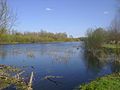
Photo gallery
-
Bug River in the vicinity of Włodawa
-
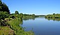
Bug River in the vicinity of Nur
-
Bug River in the vicinity of Drohiczyn
-
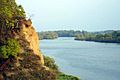
Bug River landscape near Nadbużański
-
Bug River in the vicinity of Małkinia Górna
-
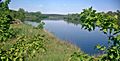
Bug River in the vicinity of Serpelice


See also
 In Spanish: Bug Occidental para niños
- Bug Landscape Park
- Geography of Belarus
- Geography of Poland
- Geography of Ukraine
- Rivers of Belarus
- Rivers of Poland
- Rivers of Ukraine
- Southern Bug
