Bull Shoals, Arkansas facts for kids
Quick facts for kids
Bull Shoals, Arkansas
|
|
|---|---|

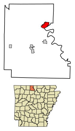
Location in Marion County, Arkansas
|
|
| Country | United States |
| State | Arkansas |
| County | Marion |
| Area | |
| • Total | 4.97 sq mi (12.87 km2) |
| • Land | 4.90 sq mi (12.70 km2) |
| • Water | 0.07 sq mi (0.18 km2) |
| Elevation | 558 ft (170 m) |
| Population
(2020)
|
|
| • Total | 1,952 |
| • Density | 398.20/sq mi (153.74/km2) |
| Time zone | UTC-6 (Central (CST)) |
| • Summer (DST) | UTC-5 (CDT) |
| ZIP code |
72619
|
| Area code(s) | 870 |
| FIPS code | 05-09790 |
| GNIS feature ID | 2403951 |
Bull Shoals is a city in Marion County, Arkansas. It was founded in 1954. In 2020, about 1,952 people lived there.
Bull Shoals is a popular place for people to retire or go on vacation. It is surrounded on three sides by the clear, deep waters of Bull Shoals Lake. This lake is man-made.
Contents
History of Bull Shoals
The city of Bull Shoals was started by real estate developers C. S. Woods and C. S. Woods Jr. It became an official city in 1954. The famous Bull Shoals Dam is located at the entrance to the town from the southeast.
The town and the dam grew up together. The developers bought land in the area when they found out the government planned to build a large dam there. This dam was meant to help control floods and create electricity. Building the dam took four years, from 1947 to 1951. It was one of the biggest dams built in the United States at that time.
Geography of Bull Shoals
Bull Shoals is located in the northeastern part of Marion County. It is surrounded by Bull Shoals Lake on three sides. The main part of the lake, which is on the White River, is to the southeast and northeast. A long arm of the lake, formed by Jimmie Creek and Moccasin Creek, is on the northwest side of the city. The southeast edge of the city is also the border with Baxter County.
The city covers a total area of about 5 square miles (12.87 square kilometers). Only a small part of this area is water.
Highway 178 is the only major road that goes into and out of Bull Shoals. This highway enters the city right after the Bull Shoals Dam. The dam is where Bull Shoals Lake starts from the White River, close to the Arkansas-Missouri border. Highway 178 goes east about 9 miles (14 km) to Midway. It also goes south the same distance to Flippin. Yellville, which is the county seat of Marion County, is about 15 miles (24 km) southwest of Bull Shoals. Mountain Home is 15 miles (24 km) southeast.
People of Bull Shoals
In 2020, there were 1,952 people living in Bull Shoals. There were 951 households and 572 families. Most of the people living in Bull Shoals are White. A small number of people are from other racial backgrounds. About 2.82% of the population is Hispanic or Latino.
The city has a higher number of older residents. About 38.3% of the people were 65 years old or older in 2010. Only 11.6% were under 18 years old. The average age in the city was 59 years.
Education
Students who live in Bull Shoals go to schools in the Flippin School District. They attend Flippin High School.
Fun Things to Do
Bull Shoals has been recognized as an Arkansas Volunteer Community of the Year five times. This shows how much people in the community help each other.
The city and Bull Shoals Lake are popular for water sports and fishing.
- In 2010 and 2011, professional wakeboarding tournaments were held here.
- "Surf the Bull" is an event for wakesurfing that happens every summer. It is hosted by the Bull Shoals Lake Boat Dock.
- The lake has also hosted many professional fishing tournaments for bass and walleye fish.
- Bull Shoals also helps host the yearly HillBilly Chili Cookoff. This event picks Arkansas's best chili to compete in international contests.
Famous People
- Loren P. Thompson was a state legislator from Minnesota. He also owned a resort and served as the mayor of Bull Shoals.
See also
 In Spanish: Bull Shoals para niños
 | William Lucy |
 | Charles Hayes |
 | Cleveland Robinson |


