Baxter County, Arkansas facts for kids
Quick facts for kids
Baxter County
|
||
|---|---|---|
|
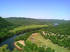
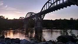
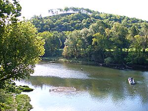
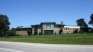
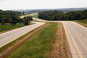
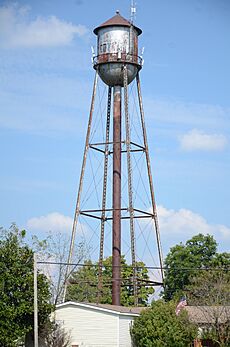
Clockwise from top: Buffalo River at Buffalo City, the 1825 Jacob Wolf House at Norfork, Vada Sheid Community Development Center on the campus of ASU-Mountain Home, Cotter Bridge over the White River at sunset, Bull Shoals Dam, Baxter County Courthouse in Mountain Home
|
||
|
||
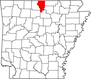
Location within the U.S. state of Arkansas
|
||
 Arkansas's location within the U.S. |
||
| Country | ||
| State | ||
| Founded | March 24, 1873 | |
| Named for | Elisha Baxter | |
| Seat | Mountain Home | |
| Largest city | Mountain Home | |
| Area | ||
| • Total | 586.74 sq mi (1,519.6 km2) | |
| • Land | 554.36 sq mi (1,435.8 km2) | |
| • Water | 32.38 sq mi (83.9 km2) 5.5%% | |
| Population
(2020)
|
||
| • Total | 41,627 | |
| • Density | 70.9462/sq mi (27.3925/km2) | |
| Time zone | UTC−6 (Central) | |
| • Summer (DST) | UTC−5 (CDT) | |
| Congressional district | 1st | |
| Website | Baxter County government's website | |
Baxter County is a county located in the beautiful Ozark Mountains of Arkansas. It became Arkansas's 66th county on March 24, 1873. The county has eight towns and cities. Mountain Home is the largest city and also the county seat, which means it's where the county government is located. The county is named after Elisha Baxter, who was the governor of Arkansas at that time.
Baxter County is often called the "Twin Lakes Area." This is because it has two very large lakes, Bull Shoals Lake and Norfork Lake, on its borders. The White River, Norfork Tailwater, and the Buffalo National River are also important waterways here. The county covers about 587 square miles (1,520 square kilometers). In 2020, about 41,627 people lived in Baxter County.
This area is popular for tourists who love nature. It has five protected areas, including parts of the Buffalo National River and Ozark National Forest. There are also places like the Jacob Wolf House and Cold Water School that help preserve the county's history.
Baxter County has three public school districts and one public community college, Arkansas State University–Mountain Home (ASUMH). Baxter Health is a major healthcare center for the region. While there are no big Interstate highways, the county is served by U.S. Highway 62 and U.S. Highway 412, along with several Arkansas state highways.
Contents
History of Baxter County
Baxter County was formed by the Arkansas government on March 24, 1873. It was created from parts of four other counties: Fulton, Izard, Marion, and Searcy. The county was named after Elisha Baxter, who was the governor of Arkansas at the time. The small town of Mountain Home was chosen as the county seat.
In 1945, people in Baxter County voted to make the county "dry," meaning that selling alcoholic drinks was not allowed. However, in 1978, in a very big election, the county voted to become "wet" again. This meant that selling alcoholic drinks became legal once more.
Geography and Nature
Baxter County is located in the Ozark Mountains, a region known for its beautiful hills and forests. Much of the land near Bull Shoals Lake, Norfork Lake, and the White River is part of the White River Hills. This area has steep, rocky land, streams fed by springs, and forests with oak, hickory, and pine trees. Other parts of the county, especially around Mountain Home, are flatter. These areas are better for farms and homes.
The county covers about 587 square miles (1,520 square kilometers) in total. About 554 square miles (1,436 square kilometers) is land, and 32 square miles (84 square kilometers) is water.
Baxter County is surrounded by other counties in the Ozarks. These include Fulton County to the east and Marion County to the west.
Waterways and Lakes
Baxter County is part of the White River system. The White River flows along the western edge of the county. Here, it is held back by the Bull Shoals Dam to form Bull Shoals Lake. South of the dam, the White River continues to flow across Baxter County from west to east. The Buffalo National River also joins the White River in Baxter County.
Another important river is the North Fork of White River. It flows into the White River below the Norfork Dam, creating the Norfork Tailwater. This area is very famous for trout fishing. Many smaller streams and creeks also flow through the county.
Protected Natural Areas
Baxter County has several special places where nature is protected.
- The Buffalo National River has a small section in Baxter County. This is where the river meets the White River.
- Most of the land south of the White River is part of the Ozark National Forest. Inside this forest, you can find the Leatherwood Wilderness. This is a wild area perfect for hiking.
- The Sylamore Wildlife Management Area (WMA) is also in the Ozark National Forest. It's a great place for hiking, fishing, and hunting wild turkey, bear, and deer. You can also go camping at places like Blanchard Springs Caverns. The Ozark Highlands Trail runs through these areas.
- The Bull Shoals-White River State Park is located near the Bull Shoals Dam. This park has campgrounds, a marina for boats, and a visitor center. The waters below the dam are well-known for excellent trout fishing.
- The Norfork Lake WMA has protected areas around Lake Norfork. These are great for hunting deer and turkey, and for watching waterfowl during their migration.
People of Baxter County
| Historical population | |||
|---|---|---|---|
| Census | Pop. | %± | |
| 1880 | 6,004 | — | |
| 1890 | 8,527 | 42.0% | |
| 1900 | 9,298 | 9.0% | |
| 1910 | 10,389 | 11.7% | |
| 1920 | 10,216 | −1.7% | |
| 1930 | 9,519 | −6.8% | |
| 1940 | 10,281 | 8.0% | |
| 1950 | 11,683 | 13.6% | |
| 1960 | 9,943 | −14.9% | |
| 1970 | 15,319 | 54.1% | |
| 1980 | 27,409 | 78.9% | |
| 1990 | 31,186 | 13.8% | |
| 2000 | 38,386 | 23.1% | |
| 2010 | 41,513 | 8.1% | |
| 2020 | 41,627 | 0.3% | |
| 2023 (est.) | 42,875 | 3.3% | |
| U.S. Decennial Census 1790–1960 1900–1990 1990–2000 2010–2016 |
|||
Racial/Ethnic Makeup of Baxter County (2020) White Non-Hispanic (91.4%) Black Non-Hispanic (0.21%) Native American Non-Hispanic (0.52%) Asian Non-Hispanic (0.56%) Pacific Islander Non-Hispanic (0.02%) Other Non-Hispanic (0.002%) Two or more races Non-Hispanic (4.73%) Hispanic Any Race (2.54%)
In 2020, the population of Baxter County was 41,627 people. There were about 18,936 households. The county has about 71 people per square mile.
The population is spread out in terms of age. About 17.5% of the people are under 18 years old. About 31.5% are 65 years or older. The average age in the county is 53 years.
Education in Baxter County
Many people in Baxter County have completed high school. In 2019, about 88.7% of adults over 25 had a high school degree or higher. About 17.9% had a bachelor's degree or higher.
Schools for Kids
There are three main public school districts in Baxter County:
- Mountain Home School District is the largest.
- Cotter School District serves the Cotter-Gassville area.
- Norfork School District serves the southeast part of the county.
Students from these districts graduate from Mountain Home High School, Cotter High School, or Norfork High School. All these high schools are approved by the Arkansas Department of Education.
College Education
The main college in Baxter County is Arkansas State University-Mountain Home (ASUMH). It is a public community college.
Libraries
The Donald W. Reynolds Library serves Baxter County. It opened in September 2010 in Mountain Home. The library offers books, e-books, movies, and programs. It also has special collections and help for finding family history.
Culture and Daily Life
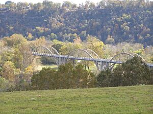
Baxter County has many places that help preserve its history and culture. One of the most important is the Cotter Bridge over the White River. When it opened in 1930, this bridge made it much easier to travel and helped the county grow.
You can learn about the county's past at two places:
- The Jacob Wolf House is a historic log cabin built in 1825. It is now a museum.
- The Baxter County Heritage Center is in the old Rollins Hospital in Gassville.
Several old school buildings are also protected because of their history. These include the Buford School Building and Cold Water School. Other historic buildings like the Baxter County Courthouse show the county's economic and cultural past.
Fun Events and Festivals
Many people visit Baxter County for trout fishing on the White River. There are also several events celebrating fishing:
- The Cotter Trout Festival is held in May.
- The Sowbug Roundup is also in May.
- The Southern Council Federation of Flyfishers Fair is in September.
The Mountain Home Farmer's Market is open on Wednesdays and Saturdays from April to November. The Baxter County Fair is a very popular event that starts with a parade in Mountain Home. The Norfork Pioneer Days Heritage Festival happens every May at the Jacob Wolf House.
The David's Trail Endurance Run is a long running race around Lake Norfork that started in 2017.
Local News and Media
The main newspaper for Baxter County is The Baxter Bulletin, which started in Mountain Home in 1901. Many other newspapers have been published in the county over the years.
Baxter County also has several local TV stations and radio stations.
Towns and Communities
Baxter County has seven incorporated cities and one town.
- Mountain Home is the largest city and the county seat. It is located between Bull Shoals Lake and Lake Norfork.
- Cotter and Gassville are west of Mountain Home.
- Smaller towns like Briarcliff, Norfork, and Salesville are south of Mountain Home.
- Lakeview is a small town on Bull Shoals Lake.
- Big Flat is in the southern part of the county.
There are also several communities that are not officially incorporated as cities or towns. These include Gamaliel, Henderson, Buffalo City, and Midway.
Other Communities
Baxter County has many small communities and old "ghost towns" that are no longer active. Early settlers often lived in small groups rather than in big towns. Some communities, like Bennett's and Cumi, were covered by water when Lake Norfork was created. Others, like Clarkridge, once had a post office or other buildings.
- Advance
- Amos
- Arkana
- Arkawana
- Buford
- Cartney
- Colfax
- County Line
- Culp
- Diamond Bay
- Dogwood Park
- Fawn Park
- Heritage Estates
- Holiday Hills
- Hopewell
- Jordan
- Kingswood Estates
- Lakeside Terrace
- Lone Rock
- Mallard Point
- McPhearson
- Norfork Lake Estates
- Norfork Village
- Old Joe
- Rodney
- Shady Grove
- Shipp
- Spring Lake Estates
- Sycamore Heights
- Sycamore Spring
- Three Brothers
- Timber Lake Manor
- Whiteville
- Woods Point Landing
Historic Communities
- Berry
- Casteel
- Chastain
- Conville
- Covey
- Herron
- Independence
- Jonesdale
- Laytonville
- Spencer
- Wake
Transportation and Services
Airports
Baxter County has one public airport, Baxter County Airport, located west of Mountain Home. It is mostly used for small, private planes. There are also three private airfields. The closest airport with bigger commercial flights is Springfield–Branson National Airport in Missouri.
Main Roads
Baxter County does not have any Interstate highways. The main roads are U.S. Highway 62 (US 62) and U.S. Highway 412 (US 412). These highways run east-west across the county. There are also special "business routes" of US 62 in Mountain Home and Cotter.
Thirteen state highways also serve the county. Arkansas Highway 5 (AR 5) runs all the way from south to north, connecting to Missouri. Other highways, like Highway 101 and Highway 201, also run north-south. Some roads, like Highway 126, connect to the lakes and rivers. Highway 341, also known as Push Mountain Road, goes through the Ozark National Forest.
Railroads
The Missouri and Northern Arkansas Railroad crosses Baxter County along the White River. There is a train yard in Cotter.
Utilities and Services
The North Arkansas Electric Cooperative provides electricity to most rural areas of Baxter County. Entergy Arkansas provides electricity to Mountain Home, Cotter, Gassville, and other populated areas.
The Arkansas Department of Health makes sure that public water systems are safe. There are nine main water systems in Baxter County, including those for Mountain Home, Cotter, and Norfork. There are also smaller water systems for residential areas.
Famous People from Baxter County

- Richard Antrim: A naval rear admiral and World War II hero.
- Lonnie D. Bentley: A professor at Purdue University.
- Robbie Branscum: A writer of books for children and young adults.
- William U. McCabe: He represented Baxter County in the Arkansas Senate and House of Representatives.
- Vada Sheid: A longtime member of the Arkansas government who represented Baxter County.
- Carolyn D. Wright: A well-known poet who was born in Mountain Home.
See also
 In Spanish: Condado de Baxter para niños
 | Charles R. Drew |
 | Benjamin Banneker |
 | Jane C. Wright |
 | Roger Arliner Young |


