
U.S. Route 62 in Arkansas facts for kids
Quick facts for kids
|
||||
|---|---|---|---|---|
_map.svg) |
||||
| Route information | ||||
| Maintained by AHTD | ||||
| Length | 329.9 mi (530.9 km) | |||
| Existed | 1930–present | |||
| Major junctions | ||||
| West end | ||||
| East end | ||||
| Location | ||||
| Counties: | Washington, Benton, Carroll, Boone, Marion, Baxter, Fulton, Sharp, Lawrence, Randolph, Clay | |||
| Highway system | ||||
| United States Numbered Highways List • Bannered • Divided • Replaced Arkansas Highway System
|
||||

U.S. Route 62 (often called US 62) is a major highway that crosses the United States. It stretches all the way from El Paso, Texas in the southwest to Niagara Falls, New York in the northeast. In the state of Arkansas, US 62 covers about 330 miles. It starts at the Oklahoma border near Summers and goes east to the Missouri border in St. Francis. This highway is super important for connecting many towns and cities in northern Arkansas. Some of these places include Fayetteville, Springdale, Bentonville, Harrison, Mountain Home, Pocahontas, and Piggott. Along its path, US 62 shares parts of its road with other highways. These include Interstate 49 and U.S. Route 71, U.S. Route 412, U.S. Route 65, U.S. Route 63, and U.S. Route 67.
Contents
Exploring US 62 in Arkansas
Journey Through Northwest Arkansas

US 62 enters Arkansas from Oklahoma. It passes by interesting spots like the Bean Cemetery and the Borden House. You can also see the Prairie Grove Battlefield State Park in Prairie Grove. The highway then enters the busy Northwest Arkansas metro area. This area includes big cities like Fayetteville, Rogers, and Bentonville.
Through these cities, US 62 actually runs on the same road as I-49 and US 71. This means you're on three highways at once! In Benton County, the road goes past Garfield Elementary School. It's near where US 62 meets Arkansas Highway 127 in Garfield. After Rogers, the highway continues east. It passes close to the Pea Ridge National Military Park, which is a historic battlefield. Soon after, it enters Carroll County.
Winding Through the Ozark Mountains

As US 62 moves through the Ozarks, it winds through beautiful, quiet countryside. You'll see small towns and amazing scenery. Near Eureka Springs, the highway passes by the famous Thorncrown Chapel, a stunning glass chapel. It also goes by the Tall Pines Motor Inn and the historic U.S. 62 White River Bridge.
In Alpena, US 62 starts sharing the road with U.S. Route 412. They travel together all the way to Imboden. These two highways also meet U.S. Route 65 in Harrison. In Marion County, US 62 meets US 62S in Pyatt. It also crosses the US 62 Bridge over Crooked Creek.
This part of US 62 crosses two of Arkansas's special Arkansas Scenic Byways. These are the Pig Trail and Scenic Highway 7. Further east, the highway enters Yellville. East of Yellville, it reaches Mountain Home in Baxter County. Here, it crosses over Norfolk Lake and enters rural Fulton County.

After Fulton County, US 62 and US 412 enter Sharp County. In Ash Flat, US 62/US 412 is where U.S. Route 167 begins. The route then goes around Cherokee Village, Arkansas and enters Hardy. In Hardy, US 62, US 412, and US 63 Business pass by four historic homes. These homes are listed on the National Register of Historic Places.
US 62 and US 412 also meet U.S. Route 63. These highways continue together to Imboden. Here, US 63 and US 412 turn south. US 62 then continues north with Arkansas Highway 115 over the St. Louis-San Francisco Overpass. This leads into Randolph County and the unique Crowley's Ridge.
Traveling Along Crowley's Ridge
In Randolph County, US 62 goes past many cotton fields. It reaches Pocahontas, where it meets US 67. This part of US 67 will someday become I-57. US 62 and US 67 travel east together until Corning in Clay County. The highway then continues east through Crowley's Ridge to Piggott. Finally, it crosses into Missouri near St. Francis.
History of US 62


Before it was US 62, this route was part of an old trail called the Ozark Trail. This was a main set of roads before the famous U.S. Route 66 was built. The Ozark Trails Association was a group that helped keep these trails in good shape and marked them. A man named William Hope Harvey was in charge. He dreamed of a road connecting Oklahoma to his resort town, Monte Ne. He wanted trails to link Monte Ne with big cities like St. Louis, Kansas City, and Oklahoma City.
A part of US 62, from Gateway to Eureka Springs, was also part of The Jefferson Highway. However, this highway wasn't always clearly marked and its path often changed. In 1924, a state map showed this road as a "Proposed Primary Federal Aid Road," but it didn't have a number yet.
This new highway brought a lot of traffic through the Arkansas hills. Before, these areas were hard to reach. Eureka Springs became a popular stop. It had many motor inns and a lively downtown. Nearby Arkansas Highway 23, also known as "The Pig Trail," brought even more tourists. Further east, cities like Mountain Home, Cotter, and Flippin grew a lot because of US 62's traffic.
The rough land and large rivers meant that big bridges were needed. Examples include the Cotter Bridge, which replaced an old ferry system, and the St. Louis-San Francisco Overpass. In 1981, a study found that 31 special "climbing lanes" were needed between Harrison and Hardy. These lanes help vehicles go up steep hills safely. This shows how challenging the terrain was.
Some parts of the old road still exist today with their original pavement. One section was built between 1932 and 1952. It's located between Busch and Eureka Springs, on both sides of the White River. On the north side, Carroll County Route 109 follows the old path. On the south side, County Route 107 continues south. This old section was added to the National Register of Historic Places in 2008.
Major Highway Connections
| County | Location | Mile | Roads intersected | Notes | |||
|---|---|---|---|---|---|---|---|
| Washington | | 0.0 | 0.0 | This is where US 62 enters Arkansas from Oklahoma. | |||
| Fayetteville | 23.9 | 38.5 | US 62 begins to share the road with I-49 and US 71 here. | ||||
| US 62 travels with I-49 and US 71 through the Northwest Arkansas area. | |||||||
| Benton | Bentonville | 44.6 | 71.8 | US 62 leaves I-49 and US 71 here. | |||
| Boone | Alpena | 114 | 183 | US 62 begins to share the road with US 412. | |||
| | 119 | 192 | US 62 also begins to share the road with US 65. | ||||
| | 132 | 212 | US 62 leaves US 65 here. | ||||
| Sharp | Ash Flat | 228.6 | 367.9 | US 167 begins at this junction. | |||
| Lawrence | Imboden | 261.5 | 420.8 | US 62 leaves US 63 and US 412 here. | |||
| Spring River | 261.7 | 421.2 | St. Louis-San Francisco Overpass | ||||
| Randolph | Pocahontas | 274.1 | 441.1 | US 62 begins to share the road with US 67 (Future I-57). | |||
| Corning | 300.3 | 483.3 | US 62 leaves US 67 here. | ||||
| Piggott | 322.3 | 518.7 | US 62 begins to share the road with US 49 and AR 1. | ||||
| | 324.3 | 521.9 | US 62 leaves US 49 and AR 1 here. | ||||
| | 329.9 | 530.9 | This is where US 62 crosses into Missouri. | ||||
| 1.000 mi = 1.609 km; 1.000 km = 0.621 mi | |||||||
| Previous state: Oklahoma |
Arkansas | Next state: Missouri |
Images for kids
-
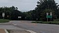
US 62 near the Oklahoma border
-
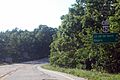
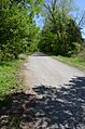
US 62 in Carroll County west of Eureka Springs.
-
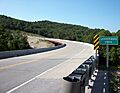
Bridge over Leatherwood Creek west of Eureka Springs.
-
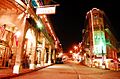
Spring Street in Eureka Springs was originally US 62 - City Route.
-
Old Highway 62 near Busch
