
Boone County, Arkansas facts for kids
Quick facts for kids
Boone County
|
|||
|---|---|---|---|
     Clockwise from top: Boone County Courthouse in Harrison, Buffalo National River, Lake Harrison Park, Overlook from Gaither Mountain in the Ozarks, Harrison Courthouse Square
|
|||
|
|||

Location within the U.S. state of Arkansas
|
|||
 Arkansas's location within the U.S. |
|||
| Country | |||
| State | |||
| Founded | April 9, 1869 | ||
| Seat | Harrison | ||
| Largest city | Harrison | ||
| Area | |||
| • Total | 602 sq mi (1,560 km2) | ||
| • Land | 590 sq mi (1,500 km2) | ||
| • Water | 12 sq mi (30 km2) 1.9% | ||
| Population
(2020)
|
|||
| • Total | 37,373 | ||
| • Density | 62.08/sq mi (23.970/km2) | ||
| Time zone | UTC−6 (Central) | ||
| • Summer (DST) | UTC−5 (CDT) | ||
| Congressional district | 1st | ||

Boone County is a county in the state of Arkansas, right next to the Missouri border. In 2020, about 37,373 people lived here. The main town, or county seat, is Harrison. Boone County was created on April 9, 1869, making it Arkansas's 62nd county.
Boone County is part of the Harrison, Arkansas, Micropolitan Statistical Area. This means it's connected to Harrison for things like jobs and economy.
Contents
History of Boone County
Boone County was formed from a part of Carroll County. Many people think it was named after the famous frontiersman Daniel Boone. However, it was actually first called Boon. The people who settled there believed it would be a "boon," meaning a great benefit or blessing, for everyone who lived there.
The county's first newspaper, started in 1870, was even called the Boon County Advocate. But when the law to create the county was signed in 1869, it was officially named Boone. So, an "e" was added for some reason.
Important Events in History
In the early 1900s, specifically in 1905 and 1909, there were events that led to African-Americans leaving the area. Because of this, Boone County was known as an "all-white" area until the 1920s. Today, Boone County is where the national office of a group called the Knights of the Ku Klux Klan is located. In recent years, local leaders have also recognized June as Confederate Heritage and History Month.
Geography of Boone County
Boone County covers about 602 square miles. Most of this area, 590 square miles, is land, and 12 square miles (about 1.9%) is water. The county is in the northwest part of Arkansas and shares a border with Missouri to the north.
The entire county is located within the Ozark Mountains. You'll find rolling hills in most of the area. More rugged mountains, called the Boston Mountains, are just to the south. Some tall peaks from the Boston Mountain range are found in the southern part of the county. These include Boat Mountain, Pilot's Knob, and Gaither Mountain. Parts of Bull Shoals Lake and Table Rock Lake are also in the county, in the northeast and northwest corners.
Main Roads
 US 62
US 62 US 412
 U.S. Route 65
 U.S. Route 65B
 Highway 7
 Highway 14
 Highway 43
 Highway 123
 Highway 206
 Highway 281
 Highway 392
 Highway 396
 Highway 397
 Highway 980
Neighboring Counties
- Taney County, Missouri (north)
- Marion County (east)
- Searcy County (southeast)
- Newton County (south)
- Carroll County (west)
People of Boone County
| Historical population | |||
|---|---|---|---|
| Census | Pop. | %± | |
| 1870 | 7,032 | — | |
| 1880 | 12,146 | 72.7% | |
| 1890 | 15,816 | 30.2% | |
| 1900 | 16,396 | 3.7% | |
| 1910 | 14,318 | −12.7% | |
| 1920 | 16,098 | 12.4% | |
| 1930 | 14,937 | −7.2% | |
| 1940 | 15,860 | 6.2% | |
| 1950 | 16,260 | 2.5% | |
| 1960 | 16,116 | −0.9% | |
| 1970 | 19,073 | 18.3% | |
| 1980 | 26,067 | 36.7% | |
| 1990 | 28,297 | 8.6% | |
| 2000 | 33,948 | 20.0% | |
| 2010 | 36,903 | 8.7% | |
| 2020 | 37,373 | 1.3% | |
| 2023 (est.) | 38,530 | 4.4% | |
| U.S. Decennial Census 1790–1960 1900–1990 1990–2000 2010–2020 |
|||
In 2020, the county had 37,373 people. Most residents, about 90%, identified as White. Other groups included Native American, Asian, and people of Hispanic or Latino background. About 22% of the people in Boone County were under 18 years old, and about 22% were 65 or older. The average age was 43 years.
Education
Boone County has several public school districts that serve its communities.
Public School Districts
- Alpena
- Bergman
- Harrison
- Lead Hill
- Omaha
- Valley Springs
Colleges and Universities
- North Arkansas College
Communities
Boone County has a mix of cities, towns, and smaller communities.
Cities
- Diamond City
- Harrison (This is the county seat, the main town)
Towns
- Alpena (partly in Carroll County)
- Bellefonte
- Bergman
- Everton
- Lead Hill
- Omaha
- South Lead Hill
- Valley Springs
- Zinc
Unincorporated Communities
These are smaller places that are not officially cities or towns.
Old Communities
- Elixir was once a town near many springs, close to today's Bergman. Heavy rains in 1883 caused floods, which led to its decline. By 1892, the town was mostly gone.
- Keener was another town about a mile south of Bergman. It was quite busy in the 1880s with about 1,000 people. However, Keener also started to decline quickly by 1892.
Images for kids
-
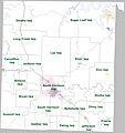
Townships in Boone County, Arkansas as of 2010

See also
 In Spanish: Condado de Boone (Arkansas) para niños
