
Spring River (Arkansas) facts for kids
Quick facts for kids Spring River |
|
|---|---|
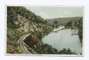
Near Hardy
|
|
| Country | United States |
| States | Arkansas, Missouri |
| Physical characteristics | |
| Main source | Mammoth Spring 490 ft (150 m) 36°29′42″N 91°32′06″W / 36.49500°N 91.53500°W |
| River mouth | Black River 236 ft (72 m) 36°06′53″N 91°04′26″W / 36.11472°N 91.07389°W |
| Length | 57 mi (92 km) |
| Discharge (location 2) |
|
The Spring River is a cool river that flows for about 57 miles (92 km). It runs through the states of Missouri and Arkansas in the United States. This river actually has two main parts. One part is called the South Fork of the Spring River. It starts in Howell County, Missouri and flows south through Fulton and Sharp counties. The South Fork is a calm stream, perfect for camping on its gravelly banks. It eventually meets the main Spring River near Hardy, Arkansas.
Where the Spring River Starts
The main part of the Spring River begins in Mammoth Spring State Park in Mammoth Spring, Arkansas. This is where two water sources come together. One is Mammoth Spring itself, and the other is the Warm Fork of the Spring River.
Mammoth Spring: A Giant Water Source
Mammoth Spring is a huge natural spring. It is the exit point for an underground river that travels from Missouri into Arkansas. A massive amount of water, over 9.78 million US gallons (37,000 cubic meters) per hour, flows out of this spring. This incredible flow of water forms the beginning of the Spring River.
Because most of its water comes from this spring, the river stays cool. The water averages about 58°F (14°C). This cool temperature is great for fish, especially trout, for many miles downstream.
Fun Activities on the River
The Spring River is a very popular spot for visitors. Many people enjoy canoeing or floating down the river in inner tubes, which are often called "toobers."
Popular River Routes
The most popular part of the river for these activities is between Mammoth Spring and the lively tourist town of Hardy. Below Hardy, the Spring River continues its journey. It flows past towns like Ravenden, Arkansas and Imboden, Arkansas.
The river then meets the Eleven Point River near Old Davidsonville State Park. Finally, the Spring River joins the Black River close to Black Rock, Arkansas.
River Services for Visitors
Along the river, especially between Mammoth Spring and Hardy, you can find many businesses called "outfitters." These places offer everything you need for a river trip. They provide supplies, rent canoes, and even offer shuttle services to help you get to and from the river. There are also several resorts where tourists can stay.
Amazing Fish in the River
The Spring River is home to many different kinds of fish. It's a great place for fishing!
Types of Fish You Might Find
You can find fish like trout, walleye, and different types of bass, such as largemouth and smallmouth bass. There are also channel catfish, redear sunfish, and even tiger muskies.
In 1995, a very large tiger muskie was caught in the river. It weighed 23 pounds and 12 ounces (10.8 kg), setting a state record!
Fish Hatcheries on the River
To help keep the fish population healthy, there are fish hatcheries on the Spring River. The Arkansas Game and Fish Commission runs a trout hatchery here. The United States Fish and Wildlife Service also operates another hatchery near Mammoth Spring. These hatcheries help raise young fish to release into the river.
When the River Floods
Sometimes, heavy rains can cause the Spring River to flood. This means the water level rises very high and the river overflows its banks.
A Big Flood in 2008
In March 2008, a large storm brought a lot of rain to Arkansas and Missouri. Over a foot of rain fell in some areas. This caused the Spring River to rise dramatically. The water reached a depth of 22.29 feet (6.79 meters).
This was one of the highest flood levels ever seen on the river. Only the record flood in 1982, which reached 29 feet, was higher. Because of the dangerous water levels, the mayor of Hardy asked about 250 people to leave their homes. The flood waters covered over 100 buildings in and around the town.
