Ravenden, Arkansas facts for kids
Quick facts for kids
Ravenden, Arkansas
|
|
|---|---|

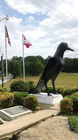
Raven statue in the town, June 2012
|
|

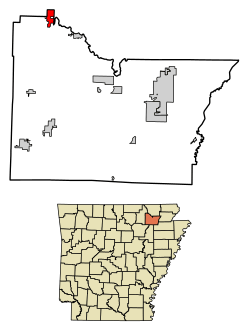
Location in Lawrence County, Arkansas
|
|
| Country | United States |
| State | Arkansas |
| County | Lawrence |
| Area | |
| • Total | 2.12 sq mi (5.49 km2) |
| • Land | 2.11 sq mi (5.47 km2) |
| • Water | 0.01 sq mi (0.03 km2) |
| Elevation | 338 ft (103 m) |
| Population
(2020)
|
|
| • Total | 426 |
| • Density | 201.80/sq mi (77.93/km2) |
| Time zone | UTC−06:00 (Central (CST)) |
| • Summer (DST) | UTC−05:00 (CDT) |
| ZIP Code |
72459
|
| Area code(s) | 870 |
| FIPS code | 05-58250 |
| GNIS feature ID | 0058465 |
Ravenden is a small town in Lawrence County, Arkansas, United States. In 2010, about 470 people lived there. The town is located in the valley of the Spring River. It is also near U.S. Highway 63 and the Burlington-Northern Railroad.
Contents
History of Ravenden
The community building in Ravenden is still used today. It was officially opened in 1960. Ray Ellis was the mayor of the town at that time. A railroad company called Frisco Railroad joined with the Burlington-Northern Railroad in 1980.
Geography of Ravenden
Ravenden is in the northwest part of Lawrence County. You can find it at these coordinates: 36°14′2″N 91°15′7″W.
Several major roads, including U.S. Highway 62, U.S. Highway 63, and U.S. Highway 412, all pass through the northern side of town. These highways go northwest about 16 miles (26 km) to Hardy. They also go southeast about 5 miles (8 km) to Imboden. Arkansas Highway 90 goes north from Ravenden about 6 miles (10 km) to Ravenden Springs.
The town of Ravenden covers a total area of about 2.1 square miles (5.5 square kilometers). A very small part of this area, about 0.01 square miles (0.03 square kilometers), is water. The Spring River flows through the southern part of the town. This river eventually flows into the Black River.
People of Ravenden
| Historical population | |||
|---|---|---|---|
| Census | Pop. | %± | |
| 1940 | 240 | — | |
| 1950 | 245 | 2.1% | |
| 1960 | 231 | −5.7% | |
| 1970 | 219 | −5.2% | |
| 1980 | 338 | 54.3% | |
| 1990 | 330 | −2.4% | |
| 2000 | 511 | 54.8% | |
| 2010 | 470 | −8.0% | |
| 2020 | 426 | −9.4% | |
| U.S. Decennial Census | |||
In 2000, there were 511 people living in Ravenden. There were 209 households, which are groups of people living together in one home. Out of these, 145 were families.
Most of the people in the town were White (about 97%). A small number were Native American (about 1.76%). Some people were from other backgrounds or a mix of two or more. About 1.37% of the people were Hispanic or Latino.
About 35% of the households had children under 18 living with them. More than half (53.6%) were married couples living together. About 13% had a female head of the household with no husband present. Around 30% were not families, meaning individuals or unrelated people living together.
The average household had about 2.44 people. The average family had about 2.97 people.
The population of Ravenden was spread out by age. About 27.6% of the people were under 18 years old. About 8.8% were between 18 and 24. Around 25% were between 25 and 44. About 23% were between 45 and 64. And about 15.7% were 65 years old or older. The average age in the town was 37 years.
Education in Ravenden
Students living in Ravenden attend schools in the Sloan-Hendrix School District. This district operates Sloan-Hendrix High School.
See also
 In Spanish: Ravenden (Arkansas) para niños
 | Madam C. J. Walker |
 | Janet Emerson Bashen |
 | Annie Turnbo Malone |
 | Maggie L. Walker |

