Burneyville, Oklahoma facts for kids
Quick facts for kids
Burneyville, Oklahoma
|
|
|---|---|
| Country | United States |
| State | Oklahoma |
| County | Love |
| Area | |
| • Total | 18.04 sq mi (46.72 km2) |
| • Land | 17.28 sq mi (44.75 km2) |
| • Water | 0.76 sq mi (1.98 km2) |
| Elevation | 771 ft (235 m) |
| Population
(2020)
|
|
| • Total | 815 |
| • Density | 47.17/sq mi (18.21/km2) |
| Time zone | UTC-6 (Central (CST)) |
| • Summer (DST) | UTC-5 (CDT) |
| ZIP code |
73430
|
| FIPS code | 40-10150 |
| GNIS feature ID | 2629937 |
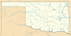
Burneyville is a small community in Love County, Oklahoma, United States. It is a "census-designated place" (CDP), which means it's an area defined by the government for statistics. The town got its name from David C. Burney. His son, Benjamin Crooks Burney, was a leader of the Chickasaw Nation from 1878 to 1880.
Burneyville is located along State Highway 96. It stretches south to the northern bank of the Red River. In 2020, about 815 people lived here.
Contents
History of Burneyville
Burneyville and Love County are named after important Chickasaw people. These families settled in the area in the early 1840s. They moved here as part of the Trail of Tears. This was when the U.S. government moved many Native American tribes from their homes.
Early Settlers and the Burney Family
David C. Burney and his wife, Lucy James Burney, were Chickasaw. They moved from northern Mississippi to what was then called Indian Territory. They started a farm where Burneyville is now. The family traveled by steamboat up the Red River. Their son, Benjamin Crooks, was born during this journey in 1844.
Both Benjamin Crooks Burney and his brother-in-law, Benjamin F. Overton, became governors of the Chickasaw Nation. This happened in the late 1870s and early 1880s.
Burney Academy and Post Office
Before he passed away, David C. Burney was honored. A girls' school called the Burney Academy opened in 1859. It had a post office for a few years.
The Burneyville post office opened on the family farm on May 5, 1879. This post office is the oldest one still in use in Love County. James C. Nall was the first postmaster.
Town Location and Growth
Burneyville's location has stayed the same. It is about 10 miles west-southwest of Marietta. Marietta is the main town in Love County. Burneyville is also about 2 miles north of the Red River.
The Burney Ferry was a major travel route. This was before the Santa Fe Railroad was built in 1887.
In 1907, Oklahoma became a state. Love County was created from part of the old Pickens County. The county was named for Overton Love. He was a respected judge of the Chickasaw Nation court.
For many years, Burneyville was small. It had a post office, a church, two cemeteries, and a few houses. But in the early 1900s, it was bigger. It had a hotel, stores, a blacksmith, and doctors.
Geography and Local Economy
The area around Burneyville is mostly farms and ranches. It covers about 93 square miles. The land is very fertile because it's near the Red River. Farmers grow peanuts, pecans, watermelons, and grains. They also raise cattle.
Oil wells are found in the area. Many horse trainers also have businesses here. Love County is known for its "quarter horses." These are special horses trained for events like reining and barrel racing. Burneyville is about 10 miles west of Interstate 35. This highway leads to major horse competition sites like Oklahoma City and Fort Worth.
Small communities like Jimtown, Batson, and Turner are also in the Burneyville area.
Population Information
| Historical population | |||
|---|---|---|---|
| Census | Pop. | %± | |
| 2020 | 815 | — | |
| U.S. Decennial Census | |||
Special Places in Burneyville
Falconhead Resort & Country Club
Many Burneyville residents live at Falconhead Resort & Country Club. It's about 2 miles west of the post office. This place was once called Turner's Lodge. It made golf history in the 1950s and 1960s. It was the smallest place to host both the LPGA (women's professional golf) and PGA (men's professional golf) tours. Waco Turner, an oil millionaire, founded it.
Today, the golf course is semi-private. This means regular golfers can play where many famous pros once did. Golf legends like Jack Nicklaus and Patty Berg played here. The course was redesigned in 1970 and renamed Falconhead.
Red River Research and Demonstration Farm
About 3 miles southeast of Burneyville, there's a special farm. It's called the Red River Research and Demonstration Farm. It's part of the Samuel Roberts Noble Foundation. This foundation is a major group that supports research. It was started by Lloyd Noble, another oil millionaire.
Scientists from all over the world come here. They study plants, improve crops, and do agricultural research. For example, they are studying switchgrass. They want to see if it can be used as a clean energy source. This research is part of the Oklahoma Bioenergy Center.
Education in Burneyville
Turner School is a public school for students from pre-kindergarten to 12th grade. It's located west of Falconhead Resort & Country Club. The school is named after Waco Turner. The gym is named after his wife, Opie James Turner.
Before they became wealthy from oil, Waco and Opie Turner were teachers in Burneyville. They gave the land for the new Turner School. This school brought together students from several smaller schools.
Getting Around
Airports Near Burneyville
Falconhead Airport (37K) is a small airport about 2 miles northwest of Burneyville. A larger airport, Ardmore Downtown Executive Airport (1F0), is about 16 miles northeast. It has a longer runway that is in better condition.
 | William Lucy |
 | Charles Hayes |
 | Cleveland Robinson |


