Burnside Township, Michigan facts for kids
Quick facts for kids
Burnside Township, Michigan
|
|
|---|---|

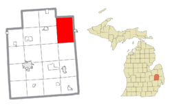
Location within Lapeer County
|
|
| Country | United States |
| State | Michigan |
| County | Lapeer |
| Area | |
| • Total | 54.1 sq mi (140.1 km2) |
| • Land | 54.1 sq mi (140.1 km2) |
| • Water | 0.0 sq mi (0.0 km2) |
| Elevation | 837 ft (255 m) |
| Population
(2020)
|
|
| • Total | 1,904 |
| • Density | 35.19/sq mi (13.590/km2) |
| Time zone | UTC-5 (Eastern (EST)) |
| • Summer (DST) | UTC-4 (EDT) |
| ZIP codes | |
| FIPS code | 26-11900 |
| GNIS feature ID | 1626006 |
Burnside Township is a special kind of local government area called a civil township. It's located in Lapeer County, which is part of the U.S. state of Michigan. In 2020, about 1,904 people lived there.
Contents
History of Burnside Township
Burnside Township was first created in 1855. Back then, it had a different name: Allison Township. Later, in 1866, its name was changed to Burnside. This new name honored Ambrose Burnside, who was a general during the American Civil War.
Communities in Burnside Township
Burnside Township includes a few different communities. Some of these are "unincorporated," meaning they don't have their own separate local government like a city or village.
- Burnside is an unincorporated community right within the township. It's located where two main roads, M-90 and M-53, meet. The first settlers arrived here in the mid-1850s. A post office was set up in 1857, also named Allison, but it closed in 1913.
- The city of Brown City is located just east of Burnside Township in a different county. However, its post office (with ZIP code 48416) also delivers mail to most homes in Burnside Township.
- To the north, the city of Marlette is also in a neighboring county. Its post office (ZIP code 48453) serves the northern parts of Burnside Township.
- The village of North Branch is to the west. Its post office (ZIP code 48461) serves some areas in western Burnside Township.
- South of Burnside Township is the city of Imlay City. Its post office (ZIP code 48444) serves a small area in the southwest part of Burnside Township.
Geography of Burnside Township
Burnside Township covers a total area of about 54.1 square miles (which is about 140.1 square kilometers). Almost all of this area is land, with very little water.
People of Burnside Township
According to information from the year 2000, there were 1,920 people living in Burnside Township. These people lived in 645 households, and 532 of those were families.
Many households (about 38.3%) had children under 18 living with them. Most households (70.4%) were married couples living together. The average household had about 2.98 people.
The population was spread out across different age groups. About 30.7% of the people were under 18 years old. About 8.8% were 65 years old or older. The average age of people in the township was 35 years.
See also
 In Spanish: Municipio de Burnside (Míchigan) para niños


