Burrum River facts for kids
Quick facts for kids Burrum |
|
|---|---|
|
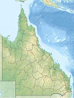
Location of Burrum River mouth in Queensland
|
|
| Country | Australia |
| State | Queensland |
| Region | Wide Bay-Burnett |
| Physical characteristics | |
| Main source | Lake Lenthall Lake Lenthall 24 m (79 ft) |
| River mouth | Hervey Bay, Coral Sea Burrum Heads 0 m (0 ft) 25°10′46″S 152°37′01″E / 25.17944°S 152.61694°E |
| Length | 31 km (19 mi) |
| Basin features | |
| Basin size | 3,371 km2 (1,302 sq mi) |
| National park | Burrum Coast National Park |
The Burrum River is a river found in the Wide Bay-Burnett area of Queensland, Australia. It's about 31 km (19 mi) long. This river is important for the local environment and the communities living nearby.
Contents
Where Does the Burrum River Flow?
The Burrum River starts at Lake Lenthall, which is a lake created by Lenthalls Dam. This dam helps to hold back water from smaller streams like Harwood Creek and Duckinwilla Creek. The river flows north, passing under the Bruce Highway near the town of Howard.
Journey to the Sea
As the river continues, it flows past a place called Pacific Haven. Then, another river, the Isis River, joins the Burrum River. This happens near the edge of the Burrum Coast National Park.
Together, the Burrum and Isis rivers, along with the Gregory River, flow into a special area called the Burrum Fish Habitat Area. This area is part of Hervey Bay and eventually reaches the Coral Sea at Burrum Heads.
Over its 31-kilometre (19 mi) journey, the river drops about 27 metres (89 ft) in height. Where the river meets the sea, it forms an estuary. An estuary is a place where fresh river water mixes with salty ocean water.
The Estuary and Its Features
The estuary of the Burrum River is quite large. It's about 12 kilometres (7 mi) long and can be between 500 metres (1,640 ft) and 2 kilometres (1 mi) wide. This area has many interesting features:
- It has wide, flat areas of land that are covered and uncovered by the tides.
- There are shallow sand banks.
- The main river channel winds and turns.
- You can find small patches of mangroves along the edges. Mangroves are special trees that can grow in salty water.
The River's Catchment Area
The area of land that collects rainwater and drains into the Burrum River is called its catchment area. This catchment area covers a huge space of about 3,371 square kilometres (1,302 sq mi). A small part of this area, about 108 square kilometres (42 sq mi), is made up of riverine wetlands. Wetlands are important areas that are often covered by water and are home to many plants and animals.
The land in the Burrum River's catchment area is mostly low and flat. It sits between the catchment areas of two other big rivers: the Burnett River and the Mary River. On average, the Burrum River carries about 153 gigalitres (200,116,445 cu yd) of water each year.
What Does "Burrum" Mean?
The name "Burrum River" comes from the language of the Kabi people, who are Indigenous Australian people from this region. In their language, "Burrum" means "rocks interrupting river flow." This name perfectly describes some parts of the river where rocks might make the water flow differently.
 | Janet Taylor Pickett |
 | Synthia Saint James |
 | Howardena Pindell |
 | Faith Ringgold |


