Burrum Heads facts for kids
Quick facts for kids Burrum HeadsQueensland |
|||||||||||||||
|---|---|---|---|---|---|---|---|---|---|---|---|---|---|---|---|

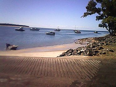
View from the Burrum Heads boat ramp, 2016
|
|||||||||||||||
| Population | 2,538 (2021 census) | ||||||||||||||
| • Density | 38.11/km2 (98.7/sq mi) | ||||||||||||||
| Postcode(s) | 4659 | ||||||||||||||
| Area | 66.6 km2 (25.7 sq mi) | ||||||||||||||
| Time zone | AEST (UTC+10:00) | ||||||||||||||
| Location |
|
||||||||||||||
| LGA(s) | Fraser Coast Region | ||||||||||||||
| State electorate(s) |
|
||||||||||||||
| Federal Division(s) | Hinkler | ||||||||||||||
|
|||||||||||||||
Burrum Heads is a lovely coastal town in Queensland, Australia. It's part of the Fraser Coast Region. In 2021, about 2,538 people lived here. It's a great spot for people who love the ocean and nature.
Contents
Exploring Burrum Heads' Geography
Burrum Heads is surrounded by beautiful waterways. Hervey Bay is to the north-east and east. The Burrum River flows along its western, north-western, and northern sides. Beelbi Creek forms the south-eastern border.
National and Marine Parks
A big part of Burrum Heads is covered by the Burrum Coast National Park. This park is a special place for nature. Also, the new Great Sandy Marine Park Zoning Plan started in May 2024. It includes parts of the Burrum River system. The Gregory Islands are also part of this marine park.
The Rivers of Burrum Heads
Three rivers meet near Burrum Heads: the Isis River, the Gregory River, and the Burrum River. Older maps show the river mouth as the Burrum River. However, some newer maps call it the Isis River mouth.
The History of Burrum Heads
The original Aboriginal name for the southern part of the Burrum River was Kolebore.
Early Transport and Coal
In 1877, a steamer called the Barbara and Jane started using the Burrum River. It was a 44-ton boat that carried coal from the Burrum coalfields to Maryborough. The coalfields were about 18 miles from the river's mouth. People hoped to make the river deeper for bigger ships.
How Burrum Heads Got Its Name
Burrum Heads was first called Traviston. This name came from Robert Travis, who was the original owner of the land. In 1960, Traviston was renamed Burrum Heads. The name "Burrum" comes from the Kabi language. It means "rocks interrupting river flow."
Community Milestones
- The Burrum Heads public library first opened in 1987. It was updated in 2013.
- A new section of the Hervey Bay-Burrum Heads Road opened in 1989. This made it easier to travel between Toogoom and Burrum Heads.
- In 1991, a timber church building was moved to Burrum Heads. It is now used for different church services.
Who Lives in Burrum Heads?
The number of people living in Burrum Heads has been growing.
- In 2011, there were 1,737 people.
- By 2016, the population grew to 2,067 people.
- In 2021, the population reached 2,538 people.
Learning in Burrum Heads
Burrum Heads does not have its own schools.
- The closest primary school is Torbanlea State School in Torbanlea.
- The nearest high school is Hervey Bay State High School in Pialba.
Fun Things to Do in Burrum Heads
Burrum Heads is a relaxed town that welcomes visitors. Many people come here to enjoy fishing and boating.
Popular Spots for Views
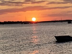
The Burrum Heads Lion Park Boat Ramp is a great place to watch the sun set. You can see the sun go down over the Isis River towards Walkers Point.
Nature and Wildlife

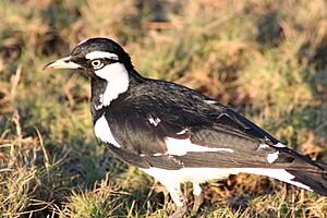
Both the national park and the marine park are popular for watching birds. You can see many different kinds of birds here.
Traviston Park Bush Chapel
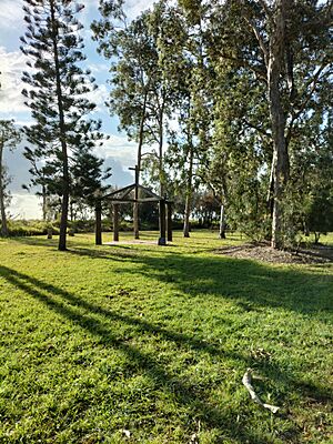
In Traviston Park, there is a special bush chapel. It is dedicated to people who have been lost at sea. Fishermen first created it in 1988. It was rebuilt after the big floods in Queensland in 2010-2011.
Services and Facilities in Burrum Heads
Burrum Heads has many useful services for its residents and visitors.
Community Services
- The Fraser Coast Regional Council runs a public library at 22 Burrum Heads Road. It offers free Wi-Fi.
- The Burrum Heads Bowls Club is a place for lawn bowls.
- Next to the Bowls Club, you'll find the SES (who help in emergencies), Tennis Courts, and the Burrum Heads Amateur Fishing Club.
- The Burrum Heads Neighbourhood Centre and a hair salon are located in the shopping centre.
- The Burrum Heads Community Hall is at 43 Howard Street.
Health and Shopping
- The Burrum Heads Medical Centre, Pharmacy, and a pathology practice are at the Burrum Heads Shopping Centre. This is next to the petrol station.
- Local shops are on Burrum Street. The post office is inside the FoodWorks store.
Emergency Services
The Burrum Heads Rural Fire Brigade is at 34 Bushnell Road. They test their siren every Monday morning at 8 am.
Boat Ramps
The Fraser Regional Council provides three boat ramps for easy access to the Burrum River:
- One is at the western end of Burrum Street. It has a floating jetty and a breakwater.
- Another is at the northern end of Ross Street, with a pontoon.
- The third is at the northern end of Burrum Heads Road.
 | Lonnie Johnson |
 | Granville Woods |
 | Lewis Howard Latimer |
 | James West |


