Butte County High Point, California facts for kids
Quick facts for kids Butte County High Point |
|
|---|---|
| Highest point | |
| Elevation | 7,124+ feet (2,171+ m) NAVD 88 |
| Listing | California county high points 28th |
| Geography | |
| Location | Butte and Plumas counties, California, U.S. |
| Parent range | Sierra Nevada |
| Topo map | USGS Humboldt Peak |
| Climbing | |
| Easiest route | Hike |
The Butte County High Point is the highest natural spot in Butte County, California. It's not a single mountain peak, but rather a high point along a mountain ridge named Robert Jenkins. This special spot sits right on the border between Butte County and Plumas County in the beautiful Sierra Nevada mountains.
Contents
What is a County High Point?
A county high point is simply the highest natural elevation within a specific county. People who enjoy hiking and exploring often try to visit these high points. It's like a fun challenge to reach the top of each county! The Butte County High Point is the 28th highest county point in California.
Where is the Butte County High Point Located?
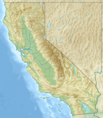
This high point is found in the northern part of the Sierra Nevada mountain range. It's located within the Lassen National Forest, which is a large area of protected land with lots of trees and wildlife. The exact spot is on the border between Butte and Plumas counties.
You can find this ridge close to a place called Lost Lake and another mountain known as Humboldt Peak. It's a remote area, meaning it's far from cities and towns, offering a true wilderness experience.
How High is It?
The Butte County High Point reaches an elevation of about 7,124 feet (2,171 meters) above sea level. That's more than 7,000 feet up! Because it's so high up in the mountains, the ridge gets a lot of snow during the winter months. This makes it a very different place depending on the season.
How Can You Visit?
Reaching the Butte County High Point usually involves a hike. One way to get close is by following a path known as Mary's Trail. This high point is also quite near to the famous Pacific Crest Trail. The Pacific Crest Trail is a very long hiking trail that stretches all the way from Mexico to Canada! The Butte County High Point is only about 700 feet (210 meters) away from this famous trail.
 | Aaron Henry |
 | T. R. M. Howard |
 | Jesse Jackson |


