
Butte County, California facts for kids
Quick facts for kids
Butte County, California
|
|||
|---|---|---|---|
| County of Butte | |||

Butte County in 2005, with a view of the
Sutter Buttes in the background |
|||
|
|||
| Nickname(s):
"The Land of Natural Wealth and Beauty"
|
|||

Location in the state of California
|
|||
| Country | United States | ||
| State | California | ||
| Incorporated | February 18, 1850 | ||
| Named for | The nearby Sutter Buttes | ||
| County seat | Oroville | ||
| Largest city | Chico | ||
| Government | |||
| • Type | Council–CAO | ||
| Area | |||
| • Total | 1,677 sq mi (4,340 km2) | ||
| • Land | 1,636 sq mi (4,240 km2) | ||
| • Water | 41 sq mi (110 km2) | ||
| Highest elevation | 7,124 ft (2,171 m) | ||
| Population
(2020)
|
|||
| • Total | 211,632 | ||
| • Density | 126.20/sq mi (48.725/km2) | ||
| GDP | |||
| • Total | $11.077 billion (2022) | ||
| Time zone | UTC−8 (Pacific Time Zone) | ||
| • Summer (DST) | UTC−7 (Pacific Daylight Time) | ||
| Area code | 530 | ||
| FIPS code | 06-007 | ||
| GNIS feature ID | 1675842 | ||
| Congressional district | 1st | ||

Butte County is a county in the northern central part of California, USA. In 2020, about 211,632 people lived there. The main city and county seat is Oroville.
Butte County is part of the Chico metropolitan area. It is located in the California Central Valley, just north of the state capital, Sacramento.
The county has important rivers like the Feather River and the Sacramento River. Other streams include Butte Creek and Big Chico Creek. Butte County is also home to two colleges: California State University, Chico and Butte College.
Contents
History of Butte County
Butte County gets its name from the amazing Sutter Buttes. These are tall, ancient volcanoes in the next county over, Sutter County. Butte County was officially created on February 18, 1850. It was one of California's first 27 counties. Back then, it was much larger, covering parts of what are now Tehama, Plumas, Colusa, and Sutter Counties.
In November 2018, a very large wildfire called the Camp Fire caused a lot of damage. It destroyed most of the town of Paradise and the nearby community of Concow. Many homes and buildings were lost, and many people had to leave their homes. It was a very serious event for the county.
Geography and Nature

Butte County covers about 1,677 square miles. Most of this is land, with about 41 square miles covered by water.
The county is shaped by its rivers, like the Feather River and Butte Creek. The Sacramento River forms part of its western border. Butte County is on the western side of the Sierra Nevada mountains. The steep slopes here are perfect for building hydroelectric power plants, which use water to create electricity. Several of these plants are in the county, including one that works with the Oroville Dam.
Protected Natural Areas
Butte County has parts of several important protected areas:
- Butte Sink National Wildlife Refuge
- Lassen National Forest
- Plumas National Forest
- Sacramento River National Wildlife Refuge
Neighboring Counties
Butte County shares borders with these other counties:
- Sutter County, California – to the south
- Colusa County, California – to the southwest
- Glenn County, California – to the west
- Tehama County, California – to the northwest
- Plumas County, California – to the northeast
- Yuba County, California – to the southeast
People and Population
| Historical population | |||
|---|---|---|---|
| Census | Pop. | %± | |
| 1850 | 3,574 | — | |
| 1860 | 12,106 | 238.7% | |
| 1870 | 11,403 | −5.8% | |
| 1880 | 18,721 | 64.2% | |
| 1890 | 17,939 | −4.2% | |
| 1900 | 17,117 | −4.6% | |
| 1910 | 27,301 | 59.5% | |
| 1920 | 30,030 | 10.0% | |
| 1930 | 34,093 | 13.5% | |
| 1940 | 42,840 | 25.7% | |
| 1950 | 64,930 | 51.6% | |
| 1960 | 82,030 | 26.3% | |
| 1970 | 101,969 | 24.3% | |
| 1980 | 143,851 | 41.1% | |
| 1990 | 182,120 | 26.6% | |
| 2000 | 203,171 | 11.6% | |
| 2010 | 220,000 | 8.3% | |
| 2020 | 211,632 | −3.8% | |
| 2023 (est.) | 207,172 | −5.8% | |
| U.S. Decennial Census 1790–1960 1900–1990 1990–2000 2010 2020 |
|||
In 2020, Butte County had a population of 211,632 people. Most residents were White (about 66%). Other groups included Hispanic or Latino (about 19%), Asian (about 5%), Black or African American (about 1.6%), and Native American (about 1.4%). Many people also identified as being of two or more races (about 6.4%).
The county's population has grown a lot over the years. In 1850, there were only about 3,500 people. By 2010, the population reached 220,000.
Education

Butte County has many schools for students of all ages.
Public Schools
There are around 90 public schools in Butte County. These schools are managed by the County Office of Education and 15 different school districts. Some of these districts include:
- Bangor Union Elementary School District
- Biggs Unified School District
- Chico Unified School District
- Durham Unified School District
- Feather Falls Union Elementary School District
- Golden Feather Union Elementary School District
- Gridley Unified School District
- Manzanita Elementary School District
- Oroville City Elementary School District
- Oroville Union High School District
- Palermo Union School District
- Paradise Unified School District
- Pioneer Union Elementary School District
- Thermalito Union School District
Colleges and Universities
For students who want to continue their education after high school, Butte County has:
- Butte College
- Butte–Glenn Community College District
- California State University, Chico
Public Libraries
The Butte County Library offers free library services to everyone in the county. It has six branches in different cities: Biggs, Chico, Durham, Gridley, Oroville, and Paradise. The library aims to give everyone access to books, information, and technology.
The library also helps adults who want to improve their reading skills through special programs.
Transportation

Main Roads
Several important state highways run through Butte County:
 State Route 32
 State Route 70
 State Route 99
 State Route 149
 State Route 162
 State Route 191
Public Transport
Butte Regional Transit, also known as the B-Line, provides bus services. These buses connect cities like Chico, Oroville, Paradise, Gridley, and Biggs. You can also connect to buses going to nearby Glenn County and Plumas County from Chico.
Long-distance bus services like Greyhound and FlixBus also have stops in Chico.
For train travel, Amtrak's Coast Starlight train stops daily at the Chico station. This train travels between Los Angeles and Seattle.
Airports
Butte County has several smaller airports for general aviation (private planes and smaller flights):
- Chico Municipal Airport
- Oroville Municipal Airport
- Paradise Airport
- Ranchaero Airport
- Richvale Airport
Communities in Butte County


Cities
- Biggs
- Chico (the largest city)
- Gridley
- Oroville (the county seat, where the main county government is)
Towns
Census-Designated Places (CDPs)
These are areas that are like towns but are not officially incorporated as cities.
Unincorporated Communities
These are smaller places that are not part of any city or CDP.
Images for kids
-
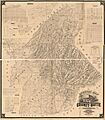
An old map showing the civil townships of Butte County in 1877.

See also
 In Spanish: Condado de Butte (California) para niños
