
Paradise, California facts for kids
Quick facts for kids
Paradise, California
|
|||
|---|---|---|---|

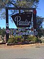
Welcome to Paradise sign in 2011
|
|||
|
|||
| Nickname(s):
the Ridge
|
|||

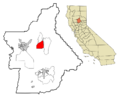
Location within Butte County and California
|
|||
| Country | United States | ||
| State | California | ||
| County | Butte | ||
| Incorporated | November 27, 1979 | ||
| Area | |||
| • Total | 18.33 sq mi (47.47 km2) | ||
| • Land | 18.32 sq mi (47.44 km2) | ||
| • Water | 0.01 sq mi (0.03 km2) 0.08% | ||
| Elevation | 1,778 ft (542 m) | ||
| Population
(2020)
|
|||
| • Total | 4,764 | ||
| • Density | 244.38/sq mi (94.35/km2) | ||
| Time zone | UTC-8 (Pacific) | ||
| • Summer (DST) | UTC-7 (PDT) | ||
| ZIP codes |
95967, 95969
|
||
| Area code | 530 | ||
| FIPS code | 06-55520 | ||
| GNIS ID | 277573 | ||


Paradise is a small town in Butte County, California, United States. It is located in the Sierra Nevada foothills, just above the northeastern Sacramento Valley. In 2020, the town had 4,764 people. This was a big drop from 26,218 residents in 2010.
On November 8, 2018, a huge wildfire called the Camp Fire destroyed most of Paradise. It also damaged nearby communities like Magalia and Concow. By November 2023, the town had grown to over 9,000 residents. More than 2,500 new buildings have been constructed, and building continues.
Contents
History of Paradise
The first post office in Paradise opened in 1877. It closed for a short time in 1911. But it reopened later that year when the post office in Orloff closed. Paradise officially became a town in 1979. For many years, the Butte County Railroad ran trains here. It helped serve local mines and sawmills.
How Paradise Got Its Name
The community of Paradise has been known by a few different names. These include Leonards Mill, Poverty Ridge, Pair-O-Dice, and Paradice.
There's a popular story that the town was named after a saloon called the Pair o' Dice Saloon. A railroad map from 1900 even spelled the town's name as Paradice. However, no one has found proof that this saloon ever existed.
Another story comes from Gene Sylva, a former mayor of Oroville. He said the town was named by his great-great-grandfather, William Pierce Leonard. In 1864, after a long, hot trip, Leonard arrived at his sawmill. He took a deep breath of the cool air and said, "boys, this is paradise." Experts think this story might be a fun tale. It's more likely the town was named because it was a very pleasant place to live.
Wildfires in Paradise
Paradise has faced several large wildfires. These fires have greatly impacted the town and its people.
2008 Fires
In June 2008, a wildfire called the "Humboldt Fire" burned over 22,800 acres (9,200 ha). This fire was between Chico and Paradise. About 9,300 people had to leave their homes in southwestern Paradise. They returned once the fire was under control.
A month later, another fire started north of Paradise. This fire was in the canyon near the Feather River. Thousands more people had to evacuate. Luckily, this fire did not cross the river. It was part of a larger group of fires called the Butte Lightning Complex.
2018 Camp Fire

On November 8, 2018, the "Camp Fire" started early in the morning. It was near Camp Creek Road. Soon after, the Butte County Sheriff's Office ordered people to leave eastern Paradise. An hour later, the rest of the town was told to evacuate. Many residents did not get a warning, or they did not understand how serious the fire was.
On that same day, most of Paradise was destroyed by the fire. The communities of Concow and Magalia were also badly hit. A fire official said the town center was "completely on the ground."
The Camp Fire caused 85 deaths. Tens of thousands of people lost their homes. A total of 18,804 buildings were destroyed. Only 5% of buildings in Paradise were left without serious damage. It was the deadliest and most destructive fire in California's history. The fire was caused by equipment belonging to a power company.
Rebuilding After the Camp Fire

The first two permits to rebuild homes in Paradise were given out on March 28, 2019. This was almost five months after the fire. Town leaders want new buildings to be more fire-resistant. They also want to improve roads to help with evacuations and emergency access. Heavy rains in March 2019 slowed down the cleanup process.
In 2010, Paradise had about 26,800 people. After the Camp Fire, the population dropped by more than 90%. By April 2019, only about 2,034 people lived there. However, more residents have slowly returned. By November 2023, over 9,000 people were living in Paradise. More than 2,500 new buildings have been constructed.
By 2024, many new people had moved to Paradise from other parts of California. Building rules had changed, so some people could not rebuild their old, smaller homes. Insurance costs also went up a lot.
One year after the fires, the town found hope in the Paradise High School football team. The team had a perfect season. A team member said, "The whole town of Paradise is here." The mayor, Jody Jones, added, "The football team has come to represent all of us.” A book was even written about the team and the town.
Paradise Greenbelt Buffer Plan
After the 2018 Camp Fire, Paradise leaders and residents made a plan to rebuild. Their goals were to make the town Safer, Welcoming, Stronger, Better, and Greener. The Paradise Recreation and Parks District (PRPD) and the Nature Conservancy are working together. They want to create a Greenbelt around the town. This greenbelt would act as a fire buffer zone. It would help stop future wildfires from reaching the town center.
The greenbelt would include managed parks and plants. Firefighters could use controlled burns to create a barrier without much fuel. This would stop wildfires from spreading into town. This borderland would also be a place for recreation and greenspace.
The Greenbelt plan includes improving parks and walking paths. It also focuses on better fuel management and easier transportation for residents and firefighters. A study showed that greening the eastern border of Paradise could lower fire risks by up to 64%.
A big challenge is getting the land needed for the greenbelt. Most of this land is privately owned. The PRPD hopes residents will sell their properties on the town's edge. This would help create a safer community. If this plan works, other towns facing fire risks might try similar ideas.
2020 North Complex Fire
The North Complex Fire, also known as the "Bear Fire," started east of Concow in 2020. This fire threatened Paradise and other communities that were hit by the 2018 Camp Fire. People were ordered to evacuate again. Luckily, areas burned in the 2018 fire had less fuel. This helped stop the 2020 fire from spreading west. Still, almost 320,000 acres (130,000 ha) burned before it was stopped.
Geography of Paradise
Paradise is located about 10 miles (16 km) east of Chico. It is also about 85 miles (137 km) north of Sacramento.
The town sits on a wide ridge. This ridge is between deep canyons. The west branch of the Feather River is to the east, and Butte Creek is to the west. The Paradise area also includes the towns of Magalia and Stirling City to the north. The town of Paradise is about 1,778 feet (542 m) above sea level.
The United States Census Bureau says Paradise covers 18.3 square miles (47.4 km2). Almost all of this area is land. The soil in Paradise is mostly reddish-brown loam. It is good for drainage and comes from volcanic material.
Climate in Paradise
Paradise has a hot-summer Mediterranean climate. This means it has hot, dry summers. Its winters are cool and rainy.
| Climate data for Paradise, California (1991-2020 normals, 1957-2012 extremes) | |||||||||||||
|---|---|---|---|---|---|---|---|---|---|---|---|---|---|
| Month | Jan | Feb | Mar | Apr | May | Jun | Jul | Aug | Sep | Oct | Nov | Dec | Year |
| Record high °F (°C) | 79 (26) |
81 (27) |
83 (28) |
90 (32) |
101 (38) |
106 (41) |
108 (42) |
113 (45) |
108 (42) |
100 (38) |
90 (32) |
79 (26) |
113 (45) |
| Mean daily maximum °F (°C) | 54.3 (12.4) |
56.3 (13.5) |
60.5 (15.8) |
66.0 (18.9) |
74.9 (23.8) |
84.2 (29.0) |
91.3 (32.9) |
90.2 (32.3) |
85.5 (29.7) |
74.4 (23.6) |
60.8 (16.0) |
53.6 (12.0) |
71.0 (21.7) |
| Daily mean °F (°C) | 47.4 (8.6) |
49.1 (9.5) |
52.5 (11.4) |
56.8 (13.8) |
64.3 (17.9) |
72.5 (22.5) |
79.2 (26.2) |
77.8 (25.4) |
73.7 (23.2) |
64.4 (18.0) |
53.0 (11.7) |
46.7 (8.2) |
61.5 (16.4) |
| Mean daily minimum °F (°C) | 40.5 (4.7) |
42.0 (5.6) |
44.5 (6.9) |
47.6 (8.7) |
53.6 (12.0) |
60.9 (16.1) |
67.0 (19.4) |
65.5 (18.6) |
61.8 (16.6) |
54.3 (12.4) |
45.3 (7.4) |
39.9 (4.4) |
51.9 (11.1) |
| Record low °F (°C) | 18 (−8) |
17 (−8) |
25 (−4) |
23 (−5) |
32 (0) |
40 (4) |
42 (6) |
41 (5) |
38 (3) |
29 (−2) |
26 (−3) |
14 (−10) |
14 (−10) |
| Average precipitation inches (mm) | 10.16 (258) |
10.13 (257) |
8.27 (210) |
4.58 (116) |
2.35 (60) |
0.81 (21) |
0.03 (0.76) |
0.16 (4.1) |
0.41 (10) |
2.77 (70) |
5.48 (139) |
11.19 (284) |
56.34 (1,431) |
| Average snowfall inches (cm) | 0.0 (0.0) |
0.1 (0.25) |
0.0 (0.0) |
0.0 (0.0) |
0.0 (0.0) |
0.0 (0.0) |
0.0 (0.0) |
0.0 (0.0) |
0.0 (0.0) |
0.0 (0.0) |
0.0 (0.0) |
0.0 (0.0) |
0.1 (0.25) |
| Average precipitation days (≥ 0.01 in) | 12.4 | 11.4 | 11.4 | 8.1 | 5.5 | 2.6 | 0.2 | 0.6 | 1.2 | 4.5 | 8.8 | 11.6 | 78.3 |
| Average snowy days (≥ 0.1 in) | 0.0 | 0.1 | 0.0 | 0.0 | 0.0 | 0.0 | 0.0 | 0.0 | 0.0 | 0.0 | 0.0 | 0.0 | 0.1 |
| Source: NOAA | |||||||||||||
Population of Paradise
| Historical population | |||
|---|---|---|---|
| Census | Pop. | %± | |
| 1960 | 8,268 | — | |
| 1970 | 14,539 | 75.8% | |
| 1980 | 22,571 | 55.2% | |
| 1990 | 25,408 | 12.6% | |
| 2000 | 26,408 | 3.9% | |
| 2010 | 26,218 | −0.7% | |
| 2020 | 4,764 | −81.8% | |
| 2023 (est.) | 8,285 | −68.4% | |
Paradise is part of the Chico Metropolitan Area.
Population in 2020
In 2020, the census counted 4,764 people living in Paradise.
Population in 2010
The 2010 census showed that Paradise had 26,218 people. Most residents (92%) were white. About 7% of the people were of Hispanic or Latino origin.
There were 11,893 households in Paradise. About 21.6% of these households had children under 18. The average household had 2.17 people. The median age in Paradise was 50.2 years old.
Education in Paradise
Paradise is served by the Paradise Unified School District. There are also other independent and private schools.
Schools in the Paradise Unified School District include:
- Paradise High School (grades 9–12)
- The high school was mostly undamaged by the 2018 Camp Fire. It reopened for the 2019–20 school year. Many students who had been displaced returned to attend.
- Ridgeview High School (continuation school)
- HomeTech Charter School (grades K–12)
- Paradise Intermediate School (grades 6–8)
- Paradise Charter Middle School (grades 6–8)
- Children's Community Charter School (grades K–8)
- Cedarwood Elementary School (grades K–5)
- Paradise Elementary School (grades K–5)
- Ponderosa Elementary School (grades K–6)
- Pine Ridge School (grades K–8)
- Honey Run Academy Elementary & Secondary (community day schools)
- Pearson Center (for special education students aged 18-22)
Other schools in Paradise are:
- Achieve Charter School
- Paradise Adventist Academy
- Paradise Elearning Charter (Online, grades 9–12)
- Butte College
Transportation in Paradise
There are not many public transport options within Paradise itself. The "B-Line" Butte County Transit serves the Paradise and Magalia areas. Butte Community College also offers bus service for its students.
Skyway Road, often called "Skyway," connects Paradise to Chico. It starts as a four-lane highway in Chico and goes up the ridge to Paradise. Through town, it is still four lanes, but then becomes a two-lane road further north. Paradise is also connected to Oroville by Highway 191, known as Clark Road in town.
The Paradise Memorial Trail is a paved path for walking and biking. It follows the old railroad tracks through town. However, because the town is very hilly and spread out, it can be hard to get around on foot or by bike. Many areas also lack sidewalks.
Paradise Skypark is a small airport located near State Route 191, south of town.
Media in Paradise
The Internet radio station Radio Paradise was started in Paradise. The local newspaper is the Paradise Post.
Notable People from Paradise
Many interesting people were born, grew up, or lived in Paradise.
- Norton Buffalo (1951–2009), a musician and artist, lived in Paradise.
- Richard Campbell, a rock and pop singer and bass guitarist, grew up here. He played with famous bands like Three Dog Night and America.
- Carla Gugino, an actress, moved to Paradise when she was five years old.
- Luther Kelly (1849–1928), a soldier and scout, lived in Paradise.
- Lazy Lester, a blues musician, lived in Paradise until his death in 2018.
- Jeff Maehl, a former NFL wide receiver.
- Nate Smith, a country music singer.
- Tiffany Brissette, a former child actress.
Images for kids
-
Welcome to Paradise sign in 2011
-

Flag of Paradise, California
-
Seal of Paradise, California
-
Location within Butte County and California
See also
 In Spanish: Paradise (California) para niños
