Glenn County, California facts for kids
Quick facts for kids
Glenn County, California
|
||
|---|---|---|
| County of Glenn | ||
|
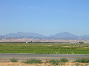
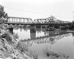
Images, from top down, left to right: A view from Interstate 5 in Glenn County, a scene in Willows, Gianella Bridge
|
||
|
||

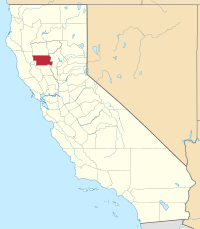
Location in the state of California
|
||
| Country | United States | |
| State | California | |
| Region | Sacramento Valley | |
| Incorporated | 1891 | |
| Named for | Hugh J. Glenn | |
| County seat | Willows | |
| Largest city | Orland | |
| Government | ||
| • Type | Council–CAO | |
| Area | ||
| • Total | 1,327 sq mi (3,440 km2) | |
| • Land | 1,314 sq mi (3,400 km2) | |
| • Water | 13 sq mi (30 km2) | |
| Highest elevation | 7,451 ft (2,271 m) | |
| Population | ||
| • Total | 28,917 | |
| • Estimate
(2023)
|
28,129 |
|
| GDP | ||
| • Total | $1.249 billion (2022) | |
| Time zone | UTC−8 (Pacific) | |
| • Summer (DST) | UTC−7 (Pacific Daylight Time) | |
| Area code | 530 | |
| FIPS code | 06-021 | |
| GNIS feature ID | 277275 | |
| Congressional district | 1st | |
| Website | Glenn County, California | |
Glenn County is a place in California, USA. In 2020, about 28,917 people lived there. The main town, or county seat, is Willows. It is located in the Sacramento Valley, which is in the northern part of California's Central Valley. The Grindstone Rancheria, a special area for the Wintun-Wailaki Indians, is also in Glenn County.
Contents
History of Glenn County
Glenn County was created in 1891. It used to be part of Colusa County. The county is named after Dr. Hugh J. Glenn. He bought a lot of land in 1867. Dr. Glenn grew to be the biggest wheat farmer in California. He was also very important in politics and business.
Geography of Glenn County
Glenn County covers about 1,327 square miles. Most of this area, about 1,314 square miles, is land. The rest, about 13 square miles, is water.
Neighboring Counties
Glenn County shares borders with these other counties:
- Colusa County to the south
- Lake County to the southwest
- Mendocino County to the west
- Tehama County to the north
- Butte County to the east
Protected Natural Areas
Parts of these important natural areas are found in Glenn County:
- Mendocino National Forest
- Sacramento National Wildlife Refuge
- Sacramento River National Wildlife Refuge
People of Glenn County (Demographics)
| Historical population | |||
|---|---|---|---|
| Census | Pop. | %± | |
| 1900 | 5,150 | — | |
| 1910 | 7,172 | 39.3% | |
| 1920 | 11,853 | 65.3% | |
| 1930 | 10,935 | −7.7% | |
| 1940 | 12,195 | 11.5% | |
| 1950 | 15,448 | 26.7% | |
| 1960 | 17,245 | 11.6% | |
| 1970 | 17,521 | 1.6% | |
| 1980 | 21,350 | 21.9% | |
| 1990 | 24,798 | 16.1% | |
| 2000 | 26,453 | 6.7% | |
| 2010 | 28,122 | 6.3% | |
| 2020 | 28,917 | 2.8% | |
| 2023 (est.) | 28,129 | 0.0% | |
| U.S. Decennial Census 1790–1960 1900–1990 1990–2000 2010 2020 |
|||
Population in 2020
In 2020, Glenn County had a population of 28,917 people. Here's a look at the different groups of people living there:
| Race / Ethnicity (NH = Non-Hispanic) | Pop 2000 | Pop 2010 | Pop 2020 | % 2000 | % 2010 | % 2020 |
|---|---|---|---|---|---|---|
| White alone (NH) | 16,548 | 15,717 | 13,897 | 62.56% | 55.89% | 48.06% |
| Black or African American alone (NH) | 117 | 192 | 140 | 0.44% | 0.68% | 0.48% |
| Native American or Alaska Native alone (NH) | 439 | 477 | 531 | 1.66% | 1.70% | 1.84% |
| Asian alone (NH) | 863 | 674 | 626 | 3.26% | 2.40% | 2.16% |
| Pacific Islander alone (NH) | 22 | 22 | 39 | 0.08% | 0.08% | 0.13% |
| Other Race alone (NH) | 55 | 39 | 144 | 0.21% | 0.14% | 0.50% |
| Mixed Race or Multi-Racial (NH) | 569 | 462 | 999 | 2.15% | 1.64% | 3.45% |
| Hispanic or Latino (any race) | 7,840 | 10,539 | 12,541 | 29.64% | 37.48% | 43.37% |
| Total | 26,453 | 28,122 | 28,917 | 100.00% | 100.00% | 100.00% |
Population in 2010
The 2010 census showed that Glenn County had 28,122 people. About 71.1% were White, 0.8% African American, 2.2% Native American, and 2.6% Asian. People of Hispanic or Latino background made up about 37.5% of the population.
Transportation in Glenn County
Main Roads
You can travel through Glenn County using these major highways:
 Interstate 5
 State Route 32
 State Route 45
 State Route 162
Public Transport
Glenn Ride offers bus services. These buses connect Willows to Hamilton City and even go to Chico in Butte County. If you want to travel by train, the closest Amtrak station is in Chico.
Airports
Glenn County has two airports for general aviation (smaller planes):
- Willows-Glenn County Airport
- Haigh Field
Railroads
The California Northern Railroad serves Willows. This railway connects north to Tehama and south to Davis. In Davis, it connects with the Union Pacific Railroad. The first train reached Willows in 1879.
Communities in Glenn County
Cities
Census-Designated Places (CDPs)
These are areas that are like towns but are not officially cities.
Other Communities
- Butte City
- Chrome
- Fruto
- Meadowood Estates (This used to be an unincorporated community.)
Largest Communities by Population
Here are the communities in Glenn County, ranked by their population in 2010:
† county seat
| Rank | City/Town/etc. | Municipal type | Population (2010 Census) |
|---|---|---|---|
| 1 | Orland | City | 7,291 |
| 2 | † Willows | City | 6,166 |
| 3 | Hamilton City | CDP | 1,759 |
| 4 | Artois | CDP | 295 |
| 5 | Grindstone Rancheria | AIAN | 164 |
| 6 | Elk Creek | CDP | 163 |
See also
 In Spanish: Condado de Glenn para niños
 | Lonnie Johnson |
 | Granville Woods |
 | Lewis Howard Latimer |
 | James West |


