
Orland, California facts for kids
Quick facts for kids
Orland, California
|
|
|---|---|
| City of Orland | |

Orland train station in 1969; now located at the Glenn County Fairgrounds.
|
|

Location within Glenn County
|
|

Orland, California
Location in California

Orland, California
Location in the United States
|
|
| Country | |
| State | |
| County | Glenn |
| Incorporated | November 11, 1909 |
| Area | |
| • Total | 2.98 sq mi (7.72 km2) |
| • Land | 2.98 sq mi (7.72 km2) |
| • Water | 0.00 sq mi (0.00 km2) 0% |
| Elevation | 259 ft (79 m) |
| Population
(2020)
|
|
| • Total | 7,622 |
| • Density | 2,558/sq mi (987.3/km2) |
| Time zone | UTC-8 (Pacific (PST)) |
| • Summer (DST) | UTC-7 (PDT) |
| ZIP code |
95963
|
| Area code(s) | 530 |
| FIPS code | 06-54274 |
| GNIS feature IDs | 1659315, 2411335 |
| Website | Orland, California |
Orland is a city in Glenn County, California. It is located in the northern part of the state. In 2020, about 7,622 people lived there. Orland is known for being a fast-growing city in Glenn County.
The city is sometimes called the "Queen Bee Capital of North America." This is because many queen bees are raised here for farming. You can learn more about bees at the Honeybee Discovery Center museum in Orland. The city also hosts fun events like the Queen Bee Festival in June and OktoBEEfest in October.
Geography
Orland is a rural farming town. It is located in the northern Sacramento Valley. The city covers about 3 square miles (7.7 square kilometers) of land.
Interstate 5, a major highway, runs just west of the city center. The Sacramento River is about 10 miles (16 km) east of Orland. Black Butte Lake is about 8 miles (13 km) to the west. Water from Black Butte Lake flows into Stony Creek, which is near the Orland Arch.
Climate
Orland has a warm-summer Mediterranean climate. This means it has hot, dry summers and mild, wet winters.
| Climate data for Orland, California, 1991–2020 normals, extremes 1903–present | |||||||||||||
|---|---|---|---|---|---|---|---|---|---|---|---|---|---|
| Month | Jan | Feb | Mar | Apr | May | Jun | Jul | Aug | Sep | Oct | Nov | Dec | Year |
| Record high °F (°C) | 81 (27) |
84 (29) |
89 (32) |
98 (37) |
110 (43) |
115 (46) |
120 (49) |
120 (49) |
114 (46) |
105 (41) |
95 (35) |
81 (27) |
120 (49) |
| Mean maximum °F (°C) | 69.7 (20.9) |
74.6 (23.7) |
81.0 (27.2) |
89.2 (31.8) |
96.4 (35.8) |
104.5 (40.3) |
106.6 (41.4) |
104.6 (40.3) |
103.2 (39.6) |
94.1 (34.5) |
79.8 (26.6) |
68.2 (20.1) |
108.7 (42.6) |
| Mean daily maximum °F (°C) | 56.8 (13.8) |
61.8 (16.6) |
66.9 (19.4) |
73.1 (22.8) |
81.1 (27.3) |
88.8 (31.6) |
94.1 (34.5) |
93.1 (33.9) |
90.0 (32.2) |
79.5 (26.4) |
65.3 (18.5) |
56.5 (13.6) |
75.6 (24.2) |
| Daily mean °F (°C) | 47.3 (8.5) |
50.9 (10.5) |
55.0 (12.8) |
59.9 (15.5) |
67.2 (19.6) |
74.5 (23.6) |
78.8 (26.0) |
77.1 (25.1) |
73.9 (23.3) |
65.1 (18.4) |
53.9 (12.2) |
46.9 (8.3) |
62.5 (17.0) |
| Mean daily minimum °F (°C) | 37.7 (3.2) |
40.1 (4.5) |
43.0 (6.1) |
46.6 (8.1) |
53.3 (11.8) |
60.2 (15.7) |
63.4 (17.4) |
61.0 (16.1) |
57.7 (14.3) |
50.7 (10.4) |
42.5 (5.8) |
37.3 (2.9) |
49.5 (9.7) |
| Mean minimum °F (°C) | 28.8 (−1.8) |
31.4 (−0.3) |
34.4 (1.3) |
36.4 (2.4) |
43.3 (6.3) |
50.4 (10.2) |
55.8 (13.2) |
54.1 (12.3) |
50.1 (10.1) |
42.2 (5.7) |
32.8 (0.4) |
28.0 (−2.2) |
25.8 (−3.4) |
| Record low °F (°C) | 17 (−8) |
19 (−7) |
24 (−4) |
27 (−3) |
31 (−1) |
41 (5) |
45 (7) |
43 (6) |
39 (4) |
29 (−2) |
21 (−6) |
15 (−9) |
15 (−9) |
| Average precipitation inches (mm) | 4.50 (114) |
4.11 (104) |
2.79 (71) |
1.37 (35) |
1.13 (29) |
0.38 (9.7) |
0.02 (0.51) |
0.08 (2.0) |
0.24 (6.1) |
0.91 (23) |
2.04 (52) |
3.82 (97) |
21.39 (543.31) |
| Average precipitation days (≥ 0.01 in) | 11.6 | 9.5 | 8.7 | 5.7 | 4.2 | 1.4 | 0.2 | 0.4 | 0.9 | 3.5 | 6.7 | 10.5 | 63.3 |
| Source 1: NOAA | |||||||||||||
| Source 2: National Weather Service | |||||||||||||
History
Orland became an official city in 1909. The first post office in Orland opened in 1916.
In 1908, Orland was part of an important project. It was one of the first irrigation projects by the United States Bureau of Reclamation. This project helped bring water to farms. Dams built around 1910, like the East Park Dam, still provide water for farming today.
During World War II, the United States Army used Orland for an airfield. Pilots were trained there, flying planes like the Boeing B-17 Flying Fortress. Parts of the airfield are now a civil airport used by Glenn County.
Orland also had a train station called Orland station. It was a stop on the Southern Pacific railroad line. From 1974 to 1982, the Amtrak Coast Starlight train also stopped in Orland.
In 2017, Orland was named a "Bee City USA." This is why it's called the "Queen Bee Capital of North America." Local farms raise many queen bees.
Population and People
| Historical population | |||
|---|---|---|---|
| Census | Pop. | %± | |
| 1880 | 292 | — | |
| 1890 | 440 | 50.7% | |
| 1910 | 836 | — | |
| 1920 | 1,582 | 89.2% | |
| 1930 | 1,195 | −24.5% | |
| 1940 | 1,366 | 14.3% | |
| 1950 | 2,067 | 51.3% | |
| 1960 | 2,534 | 22.6% | |
| 1970 | 2,884 | 13.8% | |
| 1980 | 4,031 | 39.8% | |
| 1990 | 5,052 | 25.3% | |
| 2000 | 6,281 | 24.3% | |
| 2010 | 7,291 | 16.1% | |
| 2020 | 7,622 | 4.5% | |
| U.S. Decennial Census | |||
Orland's population has grown over the years. In 2000, there were 6,281 people. By 2010, the population grew to 7,291. The most recent census in 2020 showed 7,622 people living in Orland.
The city is home to people from many different backgrounds. This mix of cultures makes Orland a diverse place to live.
Education
Orland has several schools for students of all ages.
- Public schools
- Fairview Elementary
- Mill Street Elementary
- C.K. Price Middle School
- Orland High School
- North Valley Continuation High School
- Private schools
- North Valley Christian School
Views
-
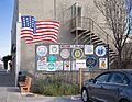
Welcome signs
-
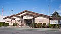
City Hall and Police Station
-
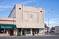
Masonic Temple
-
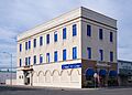
Odd Fellows Building
-
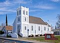
First Lutheran Church


Notable People
Many interesting people have connections to Orland:
- Mark Koenig was a baseball player for the New York Yankees. He played with famous players like Babe Ruth and Lou Gehrig. He lived in Orland when he passed away in 1993.
- Aldrick Rosas is an NFL placekicker. He was born and grew up in Orland.
- Cal Worthington was a well-known car dealer. He owned a large ranch in Orland and died there at age 92.
- George Wright was a famous organ player. He was born in Orland.
- Jackson Pollock, a very famous painter, lived near Orland for a short time when he was growing up.
See also
 In Spanish: Orland (California) para niños
