Butterfield, Missouri facts for kids
Quick facts for kids
Butterfield, Missouri
|
|
|---|---|

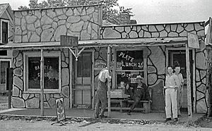
Butterfield, 1939
|
|

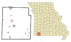
Location of Butterfield, Missouri
|
|
| Country | United States |
| State | Missouri |
| County | Barry |
| Township | Butterfield |
| Area | |
| • Total | 0.46 sq mi (1.20 km2) |
| • Land | 0.46 sq mi (1.20 km2) |
| • Water | 0.00 sq mi (0.00 km2) |
| Elevation | 1,532 ft (467 m) |
| Population
(2020)
|
|
| • Total | 378 |
| • Density | 816.41/sq mi (314.93/km2) |
| Time zone | UTC-6 (Central (CST)) |
| • Summer (DST) | UTC-5 (CDT) |
| ZIP code |
65623
|
| Area code(s) | 417 |
| FIPS code | 29-10144 |
| GNIS feature ID | 2397515 |
Butterfield is a small city located in Barry County, Missouri, in the United States. It is part of Butterfield Township. In 2020, about 378 people lived there. It's a quiet community in the southwestern part of Missouri.
Contents
History of Butterfield
Butterfield was officially planned and mapped out in 1883. This process is called "platting." The town was named after Fredrick Butterfield, who was an important official for the railroad at that time.
Where is Butterfield Located?
Butterfield is found along Missouri Route U. It is about half a mile east of Missouri Route 37. The city of Purdy is about 4.5 miles north of Butterfield. Cassville is located about five miles to the south.
The beginning of Gunter Creek is just south of the community. This is where the creek starts to flow. The United States Census Bureau says that Butterfield covers a total area of about 0.46 square miles (1.20 square kilometers). All of this area is land.
Who Lives in Butterfield? (Population)
The number of people living in Butterfield has changed over the years. Here is a look at how the population has grown or shrunk:
| Historical population | |||
|---|---|---|---|
| Census | Pop. | %± | |
| 1940 | 150 | — | |
| 1950 | 136 | −9.3% | |
| 1960 | 125 | −8.1% | |
| 1970 | 125 | 0.0% | |
| 1980 | 234 | 87.2% | |
| 1990 | 248 | 6.0% | |
| 2000 | 397 | 60.1% | |
| 2010 | 470 | 18.4% | |
| 2020 | 378 | −19.6% | |
| U.S. Decennial Census | |||
Population in 2010
According to the census from 2010, there were 470 people living in Butterfield. These people lived in 146 households, and 118 of these were families. The city had about 1021 people per square mile.
Many households in Butterfield had children under 18 living with them. The average household had about 3.22 people. The average family had about 3.54 people. The median age in Butterfield was 30 years old. This means half the people were younger than 30 and half were older. About 36.4% of the people were under 18 years old.
Schools in Butterfield
Students in Butterfield attend schools that are part of the Cassville R-IV School District.
See also
 In Spanish: Butterfield (Misuri) para niños
 | Kyle Baker |
 | Joseph Yoakum |
 | Laura Wheeler Waring |
 | Henry Ossawa Tanner |

