Butterfield Township, Michigan facts for kids
Quick facts for kids
Butterfield Township, Michigan
|
|
|---|---|

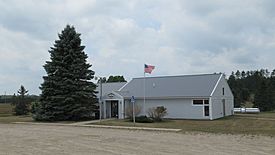
Butterfield Township Hall
|
|

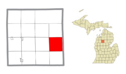
Location within Missaukee County
|
|
| Country | United States |
| State | Michigan |
| County | Missaukee |
| Area | |
| • Total | 36.02 sq mi (93.3 km2) |
| • Land | 35.40 sq mi (91.7 km2) |
| • Water | 0.62 sq mi (1.6 km2) |
| Elevation | 1,132 ft (345 m) |
| Population
(2020)
|
|
| • Total | 473 |
| • Density | 13.4/sq mi (5.2/km2) |
| Time zone | UTC-5 (Eastern (EST)) |
| • Summer (DST) | UTC-4 (EDT) |
| ZIP Codes | |
| Area code(s) | 231 |
| FIPS code | 26-113-12200 |
| GNIS feature ID | 1626015 |
Butterfield Township is a small community located in Missaukee County, in the U.S. state of Michigan. It is a type of local government area, similar to a small town or district. As of the 2020 census, about 473 people live here.
Contents
Exploring Butterfield Township
Butterfield Township is known for its quiet, natural setting. It offers a glimpse into rural life in Michigan.
Communities within Butterfield Township
There are a few small communities located inside Butterfield Township:
- Butterfield is a small, unincorporated community. This means it's a recognized place but doesn't have its own local government. It is in the southeast part of the township. A post office used to operate here from 1895 to 1922.
- Merritt is another unincorporated community. You can find it in the northern part of the township. It is located near M-55, a main highway.
- Edson Corners was a community and a former post office. It was located on the Muskegon River. The post office here operated from 1878 until 1900.
Geography and Natural Features
Butterfield Township covers a total area of about 36 square miles (93 square kilometers). Most of this area, about 35.4 square miles (91.7 square kilometers), is land. The rest, about 0.62 square miles (1.6 square kilometers), is water.
The Muskegon River is an important natural feature. This river flows from north to south through the township. It eventually empties into Lake Michigan.
Main Roads in the Township
- M-55 is a state highway that forms the northern border of Butterfield Township.
- M-74 was an older state highway. It existed from 1919 to 1939 but is no longer in use.
Population Changes Over Time
The population of Butterfield Township has changed over the years. Here's a look at how many people have lived there during different census years:
| Historical population | |||
|---|---|---|---|
| Census | Pop. | %± | |
| 1900 | 221 | — | |
| 1910 | 323 | 46.2% | |
| 1920 | 283 | −12.4% | |
| 1930 | 294 | 3.9% | |
| 1940 | 375 | 27.6% | |
| 1950 | 302 | −19.5% | |
| 1960 | 276 | −8.6% | |
| 1970 | 272 | −1.4% | |
| 1980 | 390 | 43.4% | |
| 1990 | 452 | 15.9% | |
| 2000 | 548 | 21.2% | |
| 2010 | 489 | −10.8% | |
| 2020 | 473 | −3.3% | |
| U.S. Decennial Census | |||
In 2000, there were 548 people living in the township. The average number of people per square mile was about 15.3. About 25% of the population was under 18 years old. The median age was 40 years.
See also
 In Spanish: Municipio de Butterfield (Míchigan) para niños
 | Selma Burke |
 | Pauline Powell Burns |
 | Frederick J. Brown |
 | Robert Blackburn |


