Byram River facts for kids
Quick facts for kids Byram River |
|
|---|---|

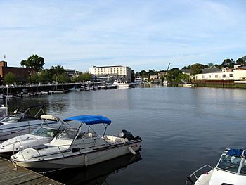
The harbor
|
|
| Country | United States |
| State | Connecticut, New York |
| County | Westchester County, Fairfield County |
| Physical characteristics | |
| Main source | Byram Lake North Castle, New York 750 feet (230 m) 41°09′19″N 73°41′33″W / 41.1554°N 73.6925°W |
| River mouth | Port Chester Harbor Port Chester, New York, Greenwich, Connecticut 0 feet (0 m) 40°59′18″N 73°39′37″W / 40.9884°N 73.6604°W |
| Length | 13.9 miles (22.4 km) |
| Basin features | |
| Basin size | 29 square miles (75 km2) |
The Byram River is a cool river that flows for about 13.9 miles (22.4 km). It runs through the southeastern part of New York and the southwestern part of Connecticut in the United States. For some of its journey, it even forms part of the border between these two states!
The river starts high up at Byram Lake in Westchester County, New York. This starting point, called its "headwaters," is about 750 feet (229 meters) above sea level. Imagine starting at the top of a tall building! From there, it flows south, crossing the border into Connecticut. Finally, it reaches Port Chester Harbor and empties into the Long Island Sound. That's where it meets the ocean!
The Byram River has a "drainage basin" of about 29 square miles (75 square kilometers). This means all the rain and water from this area eventually flows into the Byram River. You'll find several dams along the river. These dams are managed by the Town of Greenwich and help control the water flow.
Contents
Bridges Over the Byram River
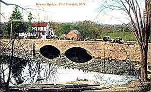
Many bridges cross the Byram River, helping people and cars get from one side to the other. In 2007, state inspectors found that some bridges in Greenwich, Connecticut, needed important repairs.
Bailiwick Road Bridge
This bridge was already in poor condition. It got even more damaged by a big storm called a "nor'easter" in April 2007. Emergency repairs were done quickly. Town officials thought the bridge might need a new design to protect it better from future floods.
Riversville Road Bridge
Officials in Greenwich put weight limits on this bridge in 2007. This meant very heavy trucks, like dump trucks, were not allowed to use it. However, slightly lighter trucks, like 10-ton box trucks, could still cross.
Sherwood Avenue Bridge
Similar to the Riversville Road bridge, this one also had weight limits in 2007. Only certain types of trucks, like 15-ton box trucks, were allowed to use it. These limits help keep the bridges safe for everyone.
History of the Byram River
The Byram River was once a very busy place for jobs and businesses. People used to build ships here, and fishing was a major industry. The area called Byram in Greenwich is right at the southern end of the river, on the Connecticut side.
In April 2007, a powerful storm called a "nor'easter" caused flooding near the river. Areas on both the Connecticut and New York sides were affected. In July 2007, officials in Greenwich decided to spend money to study how to improve drainage in these flood-prone areas. One idea was to "dredge" the river. Dredging means cleaning out the bottom of the river to make it deeper, which can help prevent future floods.
 | Delilah Pierce |
 | Gordon Parks |
 | Augusta Savage |
 | Charles Ethan Porter |


