Byrdstown, Tennessee facts for kids
Quick facts for kids
Byrdstown, Tennessee
|
|||
|---|---|---|---|
|
Town
|
|||

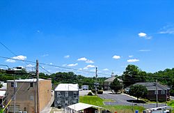
Town square in Byrdstown
|
|||
|
|||

Location of Byrdstown in Pickett County, Tennessee.
|
|||
| Country | United States | ||
| State | Tennessee | ||
| County | Pickett | ||
| Founded | 1879 | ||
| Incorporated | 1917 | ||
| Named for | Col. Robert K. Byrd | ||
| Area | |||
| • Total | 1.49 sq mi (3.85 km2) | ||
| • Land | 1.49 sq mi (3.85 km2) | ||
| • Water | 0.00 sq mi (0.00 km2) | ||
| Elevation | 1,037 ft (316 m) | ||
| Population
(2020)
|
|||
| • Total | 798 | ||
| • Density | 536.29/sq mi (207.10/km2) | ||
| Time zone | UTC-6 (Central (CST)) | ||
| • Summer (DST) | UTC-5 (CDT) | ||
| ZIP code |
38549
|
||
| Area code(s) | 931 | ||
| FIPS code | 47-10180 | ||
| GNIS feature ID | 1279260 | ||
Byrdstown is a small town in Pickett County, Tennessee, United States. It's the main town, or "county seat," of Pickett County. In 2020, about 798 people lived there.
Contents
History of Byrdstown
Byrdstown started in 1879. It became the main town for the new Pickett County. The town was named after Colonel Robert K. Byrd. He was a state senator whose area included the new county. Byrdstown became an official town in 1917.
A very important person, Cordell Hull (1871–1955), was born just west of Byrdstown. He was a US Secretary of State. He also helped create the United Nations, an organization for countries to work together.
The Pickett County Courthouse was built in 1935. Both the courthouse and the Cordell Hull Birthplace State Park are special historical places. You can also find the Amonett House at the meeting point of TN-325 and TN-111.
Geography and Location
Byrdstown is located in a hilly area. It's on the Highland Rim, which is a raised land area. The town is a few miles south of the Kentucky state line.
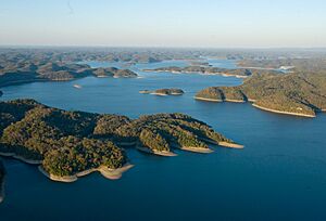
Byrdstown is south of the Wolf River. It is north of the Obey River. It's also east of Dale Hollow Lake. These two rivers meet at the lake.
Tennessee State Route 325 goes through Byrdstown. It mostly follows West Main Street and East Main Street. This road connects Byrdstown to Dale Hollow Lake. It also connects to the Cordell Hull Birthplace State Park to the west. To the east, it leads to the countryside of Pickett County.
Tennessee State Route 111 crosses SR 325 in western Byrdstown. This road connects the town to Livingston to the southwest. It also goes north to Static at the state line. At Static, this highway ends. It meets U.S. Route 127, which continues north to Albany, Kentucky.
The town covers about 1.5 square miles (3.85 square kilometers). All of this area is land.
Weather in Byrdstown
| Climate data for Byrdstown, Tennessee, 1991–2020 normals, extremes 1998–present | |||||||||||||
|---|---|---|---|---|---|---|---|---|---|---|---|---|---|
| Month | Jan | Feb | Mar | Apr | May | Jun | Jul | Aug | Sep | Oct | Nov | Dec | Year |
| Record high °F (°C) | 77 (25) |
79 (26) |
87 (31) |
90 (32) |
91 (33) |
100 (38) |
101 (38) |
100 (38) |
96 (36) |
96 (36) |
84 (29) |
81 (27) |
101 (38) |
| Mean maximum °F (°C) | 66.7 (19.3) |
71.6 (22.0) |
79.3 (26.3) |
85.3 (29.6) |
86.7 (30.4) |
90.3 (32.4) |
91.0 (32.8) |
90.7 (32.6) |
89.9 (32.2) |
85.6 (29.8) |
76.3 (24.6) |
70.3 (21.3) |
93.2 (34.0) |
| Mean daily maximum °F (°C) | 45.7 (7.6) |
50.2 (10.1) |
59.1 (15.1) |
69.6 (20.9) |
75.6 (24.2) |
82.1 (27.8) |
84.5 (29.2) |
84.4 (29.1) |
79.7 (26.5) |
70.3 (21.3) |
59.1 (15.1) |
49.2 (9.6) |
67.5 (19.7) |
| Daily mean °F (°C) | 36.2 (2.3) |
39.7 (4.3) |
47.7 (8.7) |
56.9 (13.8) |
65.0 (18.3) |
72.4 (22.4) |
75.6 (24.2) |
74.4 (23.6) |
68.5 (20.3) |
57.9 (14.4) |
47.3 (8.5) |
39.8 (4.3) |
56.8 (13.8) |
| Mean daily minimum °F (°C) | 26.7 (−2.9) |
29.2 (−1.6) |
36.2 (2.3) |
44.2 (6.8) |
54.3 (12.4) |
62.6 (17.0) |
66.6 (19.2) |
64.4 (18.0) |
57.3 (14.1) |
45.4 (7.4) |
35.5 (1.9) |
30.3 (−0.9) |
46.1 (7.8) |
| Mean minimum °F (°C) | 7.1 (−13.8) |
12.1 (−11.1) |
20.0 (−6.7) |
28.4 (−2.0) |
38.3 (3.5) |
51.7 (10.9) |
56.3 (13.5) |
55.4 (13.0) |
45.5 (7.5) |
30.7 (−0.7) |
20.5 (−6.4) |
16.2 (−8.8) |
5.5 (−14.7) |
| Record low °F (°C) | −9 (−23) |
−6 (−21) |
8 (−13) |
19 (−7) |
32 (0) |
43 (6) |
51 (11) |
49 (9) |
35 (2) |
24 (−4) |
13 (−11) |
−3 (−19) |
−9 (−23) |
| Average precipitation inches (mm) | 4.52 (115) |
4.96 (126) |
5.01 (127) |
5.19 (132) |
4.90 (124) |
4.74 (120) |
5.28 (134) |
4.09 (104) |
3.62 (92) |
3.27 (83) |
3.68 (93) |
5.32 (135) |
54.58 (1,385) |
| Average precipitation days (≥ 0.01 in) | 13.7 | 13.1 | 13.6 | 12.3 | 12.2 | 11.4 | 11.8 | 10.3 | 8.1 | 9.8 | 10.3 | 13.5 | 140.1 |
| Source 1: NOAA | |||||||||||||
| Source 2: National Weather Service (mean maxima/minima 2006–2020) | |||||||||||||
Population of Byrdstown
| Historical population | |||
|---|---|---|---|
| Census | Pop. | %± | |
| 1920 | 125 | — | |
| 1930 | 135 | 8.0% | |
| 1940 | 215 | 59.3% | |
| 1950 | 379 | 76.3% | |
| 1960 | 613 | 61.7% | |
| 1970 | 582 | −5.1% | |
| 1980 | 884 | 51.9% | |
| 1990 | 998 | 12.9% | |
| 2000 | 903 | −9.5% | |
| 2010 | 803 | −11.1% | |
| 2020 | 798 | −0.6% | |
| Sources: | |||
2020 Census Information
| Race | Number | Percentage |
|---|---|---|
| White (non-Hispanic) | 730 | 91.48% |
| Black or African American (non-Hispanic) | 1 | 0.13% |
| Asian | 2 | 0.25% |
| Other/Mixed | 28 | 3.51% |
| Hispanic or Latino | 37 | 4.64% |
In 2020, there were 798 people living in Byrdstown. There were 409 households and 246 families in the town.
Famous People from Byrdstown
- Cordell Hull (1871–1955), a US Secretary of State and winner of the Nobel Peace Prize.
- Sierra Hull (born 1991), a talented musician.
See also
 In Spanish: Byrdstown para niños
 | Roy Wilkins |
 | John Lewis |
 | Linda Carol Brown |


