Cagles Mill Lake facts for kids
Quick facts for kids Cagles Mill Lake |
|
|---|---|

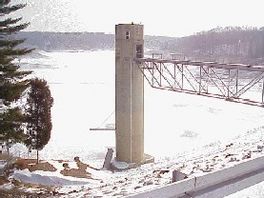
Cagles Mill Lake as seen from dam. U.S. Army Corps of Engineers photo.
|
|
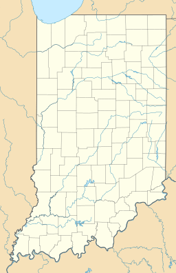
| Location | Owen / Putnam counties, Indiana, United States |
| Coordinates | 39°27′52″N 86°52′58″W / 39.4644628°N 86.8829156°W |
| Type | reservoir |
| Primary inflows | Mill Creek |
| Primary outflows | Mill Creek |
| Basin countries | United States |
| Surface elevation | 636 feet (194 m) |
Cagles Mill Lake, also known as Cataract Lake, is a large reservoir in west central Indiana. It is located near Cataract, Indiana, within the Lieber State Recreation Area. This lake sits on the border between Putnam and Owen counties.
The lake gets its water from Mill Creek in the north. Water then flows out to the Eel River in the south. The Eel River eventually joins the White River.
Discover Cagles Mill Lake
Cagles Mill Lake is a popular spot for outdoor fun. It offers many activities for visitors. The lake is known for its beautiful scenery and wildlife.
What is a Reservoir?
A reservoir is like a big, artificial lake. It is created by building a dam across a river. Reservoirs are used to store water. This water can be used for drinking, power, or to control floods. Cagles Mill Lake was built for flood control.
Fun Things to See and Do
Cagles Mill Lake is home to Cataract Falls. These are the largest waterfalls in Indiana. They are a major attraction for visitors.
Another exciting sight is a bald eagle's nest. Bald eagles are majestic birds. They return to the lake every season. Many people enjoy watching these eagles.
The lake is part of the Lieber State Recreation Area. This area offers many ways to enjoy nature. You can go boating, fishing, or hiking. There are also places for picnics and camping.
Building the Dam
The Cagles Mill Dam created Cagles Mill Lake. It is an earthen dam. This means it is made mostly of soil and rock. The United States Army Corps of Engineers built the dam. It was finished in 1953.
The dam's main purpose is to control floods. It can hold a lot of water. This helps protect nearby areas from flooding. The dam can store up to 228,120 acre-feet of water. An acre-foot is the amount of water needed to cover one acre of land one foot deep.
Before the dam was built, Indiana State Road 42 ran through the area. Now, the road has a new path. It goes around the lake on higher ground.
 | Leon Lynch |
 | Milton P. Webster |
 | Ferdinand Smith |


