Cairo, Ohio facts for kids
Quick facts for kids
Cairo, Ohio
|
|
|---|---|
|
Village
|
|

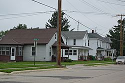
Houses on Main Street
|
|

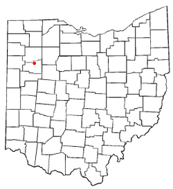
Location of Cairo, Ohio
|
|

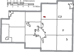
Location of Cairo in Allen County
|
|
| Country | United States |
| State | Ohio |
| County | Allen |
| Township | Monroe |
| Area | |
| • Total | 0.28 sq mi (0.72 km2) |
| • Land | 0.28 sq mi (0.72 km2) |
| • Water | 0.00 sq mi (0.00 km2) |
| Elevation | 814 ft (248 m) |
| Population
(2020)
|
|
| • Total | 517 |
| • Estimate
(2023)
|
502 |
| • Density | 1,866.43/sq mi (720.62/km2) |
| Time zone | UTC-5 (Eastern (EST)) |
| • Summer (DST) | UTC-4 (EDT) |
| ZIP code |
45820
|
| Area code(s) | 419 |
| FIPS code | 39-10884 |
| GNIS feature ID | 2397522 |
Cairo (pronounced KAIR-oh) is a small village in Allen County, Ohio, United States. It's a quiet place located in the middle of farming country. In 2020, about 517 people lived there. Cairo is part of the larger Lima area.
Contents
History of Cairo
Cairo was first called West Cairo. It was officially planned out in 1848. A post office opened there in 1852, also named West Cairo. The name was changed to Cairo in 1922.
Where is Cairo Located?
Cairo is found where two important roads used to meet. These were the east-west U.S. Route 30 (also known as the Lincoln Highway) and the north-south State Route 65. Route 65 is still called "Ottawa Road" by locals.
In the 1970s, Route 30 was improved and moved about a mile south of the village. Now, the main east-west street in Cairo is simply called Main Street.
Nearby Towns and Cities
Cairo is close to several other towns and a larger city:
- Lima: This city is about six miles south of Cairo on State Route 65.
- Columbus Grove: This town is about six miles north on State Route 65.
- Gomer: You can find Gomer about five miles west on the old Lincoln Highway route.
- Beaverdam: This town is about six miles east on the old Lincoln Highway route.
Land and Water Features
The land in Cairo is mostly flat. Its height above sea level ranges from about 812 feet on the west side to 842 feet on the east side. The average elevation is about 815 feet.
The closest stream that flows all year is Rattlesnake Creek. It flows from south of the village and passes just west of Cairo. Water in the village generally flows from the south and east towards the north and west.
The United States Census Bureau says that Cairo covers a total area of about 0.23 square miles (0.72 square kilometers). All of this area is land.
Who Lives in Cairo?
The number of people living in Cairo has changed over the years. Here's how the population has grown and shrunk:
| Historical population | |||
|---|---|---|---|
| Census | Pop. | %± | |
| 1880 | 316 | — | |
| 1890 | 325 | 2.8% | |
| 1900 | 338 | 4.0% | |
| 1910 | 386 | 14.2% | |
| 1920 | 380 | −1.6% | |
| 1930 | 374 | −1.6% | |
| 1940 | 440 | 17.6% | |
| 1950 | 505 | 14.8% | |
| 1960 | 566 | 12.1% | |
| 1970 | 587 | 3.7% | |
| 1980 | 596 | 1.5% | |
| 1990 | 473 | −20.6% | |
| 2000 | 499 | 5.5% | |
| 2010 | 524 | 5.0% | |
| 2020 | 517 | −1.3% | |
| 2023 (est.) | 502 | −4.2% | |
| U.S. Decennial Census | |||
2010 Census Information
In 2010, the census counted 524 people living in Cairo. There were 198 households, which are groups of people living together. Most people in Cairo were White (97.7%). A small number were African American, Native American, or Asian. About 1.5% of the population was Hispanic or Latino.
The average age of people in Cairo in 2010 was about 37.2 years old. About 28% of the residents were under 18 years old.
Education in Cairo
Cairo has a public library. It is a part of the Allen County Library system. This means residents can use its resources for learning and reading.
See also
 In Spanish: Cairo (Ohio) para niños
 | Mary Eliza Mahoney |
 | Susie King Taylor |
 | Ida Gray |
 | Eliza Ann Grier |

