Calabozos facts for kids
Quick facts for kids Calabozos |
|
|---|---|
| Highest point | |
| Elevation | 3,508 m (11,509 ft) |
| Geography | |
| Location | Central Chile |
| Parent range | Andes |
| Geology | |
| Age of rock | Pleistocene |
| Mountain type | Caldera |
| Volcanic belt | Andean Volcanic Belt |
| Last eruption | Unknown |
Calabozos is a huge volcano in central Chile. It's called a caldera, which means it's a big, bowl-shaped crater. This crater formed when the volcano's top collapsed after a massive eruption.
Calabozos is part of the Andes Mountains, which stretch along the western side of South America. It's located in the "Southern Volcanic Zone," one of the most active volcanic areas in the world. This zone has over 70 volcanoes and volcanic fields in Chile. Calabozos itself is in a very remote area with not many glaciers.
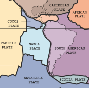
Like most volcanoes in the Andes, Calabozos formed because two giant pieces of Earth's crust, called tectonic plates, are slowly crashing into each other. The Nazca Plate is sliding underneath the South American Plate. This process creates a lot of heat and pressure, which melts rock and forms magma.
Scientists believe Calabozos gets its magma from a pool of molten rock deep underground. This magma is a mix of two types: andesite and rhyolite. Calabozos is famous for creating a huge amount of volcanic material called the Loma Seca Tuff. This material is about 200 to 500 cubic kilometers in size. It was created during at least three big eruptions that happened between 800,000 and 150,000 years ago.
The caldera itself is about 26 kilometers (16 miles) long and 14 kilometers (9 miles) wide. Its highest point is 3,508 meters (11,509 feet) above sea level. Over time, many other volcanoes have grown inside and around the Calabozos caldera, making it a complex volcano.
Contents
Where is Calabozos Located?
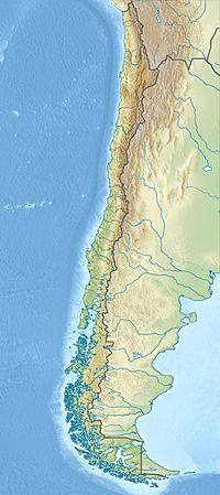
Calabozos is in the Maule Region of central Chile. It's near the cities of Curicó and Talca, in the western part of the Andes Mountains. This area is very remote and not many people live there permanently. There are no roads, so you can only reach it by horse or by walking.
Calabozos is part of the Southern Volcanic Zone (SVZ). This zone runs along the western edge of central Chile and continues south into Argentina. It includes many caldera complexes and over 70 volcanoes that have been active in the last 2.6 million years. The SVZ is the most active volcanic region in Chile, with about one eruption happening each year.
What Does Calabozos Look Like?
Calabozos is a ring-shaped caldera, like a giant oval bowl. It's about 26 kilometers (16 miles) long and 14 kilometers (9 miles) wide. The highest point of the caldera is 3,508 meters (11,509 feet) tall.
Over time, new volcanoes have grown from eruptions inside the caldera. The largest one is the Cerro del Medio complex, located on the southern edge of the caldera. It's also 3,508 meters (11,509 feet) high.
On the southwestern edge of Calabozos, there's another volcano called Descabezado Chico. It has four overlapping craters and is 3,250 meters (10,663 feet) tall. Its last eruption created a lava flow that stretched for 30 kilometers (19 miles). Another cone in the complex is Cerro Colorado, which is 2,928 meters (9,606 feet) high.
Inside the caldera, you can find hot springs like Cajon Los Calabozos. These hot springs are very old and might have formed after the second big eruption of Calabozos. This happened as the ground lifted due to ongoing volcanic activity.
How Did Calabozos Form?

Calabozos, like the rest of the Andes Mountains, formed because of a process called subduction. This is when one of Earth's giant plates slides underneath another. In this case, the Nazca Plate is sliding under the South American Plate. This happens about 160 kilometers (100 miles) west of Chile.
This sliding motion creates a deep ditch in the ocean floor called the Peru–Chile Trench. It also causes the magma to rise, forming the Andean Volcanic Belt and the Andes Mountains. Calabozos is one of 45 volcanoes in central Chile and Argentina that have been active in the last 11,700 years.
Scientists have studied the rocks in central Chile to understand its volcanic past. They found that volcanoes were very active between 15.3 and 6.4 million years ago. Then, there was a quiet period. Around 2.5 million years ago, volcanoes in central Chile became active again and have been erupting almost continuously since then.
What is Calabozos Made Of?
Calabozos sits in an area where the Earth's crust changes from thick to thin. Its eruptions are likely fed by a pool of magma that is rich in andesite and rhyolite. The ground beneath Calabozos is made of layers of volcanic rock and older sedimentary and metamorphic rocks.
Calabozos is similar in age to other nearby volcanoes like Cerro Azul and Descabezado Grande. Their eruptions might even be connected. These volcanoes are made of similar types of rock, like andesite and dacite. They are also similar in size.
Calabozos is mainly made of basaltic andesite and rhyodacite. These are types of volcanic rock. The lavas from Calabozos often have small crystals inside them, called phenocrysts. These crystals are usually made of plagioclase, but can also include other minerals like clinopyroxene and orthopyroxene.
Climate and Plants Around Calabozos
The area around Calabozos gets about 134 centimeters (53 inches) of rain each year. Most of the rain, which falls as snow, happens between May and August. During the summer, temperatures can reach 25 degrees Celsius (77 degrees Fahrenheit). But at high elevations (above 2,500 meters or 8,200 feet), temperatures often drop below freezing.
There isn't much plant life in the area. A big eruption from Cerro Azul's Quizapu Crater in 1932 turned much of the land into a desert of pumice (a light, airy volcanic rock). Above 1,200 meters (3,900 feet), plants become even rarer.
Past Eruptions of Calabozos
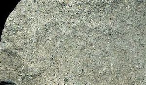
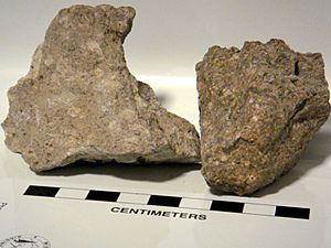
During the late Pleistocene epoch (the Ice Age), Calabozos erupted a lot of volcanic ash and rock called tuff. This tuff was mostly made of rhyodacite and dacite. Scientists have identified three major eruptions that happened in the last million years. The layers of ash from all these eruptions are known as the Loma Seca Tuff. They are huge, ranging from 200 to 500 cubic kilometers in volume.
The first big eruption happened 800,000 years ago. The ash from this eruption settled in canyons and was later shaped by glaciers.
The second eruption, about 300,000 years ago, was the largest. It was probably between 250 and 300 cubic kilometers in volume. The ash from this eruption spread far beyond the caldera.
After the second eruption, there were quieter eruptions of andesite lava for about 150,000 years, while glaciers were also active.
About 150,000 years ago, the third and final major ash flow eruption occurred. This one was smaller than the second, but it was still very powerful. The ash layers from this eruption were thickest at Loma Seca, reaching 300 meters (980 feet).
The third eruption's ash layers are different from the second. They have more crystals (phenocrysts) and less rock fragments. This suggests that the magma source changed over time.
Volcano Threats and Safety
Calabozos is in the Southern Volcanic Zone, which has many active and potentially dangerous volcanoes. Some well-known ones include Mount Hudson, Llaima, and Villarrica. These volcanoes have erupted many times throughout history.
Because Calabozos is in such a remote area, it doesn't pose a big threat to people. However, if an eruption were to happen, help could be sent. Organizations like the Volcanic Disaster Assistance Program (VDAP) are ready to help. This team works to reduce deaths and economic losses from eruptions in developing countries. They have special equipment to monitor volcanoes and can help predict eruptions, allowing people to evacuate safely.
See also
 In Spanish: Calabozos (volcán) para niños
- Geology of Chile
- List of volcanoes in Chile


