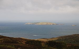
Calbha Beag facts for kids
| Gaelic name | Calbha Beag |
|---|---|
| Meaning of name | Little calf island |
| OS grid reference | NC156367 |
| Coordinates | 58°17′N 5°08′W / 58.28°N 05.14°W |
| Physical geography | |
| Island group | Islands of Sutherland |
| Area | 45 hectares (110 acres) |
| Area rank | 210= (?) |
| Highest elevation | 41 metres (135 ft) |
| Administration | |
| Sovereign state | United Kingdom |
| Country | Scotland |
| Council area | Highland |
| Demographics | |
| Population | Uninhabited |
Calbha Beag is a small, empty island located in Eddrachillis Bay, off the coast of Sutherland in the Scottish Highlands. It's right next to a slightly larger island called Calbha Mor. The name "Calbha Beag" comes from Scottish Gaelic and means "Little calf island."
Contents
Discover Calbha Beag: Scotland's Little Calf Island
Calbha Beag is one of many small islands found along the rugged coastline of Scotland. It's known for being completely natural and untouched by human settlements. This makes it a peaceful spot, often visited by local wildlife.
Where is Calbha Beag Located?
This island is found in Eddrachillis Bay, which is a beautiful part of Sutherland, in the Highland region of Scotland. It sits just west of another island named Calbha Mor. The area is famous for its stunning sea views and many small islands.
What Does "Uninhabited" Mean for Calbha Beag?
When we say Calbha Beag is "uninhabited," it means that no people live there permanently. There are no houses, roads, or towns on the island. This allows nature to thrive without much human interference. Uninhabited islands often become important homes for birds and other animals.
How Big is Calbha Beag?
The size of Calbha Beag is about 45 hectares (which is roughly 111 acres). To give you an idea, a hectare is about the size of a large football field. So, Calbha Beag is like 45 football fields put together. Some maps, like those from the Ordnance Survey, suggest it might be a bit smaller, around 31 hectares (77 acres). The difference might be because some areas are only visible at low tide. The highest point on the island is about 41 meters (135 feet) above sea level.
 | Janet Taylor Pickett |
 | Synthia Saint James |
 | Howardena Pindell |
 | Faith Ringgold |


