Caledonia Mountain facts for kids
Quick facts for kids Caledonia Mountain |
|
|---|---|

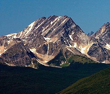
Caledonia Mountain seen from The Whistlers
|
|
| Highest point | |
| Elevation | 2,863 m (9,393 ft) |
| Prominence | 913 m (2,995 ft) |
| Geography | |
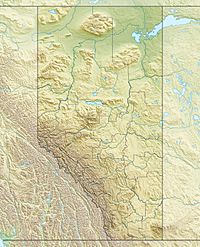
| Location | Alberta / British Columbia |
| Parent range | Victoria Cross Ranges |
| Topo map | NTS 83D/15 |
Caledonia Mountain is a tall peak in the Canadian Rockies. It stands about 2,863-metre (9,393-foot) high! This mountain is special because it sits right on the border between Alberta and British Columbia in Canada. It's also found within two big parks: Jasper National Park and Mount Robson Provincial Park.
Caledonia Mountain is one of Alberta's most important mountains. It was named in 1926. This was because it overlooks a valley that used to be called the Caledonian Valley. That valley is now known as the Yellowhead Pass.
Weather at Caledonia Mountain
Caledonia Mountain has a subarctic climate. This means it has very cold and snowy winters. The summers are usually mild. Temperatures can drop below −20 °C (that's −4 °F). With the wind chill, it can feel even colder, sometimes below −30 °C (−22 °F).
The best time to visit or climb Caledonia Mountain is from June through September. This is when the weather is usually nicer. Water from the mountain flows in two directions. Some of it drains west into rivers that join the Fraser River. Other water flows east into the Miette River.
 | Bayard Rustin |
 | Jeannette Carter |
 | Jeremiah A. Brown |


