Calhoun, Missouri facts for kids
Quick facts for kids
Calhoun, Missouri
|
|
|---|---|

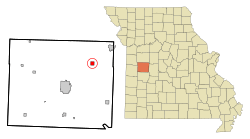
Location of Calhoun, Missouri
|
|
| Country | United States |
| State | Missouri |
| County | Henry |
| Area | |
| • Total | 0.99 sq mi (2.58 km2) |
| • Land | 0.98 sq mi (2.55 km2) |
| • Water | 0.01 sq mi (0.03 km2) |
| Elevation | 781 ft (238 m) |
| Population
(2020)
|
|
| • Total | 392 |
| • Density | 398.37/sq mi (153.81/km2) |
| Time zone | UTC-6 (Central (CST)) |
| • Summer (DST) | UTC-5 (CDT) |
| ZIP code |
65323
|
| Area code(s) | 660 |
| FIPS code | 29-10450 |
| GNIS feature ID | 2393494 |
Calhoun is a small city located in Henry County, Missouri, in the United States. In 2010, about 469 people lived there. By 2020, the population was 392. It is a quiet place in the central part of Missouri.
Contents
History of Calhoun
Calhoun was officially started in 1837. The town was named after John C. Calhoun, who was an important person in American history. He served as the seventh Vice President of the United States. A post office opened in Calhoun in 1844, which meant people could send and receive mail there.
Geography of Calhoun
According to the United States Census Bureau, the city of Calhoun covers a total area of about 2.58 square kilometers (or 0.99 square miles). Most of this area is land, which is about 2.55 square kilometers (0.98 square miles). A very small part, about 0.03 square kilometers (0.01 square miles), is water.
Population Changes in Calhoun
| Historical population | |||
|---|---|---|---|
| Census | Pop. | %± | |
| 1880 | 492 | — | |
| 1890 | 698 | 41.9% | |
| 1900 | 561 | −19.6% | |
| 1910 | 684 | 21.9% | |
| 1920 | 603 | −11.8% | |
| 1930 | 501 | −16.9% | |
| 1940 | 521 | 4.0% | |
| 1950 | 463 | −11.1% | |
| 1960 | 374 | −19.2% | |
| 1970 | 360 | −3.7% | |
| 1980 | 427 | 18.6% | |
| 1990 | 450 | 5.4% | |
| 2000 | 491 | 9.1% | |
| 2010 | 469 | −4.5% | |
| 2020 | 392 | −16.4% | |
| U.S. Decennial Census | |||
Calhoun's Population in 2010
In 2010, the census showed that 469 people lived in Calhoun. There were 175 households, which are groups of people living together in one home. Out of these, 115 were families. The city had about 478 people per square mile, which is called the population density.
Most of the people living in Calhoun were White (97.7%). A small number were African American (0.2%), Native American (0.2%), or Asian (0.6%). About 1.3% of the people were from two or more racial backgrounds. A small percentage (0.4%) were of Hispanic or Latino background.
Many households (33.1%) had children under 18 living with them. About 44% were married couples. Some households were led by a single parent, either a mother (14.3%) or a father (7.4%). About 29.7% of all households had only one person living there. About 9.2% of homes had someone aged 65 or older living alone.
The average age of people in Calhoun was 37.2 years old. About 26.7% of residents were under 18. About 9.3% were between 18 and 24 years old. People aged 25 to 44 made up 22.5% of the population. Those aged 45 to 64 were 28.9%. Finally, 12.6% of residents were 65 years or older. The city had a very close number of males and females, with 50.1% male and 49.9% female.
Famous People from Calhoun
- Dorla Eaton Kemper (born in 1929) was the 37th President General of the Daughters of the American Revolution. This is a group that helps preserve American history and promote education.
See also
 In Spanish: Calhoun (Misuri) para niños
 | Charles R. Drew |
 | Benjamin Banneker |
 | Jane C. Wright |
 | Roger Arliner Young |

