
California Historical Landmarks in San Francisco facts for kids
San Francisco is a super cool city in California, famous for its Golden Gate Bridge, cable cars, and amazing history! Did you know that many places in San Francisco are so important that they've been named California Historical Landmarks? These special spots help us remember important events and people from California's past.
A California Historical Landmark is a building, place, or event that has played a big role in the history of California. When a place gets this title, it means it's officially recognized for its historical value. Let's explore some of these awesome landmarks right here in San Francisco!
Historic San Francisco Landmarks
Birthplace of the United Nations
One of the most important places in San Francisco is the San Francisco War Memorial and Performing Arts Center in the Civic Center. This is where the United Nations Charter was signed in 1945. The United Nations is an organization where countries work together to promote peace and solve global problems. It's amazing to think that such a big step for world peace happened right here!

Fort Point: A Historic Fortress
Underneath the famous Golden Gate Bridge, you'll find Fort Point. This old fort, also known as Castillo de San Joaquín, was built to protect San Francisco Bay. It's a really cool place to visit and imagine what it was like to guard the city many years ago.

The Conservatory of Flowers
In Golden Gate Park, you can find the beautiful Conservatory of Flowers. This amazing greenhouse is filled with rare and exotic plants from all over the world. It's like stepping into a tropical jungle, right in the middle of San Francisco! It's a wonderful place to learn about different plants and enjoy nature.

First Cable Car Line
Have you ever ridden a cable car in San Francisco? They're iconic! The very first cable car line, the Clay Street Hill Railroad, had its eastern end at Portsmouth Square in Chinatown. This was a huge invention that helped people travel up and down San Francisco's steep hills.
_VIEW_OF_CLAY_STREET_SHOWING_THE_WIRE_RAILROAD_pg191.jpg)
El Camino Real
The El Camino Real was a historic road that connected the Spanish missions in California. A plaque marking this important route can be found on Dolores Street in the Mission District. It reminds us of the early days of California's settlement.

The Golden Gate Bridge
Of course, no list of San Francisco landmarks would be complete without the Golden Gate Bridge! This incredible bridge is one of the most famous landmarks in the world. It connects San Francisco to Marin County and offers breathtaking views. It's a true marvel of engineering.

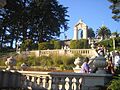
The Presidio of San Francisco
The Presidio of San Francisco is a large national park that used to be a military post. It has a long history, dating back to when it was a Spanish fortress. Today, it's a beautiful place with hiking trails, historic buildings, and amazing views of the bay and the Golden Gate Bridge.

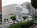
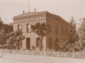
The Old San Francisco Mint
San Francisco has had two mint buildings where money was made. The first one, known as the First San Francisco Mint building, was located on Commercial Street. The second, and more famous, is the Old San Francisco Mint on 5th Street. This grand building, sometimes called "The Granite Lady," survived the 1906 earthquake and fire! It's a fantastic example of old architecture.
.jpg)
_3.JPG)
Telegraph Hill
Telegraph Hill is one of San Francisco's famous hills. In the early days, a semaphore (a signaling device) was placed here to tell people when ships were entering the Golden Gate. Today, it's known for Coit Tower and its wild parrots, offering amazing views of the city and the bay.

Treasure Island
Treasure Island is an artificial island in San Francisco Bay, built for the 1939 Golden Gate International Exposition. It offers unique views of the city skyline and the Bay Bridge. It's a fascinating place with a history of hosting world's fairs and serving as a naval base.
.JPG)
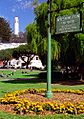
Union Square
Union Square is a lively public plaza in the heart of San Francisco's shopping and theater district. It's a popular spot for locals and visitors alike, with its central monument and surrounding shops and hotels. It's a great place to experience the energy of the city.

Images for kids
-
The California Masonic Lodge No. 1.
-
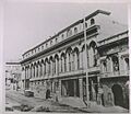
The historic California Theatre.
-
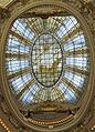
The beautiful rotunda dome of the City of Paris building.
-
A painting depicting the entrance of the San Carlos into San Francisco Bay.
-
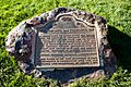
A plaque marking Farnsworth's Green Street Lab.
-
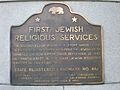
A plaque for the first Jewish religious services in San Francisco.
-
A plaque for the first public school in California.
-
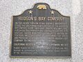
A plaque for the Hudson's Bay Company headquarters.
-
Washington Square, where a plaque for Juana Briones is located.
-
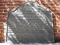
A plaque marking the landing place of Captain J. Montgomery.
-
Steps at the former Laurel Hill Cemetery.
-
The Liberty Bell Slot Machine.
-
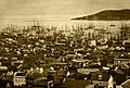
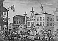
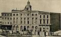
San Francisco harbor in 1851, showing the Long Wharf.
-
A plaque for the Lucas, Turner & Co. Bank.
-
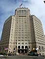
The Mark Hopkins Institute of Art building.
-
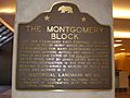
A historical marker for the Montgomery Block.
-
The Niantic Hotel, built on a buried ship.
-
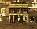
The office of the California Star newspaper in 1851.
-
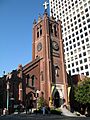
Old Saint Mary's Cathedral.
-
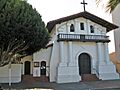
Mission Dolores.
-
The original site of the Bancroft Library.
-
A bell marking the original site of St. Mary's College.
-
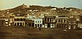
Portsmouth Plaza in 1851.
-
Rincon Hill.
-

Thomas Starr King.
-
A plaque marking the site of the first California State Fair.
-
The Jenny Lind Theatre, which later became San Francisco City Hall.
-
Tablets marking the original shoreline of San Francisco Bay.
-
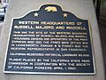
A marker for the Western business headquarters of Russell, Majors and Waddell (Pony Express).
-
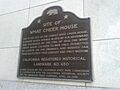
The What Cheer House.
-
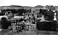
An illustration of Woodward's Gardens in 1875.


.JPG)


.jpg)


.jpg)


.jpg)


.jpg)

.jpg)
.jpg)


.jpg)

See also
