
Callensburg, Pennsylvania facts for kids
Quick facts for kids
Callensburg, Pennsylvania
|
|
|---|---|
|
Borough
|
|

Post office and adjacent store
|
|

Location of Callensburg in Clarion County, Pennsylvania.
|
|

Map showing Clarion County in Pennsylvania
|
|

Callensburg, Pennsylvania
Location in Pennsylvania
|
|
| Country | United States |
| State | Pennsylvania |
| County | Clarion |
| Settled | 1826 |
| Incorporated | 1851 |
| Government | |
| • Type | Borough Council |
| Area | |
| • Total | 0.14 sq mi (0.37 km2) |
| • Land | 0.14 sq mi (0.37 km2) |
| • Water | 0.00 sq mi (0.00 km2) |
| Elevation | 1,110 ft (340 m) |
| Population
(2020)
|
|
| • Total | 150 |
| • Density | 1,034.48/sq mi (400.65/km2) |
| Time zone | UTC-5 (Eastern (EST)) |
| • Summer (DST) | UTC-4 (EDT) |
| ZIP code |
16213
|
| FIPS code | 42-10792 |
Callensburg is a small town, called a borough, located in Clarion County, Pennsylvania, USA. In 2020, about 150 people lived there. It's a quiet place with a rich history.
Where is Callensburg?
Callensburg is in the western part of Clarion County. It sits on a hill that looks over where Licking Creek joins the Clarion River. This river is part of the larger Allegheny River system.
Pennsylvania Route 368 goes right through the middle of Callensburg. If you go west on this road for about 7 miles (11 km), you'll reach Parker on the Allegheny River. Just east of Callensburg, Route 368 ends at Pennsylvania Route 58. Route 58 can take you east to Sligo or northwest to St. Petersburg. St. Petersburg is also close to Interstate 80.
Callensburg covers a small area of about 0.14 square miles (0.37 square kilometers). It's all land, with no large bodies of water inside its borders.
Callensburg's History
Callensburg was first planned out in 1826. A man named Hugh Callen, Sr., owned the land. He asked a young surveyor named Sidle Lobaugh to design a town on his property. Mr. Callen thought that the Pennsylvania Canal would be built nearby. Even though the canal didn't end up passing through Callensburg, enough people still moved there to form a town.
The town officially became a borough in 1851. The very first town election was held on March 21, 1851.
When Mr. Callen planned the town, he set aside three acres of land. This land was for building a Presbyterian Church and a cemetery. He also gave an open lot north of Main Street to the town. This lot had the town's spring, which was an important water source.
There's a local story about a large poplar tree near Mr. Callen's house. People say this tree grew from a small twig he used as a riding whip. He supposedly stuck the whip into the ground after returning from church one Sunday. This tree is still seen as a reminder of his strong faith.
People of Callensburg
| Historical population | |||
|---|---|---|---|
| Census | Pop. | %± | |
| 1860 | 319 | — | |
| 1870 | 255 | −20.1% | |
| 1880 | 277 | 8.6% | |
| 1890 | 241 | −13.0% | |
| 1900 | 248 | 2.9% | |
| 1910 | 198 | −20.2% | |
| 1920 | 215 | 8.6% | |
| 1930 | 208 | −3.3% | |
| 1940 | 280 | 34.6% | |
| 1950 | 261 | −6.8% | |
| 1960 | 280 | 7.3% | |
| 1970 | 249 | −11.1% | |
| 1980 | 248 | −0.4% | |
| 1990 | 205 | −17.3% | |
| 2000 | 224 | 9.3% | |
| 2010 | 207 | −7.6% | |
| 2020 | 150 | −27.5% | |
| Sources: | |||
In 2000, there were 224 people living in Callensburg. There were 96 households and 54 families. Most people living in the borough were White.
About 22.8% of the people were under 18 years old. About 12.9% were 65 years or older. The average age in Callensburg was 37 years old.
The average income for a household in Callensburg was $28,000 per year. For families, it was $37,083 per year.
Images for kids
-
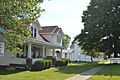
Houses on Main Street

See also
 In Spanish: Callensburg para niños
