Campo, Colorado facts for kids
Quick facts for kids
Campo, Colorado
|
|
|---|---|

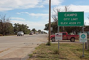
Entering Campo from the north on U.S. Route 287/385 (2015)
|
|

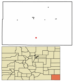
Location within Baca County and Colorado
|
|
| Country | United States |
| State | Colorado |
| County | Baca County |
| Incorporated | March 6, 1950 |
| Government | |
| • Type | Statutory Town |
| Area | |
| • Total | 0.144 sq mi (0.374 km2) |
| • Land | 0.144 sq mi (0.374 km2) |
| • Water | 0 sq mi (0.000 km2) |
| Elevation | 4,344 ft (1,324 m) |
| Population
(2020)
|
|
| • Total | 103 |
| • Density | 713/sq mi (275/km2) |
| Time zone | UTC−7 (MST) |
| • Summer (DST) | UTC−6 (MDT) |
| ZIP Code |
81029
|
| Area code | 719 |
| FIPS code | 08-11645 |
| GNIS ID | 196360 |
Campo is a small town in Colorado, United States. It is located in Baca County. In 2020, about 103 people lived there. Campo is found on the High Plains. It is also right on U.S. Route 287 and 385, which are important roads.
Contents
History of Campo
The name "Campo" comes from a Spanish word. It means "field." The town started growing in 1913. That's when a post office was first opened there.
Where is Campo Located?
Campo is in the southern part of Baca County. It is very close to the border of Oklahoma.
Travel to Nearby Towns
You can travel north on U.S. Route 287/385. It's about 21 miles (34 km) to Springfield. Springfield is the main town of Baca County. If you go south, it's about 27 miles (43 km) to Boise City, Oklahoma.
Land Area of Campo
In 2020, the town covered a total area of 0.374 square kilometers. All of this area is land. There is no water within the town limits.
Explore Picture Canyon
Southwest of Campo is Picture Canyon. It is part of the Comanche National Grassland. This area has beautiful views and cool rock shapes. You can also see ancient rock art there. This art was made by Plains Indian cultures.
What is the Climate Like?
The climate in Campo changes with the seasons. It has warm summers and cool winters.
| Climate data for Campo, Colorado | |||||||||||||
|---|---|---|---|---|---|---|---|---|---|---|---|---|---|
| Month | Jan | Feb | Mar | Apr | May | Jun | Jul | Aug | Sep | Oct | Nov | Dec | Year |
| Mean daily maximum °F (°C) | 47 (8) |
51 (11) |
59 (15) |
69 (21) |
78 (26) |
88 (31) |
93 (34) |
91 (33) |
83 (28) |
71 (22) |
58 (14) |
47 (8) |
69.5 (20.8) |
| Mean daily minimum °F (°C) | 22 (−6) |
25 (−4) |
32 (0) |
40 (4) |
51 (11) |
60 (16) |
66 (19) |
65 (18) |
56 (13) |
43 (6) |
32 (0) |
23 (−5) |
42.9 (6.1) |
| Source: Accuweather | |||||||||||||
Population of Campo
The number of people living in Campo has changed over the years.
| Historical population | |||
|---|---|---|---|
| Census | Pop. | %± | |
| 1950 | 266 | — | |
| 1960 | 235 | −11.7% | |
| 1970 | 206 | −12.3% | |
| 1980 | 185 | −10.2% | |
| 1990 | 121 | −34.6% | |
| 2000 | 150 | 24.0% | |
| 2010 | 109 | −27.3% | |
| 2020 | 103 | −5.5% | |
| U.S. Decennial Census | |||
Who Lives in Campo?
In 2000, there were 150 people living in Campo. Most residents were White. A small number were Native American or from two or more races. Some residents were also of Hispanic or Latino background.
There were 55 households in the town. Many of these households had children under 18 living with them. Most households were married couples. Some households were single-parent families or individuals living alone.
The average age of people in Campo was 38 years old. About 30% of the population was under 18. Around 16% were 65 years or older.
See also
 In Spanish: Campo (Colorado) para niños
 | Valerie Thomas |
 | Frederick McKinley Jones |
 | George Edward Alcorn Jr. |
 | Thomas Mensah |

