Cape Grenville facts for kids
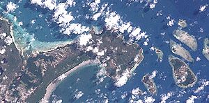
Cape Grenville (11°58′S 143°15′E / 11.967°S 143.250°E) is a small piece of land that sticks out into the ocean on the eastern coast of Queensland, Australia. It's located on the Cape York Peninsula, a large area of land in northern Australia. This cape sits between two bays: Shelburne Bay to the north and Temple Bay to the south. The closest town is Weipa, which is on the western side of Cape York.
Where is Cape Grenville?
Cape Grenville is found in a beautiful part of northern Australia. The northern part of the cape forms the southern edge of Margaret Bay. Off its eastern coast, you'll find several small islands. These are known as the Home Islands. Some of them include Orton Island, Gore Island, and Hicks Island. To the south of the cape is Indian Bay.
About 90 kilometers (about 56 miles) to the east of Cape Grenville is a special protected area. This is the far northern part of the amazing Great Barrier Reef Marine Park.
Amazing Sand Dunes and Wetlands
Strong winds have pushed sand from the coast far inland at Cape Grenville. These moving sand dunes can stretch up to 29 kilometers (about 18 miles) from the shore. They form Queensland's largest system of moving sand dunes on the mainland. It's even a bit bigger than the dunes found at Cape Flattery.
Cape Grenville is also home to important wetlands. About 7,304 hectares (over 18,000 acres) of these wet areas are recognized as "nationally important wetlands." They are listed in a special directory that highlights important natural places in Australia.
Traditional Owners of the Land
The Wuthathi people are the traditional owners of the Cape Grenville area. They have lived on this land for a very long time. In the past, they spoke the Wuthathi language, which is now no longer spoken.
The Wuthathi Land Trust has worked to regain control of their traditional lands. They were granted ownership of fifteen areas of land. These included former Aboriginal reserve lands and islands around Cape Grenville. Some of these islands are Rodney Island, Manley Island, Pig Island, Bootie Island, Sunday Island, and Ethel Island. This was made possible by the Aboriginal Land Act 1991 in Queensland.
On April 29, 2015, a large area of land and surrounding waters, including Cape Grenville, was officially recognized. The Federal Court of Australia agreed that this land belonged to the Wuthathi people. This special area covers about 1,181 square kilometers (about 456 square miles). It is a beautiful and important natural area around Shelburne Bay. The Wuthathi country stretches along the coast from Captain Billy Landing in the north, south to the Olive River, and east to the Great Barrier Reef.
 | Emma Amos |
 | Edward Mitchell Bannister |
 | Larry D. Alexander |
 | Ernie Barnes |


