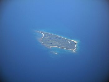
Caribou Island (near Michipicoten Island) facts for kids
 |
|
| Geography | |
|---|---|
| Location | Lake Superior |
| Coordinates | 47°21′33″N 85°48′36″W / 47.35917°N 85.81000°W |
| Administration | |
| Territory | Ontario |
| Demographics | |
| Population | 0 |
Caribou Island is an island in the eastern part of Lake Superior. It's about 40 kilometers (25 miles) south of Michipicoten Island. This island is part of Canada, even though it's only about five kilometers (3 miles) from the border with the United States.
Caribou Island is about 5.6 kilometers (3.5 miles) long and 2.4 kilometers (1.5 miles) wide. It covers an area of about 1,600 acres. The middle of the island has low bushes and swampy areas with small lakes. Some of these lakes are named Little Italy, Hambone, and Deer Lake. Beavers help keep many of these lakes full. All the lakes are several feet higher than Lake Superior itself.
Contents
A Look Back: Caribou Island's History
Caribou Island has an interesting past, from old plans to its role as a wildlife home.
Early Plans and Private Owners
During World War II, people thought about building an emergency airport on Caribou Island. This airport would have been called YCI. However, the idea was dropped because the cities of Sault Ste. Marie, Michigan and Sault Ste. Marie, Ontario were only about 80–90 miles away.
Later, a lake on the island called Deer Lake was used as a base for small planes that could land on water. The last private owners of the island built a dock and a ramp there. They did this because Lake Superior's water can be very rough and unpredictable. A small, three-room cabin was also built on the east shore of Lake Superior, right next to Deer Lake and the plane base.
Caribou and the Lighthouse
In the late 1800s, a group of hunters owned the island. They brought caribou to the island, making it a private hunting area into the early 1900s. The caribou were known to be quite wild. There were stories that they sometimes chased the lighthouse keeper up trees, trapping him for hours! It was also rumored that the lighthouse keepers sometimes hunted the caribou and beaver.
In the 1920s, during one cold winter, Lake Superior froze over. The caribou simply walked off the island across the ice. Because of the Great Depression, the island was not restocked with caribou. The many owners of the island mostly stopped paying attention to it.
In the 1960s, the Roys A. Ellis family bought the entire island. Then, in the early 1980s, they gave it to the Mellon Conservancy Trust. This trust is part of the Andrew W. Mellon Foundation. The goal was to make sure the island would never be developed or built on.
A New Home for Caribou
In 2018, six caribou were moved to Caribou Island. They came from Michipicoten Island to the north. This move happened because the Michipicoten First Nation wanted to help protect the caribou.
Understanding Caribou Island's Geology
Caribou Island is made up of different types of rock and soil. It tells a story about how the Earth has changed over millions of years.
How the Island Was Formed
Caribou Island has a mix of materials left behind by glaciers. It also has very old Precambrian sandstone. The island is actually part of a large pile of rocks and dirt called a glacial moraine. This moraine built up south of Michipicoten Island.
You can also find Jacobsville Sandstone on Caribou Island. This sandstone is the top and newest layer of rock in this area. It's about 8 kilometers (5 miles) thick and lies under Lake Superior. This sandstone fills the upper part of a huge crack in the Earth's crust called the Midcontinent Rift System. Below this sandstone, there are another 22 kilometers (14 miles) of basaltic volcanic rocks and other deep rocks. These fill the rest of the Midcontinent Rift.
The waters around Caribou Island can be tricky. There are hidden dangers that ships need to watch out for.
Dangerous Reefs and the Lighthouse
One dangerous underwater rock formation is called "Six Fathom Shoal." This reef stretches more than 1 kilometer (0.6 miles) north from the island's northern tip. Some people believe the famous ship SS Edmund Fitzgerald might have hit this shoal before it sank.
Another shallow reef is located 2.5 kilometers (1.5 miles) southwest of the Caribou Island Lighthouse. This reef is only 11 feet (3.4 meters) below the lake's surface. The lighthouse is now controlled remotely and is owned by the Canadian Coast Guard. It sits on a tiny island nearby, called Lighthouse Island. This small island is a few hundred feet across and is about 1 kilometer (0.6 miles) west of the southern tip of Caribou Island. When the lighthouse was first built, its light could be seen for 16 kilometers (10 miles). It flashed every 30 seconds.
What Are These Reefs Made Of?
These reefs are not like coral reefs you might see in warmer oceans. Instead, they are made of bedrock ridges. These ridges are found between valleys that run north. These valleys are called tunnel valleys. They were carved out by melting ice and water under the Laurentide Ice Sheet. This happened along old cracks in the bedrock floor of Lake Superior.
Samples taken from a shoal northwest of Caribou Island look like Jacobsville Sandstone. The way these tunnel valleys are lined up and run in the same direction suggests they were carved from the soft sandstones that lie under most of eastern Lake Superior.
 | Toni Morrison |
 | Barack Obama |
 | Martin Luther King Jr. |
 | Ralph Bunche |

