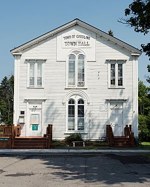
Caroline, New York facts for kids
Quick facts for kids
Caroline, New York
|
|
|---|---|
 |
|
| Country | United States |
| State | New York |
| County | Tompkins |
| Area | |
| • Total | 54.89 sq mi (142.17 km2) |
| • Land | 54.76 sq mi (141.84 km2) |
| • Water | 0.13 sq mi (0.34 km2) |
| Elevation | 1,644 ft (501 m) |
| Population
(2010)
|
|
| • Total | 3,282 |
| • Estimate
(2016)
|
3,481 |
| • Density | 63.56/sq mi (24.54/km2) |
| Time zone | UTC-5 (Eastern (EST)) |
| • Summer (DST) | UTC-4 (EDT) |
| FIPS code | 36-12606 |
| GNIS feature ID | 0978795 |
Caroline is a small town located in Tompkins County, New York. It is in the state of New York, in the United States. In 2010, about 3,282 people lived there.
Caroline is found on the southeast border of Tompkins County. It is southeast of the city of Ithaca.
Contents
History of Caroline
People first started settling in the Caroline area around 1794. At that time, this region was part of Tioga County. The land was bought as part of the Watkins and Flint Purchase in 1791.
The town of Caroline was officially formed in 1811. It was created from a larger town called Spencer. Spencer is now located in Tioga County.
Famous People from Caroline
Some well-known people were born or lived in Caroline:
- Charles R. Gleason (1830-1907) was born in Caroline. He later became a businessman and politician in Wisconsin.
- Austin Blair (1818-1894) was also born here. He became the 13th governor of Michigan.
Geography of Caroline
The town of Caroline covers a total area of about 55.1 square miles (142.7 square kilometers). Most of this area is land. Only a small part, about 0.1 square miles (0.3 square kilometers), is water.
The eastern and southern borders of the town are shared with Tioga County. New York State Route 79 is an important road that goes through the town.
Population and People
| Historical population | |||
|---|---|---|---|
| Census | Pop. | %± | |
| 1820 | 1,608 | — | |
| 1830 | 2,633 | 63.7% | |
| 1840 | 2,457 | −6.7% | |
| 1850 | 2,537 | 3.3% | |
| 1860 | 2,345 | −7.6% | |
| 1870 | 2,175 | −7.2% | |
| 1880 | 2,171 | −0.2% | |
| 1890 | 2,092 | −3.6% | |
| 1900 | 1,938 | −7.4% | |
| 1910 | 1,646 | −15.1% | |
| 1920 | 1,542 | −6.3% | |
| 1930 | 1,617 | 4.9% | |
| 1940 | 1,737 | 7.4% | |
| 1950 | 1,900 | 9.4% | |
| 1960 | 2,118 | 11.5% | |
| 1970 | 2,536 | 19.7% | |
| 1980 | 2,754 | 8.6% | |
| 1990 | 3,044 | 10.5% | |
| 2000 | 2,910 | −4.4% | |
| 2010 | 3,282 | 12.8% | |
| 2016 (est.) | 3,481 | 6.1% | |
| U.S. Decennial Census | |||
In the year 2000, there were 2,910 people living in Caroline. These people lived in 1,161 households. About 33% of these households had children under 18 living there.
The average age of people in Caroline in 2000 was 38 years old. Many residents travel to the Ithaca area for work.
Schools and Education
Students in Caroline attend schools in several different school districts. These include Dryden, Ithaca, Candor, and Newark Valley.
One school located right in the town is Caroline Elementary School. This school is part of the Ithaca City School District.
Towns and Villages in Caroline
Caroline has several smaller communities and hamlets within its borders:
- Besemer (also called "Besemer Depot") – This spot is on NY-79 in the northwest part of town.
- Brooktondale (once "Mott's Corner") – A small village near the western edge of the town.
- Caroline – A hamlet on NY-79, located at the northern town line.
- Caroline Center (formerly "Centerville") – This hamlet is right in the middle of the town.
- Caroline Depot – Found in the northwest, south of Brooktondale.
- Guide Board Corners – A place south of Slaterville Springs.
- Slaterville Springs (once "Slaterville") – This hamlet has a post office and is where the Caroline Town Hall is located.
- Speedsville – A hamlet in the southeast corner of the town.
- West Slaterville (formerly "Boiceville") – On NY-79 near the northern town line. This was the site of the very first town meeting.
- White Church – A hamlet in the southwest part of Caroline.
See also

- In Spanish: Caroline (Nueva York) para niños
 | William M. Jackson |
 | Juan E. Gilbert |
 | Neil deGrasse Tyson |


