Carr Peak facts for kids
Quick facts for kids Carr Peak |
|
|---|---|
 |
|
| Highest point | |
| Elevation | 9,229 ft (2,813 m) NAVD 88 |
| Prominence | 675 ft (206 m) |
| Geography | |
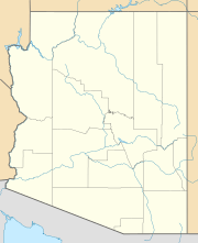
| Location | Cochise County, Arizona, U.S. |
| Parent range | Huachuca Mountains |
| Topo map | USGS Miller Peak |
| Climbing | |
| Easiest route | Hike |
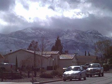
Carr Peak is a tall mountain located in Cochise County, Arizona. It's the second-highest peak in the Huachuca Mountains. This mountain stands about 10 miles (16 km) south of Sierra Vista, Arizona.
The top of Carr Peak is part of the Miller Peak Wilderness area. It's also found within the Coronado National Forest. Just a few miles south is the Nature Conservancy's Ramsey Canyon Preserve.
This area is super popular with people who love to watch birds. You can see many different kinds of hummingbirds here, sometimes as many as 15 species! It's also home to special southwestern plants and animals. These include the Apache pine, Chihuahua pine, and unique animals like the ridge-nosed rattlesnake, lesser long-nosed bat, and the colorful Elegant Trogon.
Exploring Carr Peak Trail
The Carr Peak Trail is a great way to explore the Huachuca Mountains. It's easy to reach and offers amazing views. This trail is a moderate hike, meaning it's not too hard but still a good workout.
It also helps you get to two of the highest spots in southeastern Arizona. You can reach Carr Peak itself. Plus, you can connect to the Crest Trail #103 to reach Miller Peak. Because of these reasons, this trail is one of the most popular for hiking in the area.
Getting to the Trail
You can easily get to the Carr Peak Trail from two campgrounds. These are the Reef Townsite Campground and Ramsey Vista Campground. Both are located on the scenic Carr Canyon Road.
The main starting point for the trail is near a parking area. This parking area is just outside Ramsey Vista Campground. There are other ways to access the trail too. A short path leads directly from Ramsey Vista Campground. You can also use the Old Sawmill Spring Trail. This trail starts from a parking lot across from FR 368, near the Reef Townsite Campground.
Nature's Comeback
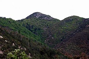
As you hike, you'll climb about 2,000 feet (610 meters) from the start to the summit. Much of this area has been affected by wildfires in the past. There was a large fire in 1977, a smaller one in 1991, and the Monument Fire in 2011.
Even after these fires, nature is making a strong comeback. Different shrubs, trees, and wildflowers are growing back. Areas that once looked burnt are now filled with healthy young aspen trees. In the fall, these aspens put on a beautiful show of bright colors.
Views and Connections
The trail offers great views as you hike. You'll see the upper parts of Carr Peak itself. You can also look across Miller Canyon to see Miller Peak.
To reach the very top of Carr Peak, you'll take a short but steep path called the Carr Peak Spur. The main trail continues on past this spur. It connects with the Crest Trail. This connection allows you to reach not only Miller Peak but also other trails in the Huachuca Mountains network.
 | Mary Eliza Mahoney |
 | Susie King Taylor |
 | Ida Gray |
 | Eliza Ann Grier |


