Miller Peak (Arizona) facts for kids
Quick facts for kids Miller Peak |
|
|---|---|

Miller Canyon
|
|
| Highest point | |
| Elevation | 9,470 ft (2,886 m) NAVD 88 |
| Prominence | 5,006 ft (1,526 m) |
| Listing |
|
| Geography | |
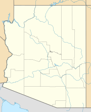
| Location | Cochise County, Arizona, U.S. |
| Parent range | Huachuca Mountains |
| Topo map | USGS Miller Peak |
| Climbing | |
| Easiest route | Trail Hike |
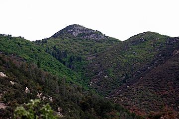
Miller Peak is a tall mountain in Arizona, standing at 9,470 feet (2,886 m) high. It is the highest point in the Huachuca Mountains and a popular spot for hiking. This peak is located about 10 miles south of Sierra Vista, Arizona. It is also the second-highest mountain in Cochise County.
Around Miller Peak, there is a special protected area called the Miller Peak Wilderness. This wilderness covers a large area of 20,190 acres. The Coronado National Forest helps to manage and protect this beautiful natural space. Miller Peak is also the most southerly mountain in the continental United States that rises above 9,000 feet.
In 2011, a large wildfire called the Monument Fire affected this area. Many of the pine trees that used to grow there were burned. Now, new plants like scrub oak are starting to grow in their place.
Contents
Hiking to Miller Peak's Summit
Reaching the top of Miller Peak is an exciting adventure! There are several trails you can take. All of them are moderately challenging hikes. They usually involve climbing about 3,500 feet (1,100 m) in height. The round-trip distance is typically between 9 to 11 miles (14 to 18 km).
Popular Trailheads for Miller Peak
One of the most well-known starting points for the hike is at the end of Miller Canyon Road. This road is close to Hereford, Arizona. Other popular trails begin at the Montezuma Pass trailhead. You can also start from the Carr Peak trailhead. No matter where you start in the Huachuca Mountains, you can usually find a trail that connects to the main Crest Trail. From there, a short path leads to the summit of Miller Peak.
Landmarks on the Trail
As you hike, you might see some interesting spots. These include Bathtub Springs and Bear Saddle. If you are feeling extra adventurous, you can also hike to nearby Carr Peak on the same day. Carr Peak is 9,229 ft (2,813 m) tall and can be reached along the Crest Trail.
Staying Safe While Hiking
It is very important to be prepared when hiking to Miller Peak. Always bring at least 3 liters of water, especially during the summer months. Even in winter, the air can be very dry, so you will still need plenty of water.
Weather Conditions to Watch For
In winter, snowstorms are common on the peak. In summer, strong lightning storms and sudden flash floods can happen. It is best not to hike during the summer if thunderstorms are expected. Always pay attention to the weather and your surroundings. You might also see Border Patrol agents hiking in the area, as they patrol these trails.
 | Selma Burke |
 | Pauline Powell Burns |
 | Frederick J. Brown |
 | Robert Blackburn |


