Cartier Island facts for kids

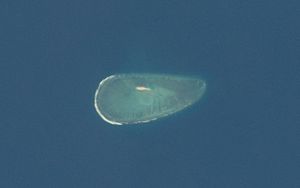
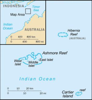
Cartier Island is a tiny, empty sand island located in the Timor Sea. It's found north of Australia and south of Indonesia. This small island is part of the Territory of Ashmore and Cartier Islands, which is an external territory of Australia.
Cartier Island is very small, only about 0.4 hectares in size. To give you an idea, that's roughly half the size of a football field! It sits on the edge of the Sahul Shelf, about 300 kilometers (186 miles) off the northwest coast of Western Australia. It's also about 200 kilometers (124 miles) south of the Indonesian island of Roti.
You won't find any plants growing on Cartier Island itself. However, there is a type of seagrass called Thallassia hemprichii that grows in sandy spots within the surrounding reef. You might even see it when the tide is low.
What's on the Island?
At the southern edge of the reef, you can find the remains of a shipwreck. This is the Ann Millicent, an iron barge that sank there in 1888. If you visit during low tide, you might also spot parts of an old Beaufighter plane from the Royal Australian Air Force (RAAF).
The island was once used as a bombing range. Because of this, there's a risk of finding unexploded ordnance (old bombs or shells) in the area. For your safety, access to the island is not allowed. Even though it's no longer actively used for training, it's still officially a Defence Practice Area.
Island History
The island was first mapped in 1800 and was named after the ship Cartier. Its exact location wasn't quite right until 1878, when it was properly surveyed.
On January 5, 1888, the ship Ann Millicent was wrecked on the island. It was on a journey from the Gulf of Carpentaria to Adelaide, South Australia. In 1909, the United Kingdom took control of the island. However, on July 23, 1931, both Ashmore Reef and Cartier Island were given to Australia.
During World War II, the area around Cartier Island was used as a bombing range. Up until 2011, Cartier Island and the ocean area within 10 kilometers (6.2 miles) of it were officially a Defence Practice Area. This means it was used for air weapons training. Even though it's not an active weapons range anymore, there's still a significant chance that unexploded items remain there.
Cartier Island is also in an area that's part of a special agreement between Australia and Indonesia. This agreement, called the Memorandum of Understanding (MOU Box), was signed in 1974 and updated in 1989. It allows Indonesian traditional fishing to continue in certain parts of the area.
Protecting the Environment
The Cartier Island Marine Park protects the area within 4 nautical miles (about 7.4 kilometers) of the reef's center. This protected zone is called a Sanctuary Zone.
In 2003, environmental groups closed off access to the island and its surrounding reef. This was done for two main reasons: to help fish populations grow back and for safety. The plan was to close the area for seven years to check on marine wildlife levels and to find any unexploded ordnance. Before this closure, yachts often visited the area, and Indonesian boats fished there.
See also
 In Spanish: Isla Cartier para niños
 | Janet Taylor Pickett |
 | Synthia Saint James |
 | Howardena Pindell |
 | Faith Ringgold |


