Cathey Peak facts for kids
Quick facts for kids Cathey Peak |
|
|---|---|
| Highest point | |
| Elevation | 9,645 ft (2,940 m) |
| Geography | |
| Location | Otero County, New Mexico, U.S. |
| Parent range | Sacramento Mountains |
| Topo map | USGS Sacramento Peak |
| Climbing | |
| Easiest route | Road |
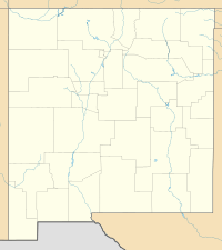
Cathey Peak is a tall mountain in the Sacramento Mountains of New Mexico. It's located in Otero County, about 10 miles (16 km) southeast of the town of Alamogordo.
Contents
Sacramento Peak: A Star-Gazing Spot
Close to Cathey Peak is another mountain called Sacramento Peak. It is 9,262 feet (2,823 meters) high. Sacramento Peak is famous because it has several observatories (places where scientists study stars and space).
Important Observatories
The Sunspot Solar Observatory is right on top of Sacramento Peak. This observatory is so important that a small town, Sunspot, grew up nearby. It's less than half a mile (0.8 km) away. Another observatory, the Apache Point Observatory, is also close by. It sits on a high point about half a mile (0.8 km) south of the peak.
Exploring Cathey and Sacramento Peaks
Both Cathey Peak and Sacramento Peak are on the western side of the Sacramento Mountains. This means they have gentle, tree-covered slopes on their eastern side. But to the west, they have a very steep drop-off leading down to the Tularosa Basin.
How to Visit the Peaks
You can reach both peaks by driving on New Mexico Scenic Byway 6563. This road starts from the town of Cloudcroft. It's a great way to see the beautiful mountain scenery.
 | Delilah Pierce |
 | Gordon Parks |
 | Augusta Savage |
 | Charles Ethan Porter |


