Chaitén facts for kids
Quick facts for kids
Chaitén
|
|||||
|---|---|---|---|---|---|
|
Town and Commune
|
|||||

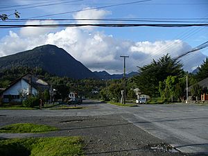
The town of Chaitén in 2007
|
|||||
|
|||||
| Country | Chile | ||||
| Region | Los Lagos | ||||
| Province | Palena | ||||
| Founded | 1933 | ||||
| Evacuated | May 2008 | ||||
| Government | |||||
| • Type | Municipality | ||||
| Area | |||||
| • Town and Commune | 8,470.5 km2 (3,270.5 sq mi) | ||||
| Elevation | 12 m (39 ft) | ||||
| Population
(2012 census)
|
|||||
| • Town and Commune | 3,347 | ||||
| • Density | 0.39514/km2 (1.02340/sq mi) | ||||
| • Urban | 4,065 | ||||
| Time zone | UTC-4 (CLT) | ||||
| • Summer (DST) | UTC-3 (CLST) | ||||
| Area code(s) | country 56 + city = 65 | ||||
| Climate | Cfb | ||||
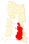
Chaitén is a town in Chile, a country in South America. It used to be the main town of the Palena Province in the Los Lagos Region. The town is located north of the mouth of the Yelcho River. It sits on the east coast of the Gulf of Corcovado. Chaitén is also close to the northern end of the Carretera Austral, a major highway that goes inland. The Desertores Islands are also part of the Chaitén area.
Why Chaitén Was Evacuated

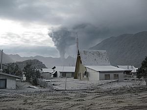
The town of Chaitén had to be evacuated in May 2008. This happened because the Chaitén volcano, which had been quiet for over 9,000 years, suddenly erupted!
The eruption started on May 2nd and became much stronger by May 5th. It shot a huge cloud of ash and sulfur steam high into the sky, reaching about 19 miles (30 kilometers) up. Ash from the volcano drifted across Patagonia and even over the Atlantic Ocean. A few years before, in 2005, small earthquakes had been felt near Chaitén.
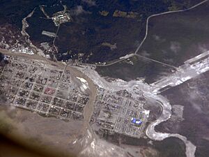
On May 12, 2008, the town was completely flooded. This was caused by a lahar, which is a destructive mudflow made of volcanic ash, rock, and water. The lahar caused the Blanco River to overflow its banks by about 200 meters (656 feet) on each side.
Over the next few weeks, the river carved a new path right through Chaitén. This destroyed a large part of the town by July 2008. The damage continued for some time. The government tried to build some defenses. However, they eventually decided to abandon the town. All residents were moved and given help to start over. The capital of the province was temporarily moved to Futaleufú after the eruption. Later, this move was made permanent. The future of Chaitén became a big topic of discussion in Chile.
Rebuilding Chaitén
On February 25, 2009, the government announced plans to rebuild Chaitén. The new location was planned to be about 10 kilometers (6 miles) north of the old town. This coastal place was known as Santa Bárbara or "Fandango Norte." On March 3, 2009, construction work began on the new town's government buildings.
However, on April 9, 2011, President Sebastián Piñera announced a different plan. He said the town would be rebuilt in its existing northern area. This reversed the previous government's decision to move the town to a completely different spot further north.
Fun Places to Visit Nearby
If you visit the area around Chaitén, you can find some amazing natural attractions:
- Corcovado National Park, which is home to the Corcovado volcano
- Pumalín Park, where you can see the Michinmahuida volcano
- Yelcho Lake
- The Carretera Austral highway, great for scenic drives
- The Futaleufu River, famous for rafting
See also
 In Spanish: Chaitén (comuna) para niños
 | Ernest Everett Just |
 | Mary Jackson |
 | Emmett Chappelle |
 | Marie Maynard Daly |


